Grande Pointe, Manitoba
Grande Pointe is a place in the province of Manitoba, Canada that is designated as both an unincorporated community and a settlement.[2] It is located 15 km (9.3 mi) southeast of downtown Winnipeg within the Rural Municipality of Ritchot.
Grande Pointe | |
|---|---|
| Coordinates: 49.7644°N 97.0514°W | |
| Country | |
| Province | |
| Region | Winnipeg Metro Region |
| Area | |
| • Metro | 5,306.79 km2 (2,048.96 sq mi) |
| Elevation | 232 m (761 ft) |
| Population | |
| • Metro | 778,489 |
| Area code(s) | Area codes 204 and 431 |
Grande Pointe was affected by the 1997 Red River Flood because the homes were not built above 1979 flood levels plus 2 feet. One hundred twenty-five out of 150 homes in the area experienced food damage to their homes,[3] caused by elevated CPR track acting as a dam.[4] In the September 1999 provincial election, Ron Lemieux (NDP) won the seat because residents were upset at how the Filmon government handled the flood issue in their community.[5]
Additional water infrastructure was constructed in the late 2010s to accommodate growth in the R.M. of Tache, including an additional distribution pipe from Ste.Agathe to Grande Pointe.[6]
References
- "Elevation at Grande Pointe". earthtools.org.
- "Geographical Names" (Esri shapefile). Manitoba Land Initiative. Retrieved April 18, 2014.
- "The Flood". Winnipeg Free Press. June 15, 1997. p. B11.
- Paul, Alexandra; Rollason, Kevin; Verhaeghe, Melanie (May 4, 1997). "We're not out of the woods". Winnipeg Free Press. p. A1.
- "Red Sea Rising: 10 Years After". Winnipeg Free Press. April 29, 2007. p. B4.
- "Province Invests in Ritchot Water Infrastructure". nivervillecitizen.com. Retrieved 2020-02-13.
| Cities | 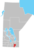 | ||
|---|---|---|---|
| Towns | |||
| Villages | |||
| Rural municipalities |
| ||
| First Nations | |||
| Indian reserves | |||
| Unincorporated communities | |||