Pyrénées – Mont Perdu World Heritage Site
The Pyrénées – Mont Perdu World Heritage Site (also known as UNESCO Patrimonio Mundial Pirineos – Monte Perdido in Spanish[1]) is a World Heritage site straddling the border between Spain and France in the Pyrenees mountain chain. The summit of Monte Perdido (French: Mont Perdu) is on the Spanish side of the border. The site was designated in 1997 and extended north in 1999 to include the Commune of Gèdre in France.
| UNESCO World Heritage Site | |
|---|---|
 | |
| Location | Pyrenees in France and Spain |
| Criteria | Cultural and Natural: (iii), (iv), (v), (vii), (viii) |
| Reference | 773bis |
| Inscription | 1997 (21st session) |
| Extensions | 1999 |
| Area | 30,639 ha (75,710 acres) |
| Coordinates | 42°41′7.5″N 0°0′1.8″E |
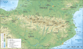 Location of Pyrénées – Mont Perdu World Heritage Site in Pyrenees  Pyrénées – Mont Perdu World Heritage Site (Europe) | |
The site includes two bordering national parks: the entire Ordesa y Monte Perdido National Park in Spain and the eastern part of Pyrénées Occidentales National Park in France.[2] The World Heritage site comprises a total area of 30,639 hectares.[1]

The Cirque de Gavarnie in the French section of the World Heritage site
References
- "UNESCO Patrimonio Mundial Pirineos – Monte Perdido " mcu.es, retrieved 2013-08-20 (in Spanish)
- "Protected Areas and World Heritage". United Nations Environment Program - World Conservation Monitoring Centre. January 2000. Archived from the original on 2008-07-18. Retrieved 2008-08-12.
External links
- UNESCO Pyrénées - Mont Perdu unesco.org, retrieved 2013-08-20 (in French)
- "UNESCO Patrimonio Mundial Pirineos – Monte Perdido " mcu.es, retrieved 2013-08-20 (in Spanish)
- MPPM - Monte Perdido Patrimonio Mundial mppm.org, retrieved 2013-08-20 (in Spanish)
This article is issued from Wikipedia. The text is licensed under Creative Commons - Attribution - Sharealike. Additional terms may apply for the media files.