President Roxas, Capiz
President Roxas, officially the Municipality of President Roxas, is a 4th class municipality in the province of Capiz, Philippines. According to the 2015 census, it has a population of 29,676 people.[4]
President Roxas Lutod-lutod | |
|---|---|
| Municipality of President Roxas | |
 Map of Capiz with President Roxas highlighted | |
OpenStreetMap 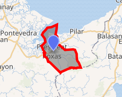
| |
.svg.png) President Roxas Location within the Philippines | |
| Coordinates: 11°26′N 122°56′E | |
| Country | |
| Region | Western Visayas (Region VI) |
| Province | Capiz |
| District | 1st district of Capiz |
| Founded | 1949 |
| Named for | Manuel Roxas |
| Barangays | 22 (see Barangays) |
| Government | |
| • Type | Sangguniang Bayan |
| • Mayor | Receliste L. Escolin |
| • Vice Mayor | Edvil John V. Alfaro |
| • Congressman | Emmanuel A. Billones |
| • Electorate | 19,788 voters (2019) |
| Area | |
| • Total | 77.88 km2 (30.07 sq mi) |
| Elevation | 8.4 m (27.6 ft) |
| Population (2015 census)[4] | |
| • Total | 29,676 |
| • Density | 380/km2 (990/sq mi) |
| • Households | 6,883 |
| Economy | |
| • Income class | 4th municipal income class |
| • Poverty incidence | 22.09% (2015)[5] |
| • Revenue (₱) | 83,986,332.13 (2016) |
| Time zone | UTC+8 (PST) |
| ZIP code | 5803 |
| PSGC | |
| IDD : area code | +63 (0)36 |
| Climate type | tropical climate |
| Native languages | Capiznon Hiligaynon Tagalog |
Formerly known as Lutod-lutod,[6] it is 37 kilometres (23 mi) from the provincial capital, Roxas City.
History
In 1949, the sitios and barrios of Aranguel, Culilang, Pandan, Pinamihagan, Cadoulan, Quiajo, Sangcal, Pondol, Marita, Madulano, Jabuyana, Bo-ac, Cabugcabug, Goce Badiangon, Bayuyan, Agbobolo, Cubay, Ibaca, and the sitio of Lotudlotud which was converted into a barrio of Elizalde was separated from Pilar, and formed into the separate town of President Roxas by virtue of Republic Act No. 374.[7]
In 1952, barrio of Agbobolo was renamed Manoling.[8]
Barangays
President Roxas is politically subdivided into 22 barangays. [2]
- Aranguel
- Badiangon
- Bayuyan
- Cabugcabug
- Carmencita
- Cubay
- Culilang
- Goce
- Hanglid
- Ibaca
- Madulano
- Manoling
- Marita
- Pandan
- Pantalan
- Pinamihagan
- Poblacion
- Pondol
- Quiajo
- Sangkal
- Santo Niño
- Vizcaya
Climate
| Climate data for President Roxas, Capiz | |||||||||||||
|---|---|---|---|---|---|---|---|---|---|---|---|---|---|
| Month | Jan | Feb | Mar | Apr | May | Jun | Jul | Aug | Sep | Oct | Nov | Dec | Year |
| Average high °C (°F) | 27 (81) |
28 (82) |
29 (84) |
31 (88) |
32 (90) |
31 (88) |
30 (86) |
30 (86) |
29 (84) |
29 (84) |
29 (84) |
27 (81) |
29 (85) |
| Average low °C (°F) | 23 (73) |
23 (73) |
23 (73) |
24 (75) |
25 (77) |
25 (77) |
24 (75) |
24 (75) |
24 (75) |
24 (75) |
24 (75) |
23 (73) |
24 (75) |
| Average precipitation mm (inches) | 61 (2.4) |
39 (1.5) |
46 (1.8) |
48 (1.9) |
90 (3.5) |
144 (5.7) |
152 (6.0) |
145 (5.7) |
163 (6.4) |
160 (6.3) |
120 (4.7) |
90 (3.5) |
1,258 (49.4) |
| Average rainy days | 12.3 | 9.0 | 9.9 | 10.0 | 18.5 | 25.0 | 27.4 | 26.0 | 25.9 | 24.9 | 17.9 | 14.2 | 221 |
| Source: Meteoblue [9] | |||||||||||||
Demographics
| Population census of President Roxas | ||
|---|---|---|
| Year | Pop. | ±% p.a. |
| 1960 | 15,263 | — |
| 1970 | 19,972 | +2.72% |
| 1975 | 21,632 | +1.61% |
| 1980 | 21,805 | +0.16% |
| 1990 | 24,052 | +0.99% |
| 1995 | 24,695 | +0.50% |
| 2000 | 27,531 | +2.36% |
| 2007 | 28,459 | +0.46% |
| Source: Philippine Statistics Authority[4][10][11][12] | ||
In the 2015 census, the population of Pres. Roxas was 29,676 people,[4] with a density of 380 inhabitants per square kilometre or 980 inhabitants per square mile.
See also
- List of renamed cities and municipalities in the Philippines
References
- "Municipality". Quezon City, Philippines: Department of the Interior and Local Government. Retrieved 31 May 2013.
- "Province: Capiz". PSGC Interactive. Quezon City, Philippines: Philippine Statistics Authority. Retrieved 12 November 2016.
- "President Roxas, Capiz Profile". PhilAtlas.com. Retrieved 15 June 2020.
- Census of Population (2015). "Region VI (Western Visayas)". Total Population by Province, City, Municipality and Barangay. PSA. Retrieved 20 June 2016.
- "PSA releases the 2015 Municipal and City Level Poverty Estimates". Quezon City, Philippines. Retrieved 12 October 2019.
- http://www.choosephilippines.com/go/water-forms/1654/captivating-capiz-virgin-waterfalls-pilar
- "An act to create the municipality of President Roxas in the province of Capiz". LawPH.com. Retrieved 2011-04-09.
- "An Act Changing the Name of the Barrio of Agbobolo in the Municipality of President Roxas, Province of Capiz, to Manoling". LawPH.com. Retrieved 2011-04-09.
- "President Roxas: Average Temperatures and Rainfall". Meteoblue. Retrieved 2 May 2020.
- Census of Population and Housing (2010). "Region VI (Western Visayas)". Total Population by Province, City, Municipality and Barangay. NSO. Retrieved 29 June 2016.
- Censuses of Population (1903–2007). "Region VI (Western Visayas)". Table 1. Population Enumerated in Various Censuses by Province/Highly Urbanized City: 1903 to 2007. NSO.
- "Province of Capiz". Municipality Population Data. Local Water Utilities Administration Research Division. Retrieved 17 December 2016.
External links
- President Roxas Profile at PhilAtlas.com
- Philippine Standard Geographic Code
- Philippine Census Information
Places adjacent to President Roxas, Capiz | ||||||||||
|---|---|---|---|---|---|---|---|---|---|---|
| ||||||||||