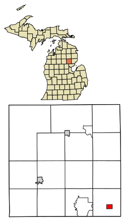
Prescott, Michigan
Prescott is a village in Ogemaw County of the U.S. state of Michigan. The population was 1266 at the 2010 census. The village is within Richland Township.
Prescott, Michigan | |
|---|---|
 Location of Prescott, Michigan | |
| Coordinates: 44°11′31″N 83°55′51″W | |
| Country | United States |
| State | Michigan |
| County | Ogemaw |
| Area | |
| • Total | 1.11 sq mi (2.87 km2) |
| • Land | 1.11 sq mi (2.87 km2) |
| • Water | 0.00 sq mi (0.00 km2) |
| Elevation | 797 ft (243 m) |
| Population | |
| • Total | 1,266 |
| • Estimate (2017)[3] | 257 |
| • Density | 231.74/sq mi (89.46/km2) |
| Time zone | UTC-5 (Eastern (EST)) |
| • Summer (DST) | UTC-4 (EDT) |
| ZIP code | 48756 |
| Area code(s) | 989 |
| FIPS code | 26-66300[4] |
| GNIS feature ID | 0635424[5] |
Geography
According to the United States Census Bureau, the village has a total area of 1.11 square miles (2.87 km2), all land.[6]
Demographics
| Historical population | |||
|---|---|---|---|
| Census | Pop. | %± | |
| 1950 | 281 | — | |
| 1960 | 308 | 9.6% | |
| 1970 | 306 | −0.6% | |
| 1980 | 332 | 8.5% | |
| 1990 | 314 | −5.4% | |
| 2000 | 286 | −8.9% | |
| 2010 | 266 | −7.0% | |
| Est. 2017 | 257 | [3] | −3.4% |
| U.S. Decennial Census[7] | |||
2010 census
As of the census[2] of 2010, there were 266 people, 101 households, and 70 families living in the village. The population density was 239.6 inhabitants per square mile (92.5/km2). There were 131 housing units at an average density of 118.0 per square mile (45.6/km2). The racial makeup of the village was 96.6% White, 0.4% from other races, and 3.0% from two or more races. Hispanic or Latino of any race were 3.8% of the population.
There were 101 households of which 30.7% had children under the age of 18 living with them, 48.5% were married couples living together, 13.9% had a female householder with no husband present, 6.9% had a male householder with no wife present, and 30.7% were non-families. 26.7% of all households were made up of individuals and 18.8% had someone living alone who was 65 years of age or older. The average household size was 2.63 and the average family size was 3.11.
The median age in the village was 43 years. 23.7% of residents were under the age of 18; 6% were between the ages of 18 and 24; 23.3% were from 25 to 44; 28.2% were from 45 to 64; and 18.8% were 65 years of age or older. The gender makeup of the village was 46.2% male and 53.8% female.
2000 census
As of the census[4] of 2000, there were 286 people, 111 households, and 75 families living in the village. The population density was 244.2 per square mile (94.4/km²). There were 130 housing units at an average density of 111.0 per square mile (42.9/km²). The racial makeup of the village was 99.65% White and 0.35% Native American. Hispanic or Latino of any race were 2.10% of the population.
There were 111 households out of which 30.6% had children under the age of 18 living with them, 55.0% were married couples living together, 11.7% had a female householder with no husband present, and 32.4% were non-families. 28.8% of all households were made up of individuals and 13.5% had someone living alone who was 65 years of age or older. The average household size was 2.58 and the average family size was 3.19.
In the village, the population was spread out with 29.0% under the age of 18, 7.0% from 18 to 24, 23.1% from 25 to 44, 24.8% from 45 to 64, and 16.1% who were 65 years of age or older. The median age was 38 years. For every 100 females, there were 85.7 males. For every 100 females age 18 and over, there were 86.2 males.
The median income for a household in the village was $27,188, and the median income for a family was $30,000. Males had a median income of $22,500 versus $23,750 for females. The per capita income for the village was $11,014. About 20.7% of families and 26.9% of the population were below the poverty line, including 39.0% of those under the age of eighteen and 11.8% of those sixty five or over.
References
- "2017 U.S. Gazetteer Files". United States Census Bureau. Retrieved Jan 3, 2019.
- "U.S. Census website". United States Census Bureau. Retrieved 2012-11-25.
- "Population and Housing Unit Estimates". Retrieved March 24, 2018.
- "U.S. Census website". United States Census Bureau. Retrieved 2008-01-31.
- U.S. Geological Survey Geographic Names Information System: Prescott, Michigan
- "US Gazetteer files 2010". United States Census Bureau. Archived from the original on 2012-01-25. Retrieved 2012-11-25.
- "Census of Population and Housing". Census.gov. Retrieved June 4, 2015.
Municipalities and communities of Ogemaw County, Michigan, United States | ||
|---|---|---|
| Cities | 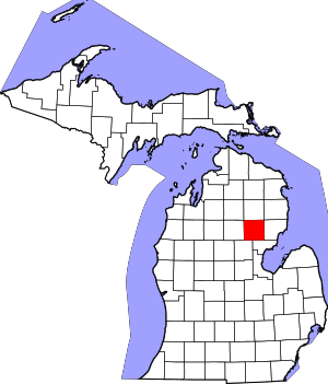 Map of Michigan highlighting Ogemaw County.svg | |
| Village | ||
| Townships | ||
| CDPs | ||