Lupton, Michigan
Lupton is an unincorporated community and census-designated place in Rose Township, Ogemaw County, Michigan, United States. Its population was 348 as of the 2010 census.[1] Lupton's post office closed on November 5, 2011; it still has its own ZIP code 48635.[3][4]
Lupton, Michigan | |
|---|---|
 Lupton, Michigan  Lupton, Michigan | |
| Coordinates: 44°25′52″N 84°01′33″W | |
| Country | United States |
| State | Michigan |
| County | Ogemaw |
| Area | |
| • Total | 3.262 sq mi (8.45 km2) |
| • Land | 3.232 sq mi (8.37 km2) |
| • Water | 0.030 sq mi (0.08 km2) |
| Elevation | 922 ft (281 m) |
| Population | |
| • Total | 348 |
| • Density | 110/sq mi (41/km2) |
| Time zone | UTC-5 (Eastern (EST)) |
| • Summer (DST) | UTC-4 (EDT) |
| ZIP code | 48635 |
| Area code(s) | 989 |
| GNIS feature ID | 1620647[2] |
Geography
According to the U.S. Census Bureau, the community has an area of 3.262 square miles (8.45 km2), of which 3.232 square miles (8.37 km2) is land and 0.030 square miles (0.078 km2) is water.[1]
History
Lupton was first settled by several Quaker families from Ohio, including that of Emmor Lupton in 1880. It was first known as "Lane Heights" and given a post office as "Lane" in April 1881. A depot on the Detroit, Bay City and Alpena Railroad was opened in January 1893. The post office was renamed Lupton in June 1893.[5]
References
- "2010 Census Gazetteer Files - Places: Michigan". U.S. Census Bureau. Retrieved May 13, 2018.
- "Lupton". Geographic Names Information System. United States Geological Survey.
- United States Postal Service. "USPS - Look Up a ZIP Code". Retrieved May 13, 2018.
- "Postmaster Finder - Post Offices by ZIP Code". United States Postal Service. Retrieved May 13, 2018.
- Romig, Walter (1986) [1973]. Michigan Place Names. Detroit, Michigan: Wayne State University Press. ISBN 0-8143-1838-X.
Municipalities and communities of Ogemaw County, Michigan, United States | ||
|---|---|---|
| Cities | 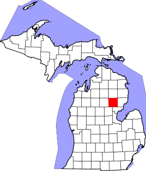 Map of Michigan highlighting Ogemaw County.svg | |
| Village | ||
| Townships | ||
| CDPs | ||