Prayagpur
Prayagpur is a census town in the Kanksa CD block in the Durgapur subdivision of the Paschim Bardhaman district in the Indian state of West Bengal.
Prayagpur | |
|---|---|
Census Town | |
 Prayagpur Location in West Bengal, India  Prayagpur Prayagpur (India) | |
| Coordinates: 23°26′57.5″N 87°26′52.4″E | |
| Country | |
| State | West Bengal |
| District | Paschim Bardhaman |
| Area | |
| • Total | 2.59 km2 (1.00 sq mi) |
| Population (2011) | |
| • Total | 4,479 |
| • Density | 1,700/km2 (4,500/sq mi) |
| Languages | |
| • Official | Bengali, English |
| Time zone | UTC+5:30 (IST) |
| PIN | 713148 |
| Telephone/ STD code | 0341 |
| Vehicle registration | WB |
| Website | paschimbardhaman |
Geography
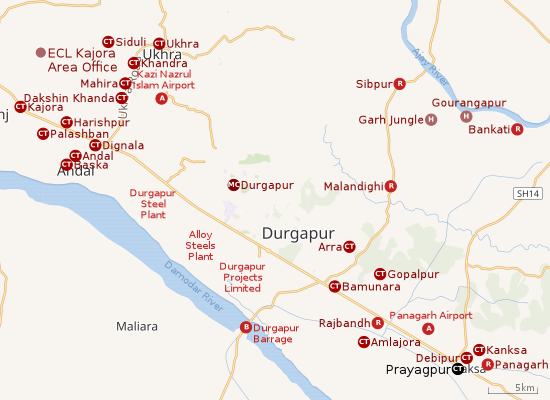 |
| Cities and towns in the southern and eastern portions of Durgapur subdivision in Paschim Bardhaman district MC: Municipal Corporation, CT: census town, R: rural centre, A: airport, B: barrage, H: historical site Owing to space constraints in the small map, the actual locations in a larger map may vary slightly |
Location
The Asansol-Durgapur region is composed of undulating laterite soil. This area lies between two mighty rivers – the Damodar and the Ajay. They flow almost parallel to each other in the region – the average distance between the two rivers is around 30 km. The entire Durgapur-Kanksa-Faridpur-Ausgram area was densely forested even in more recent times. The influx of refugees from East Pakistan and their rehabilitation in the area, and irrigation facilities extended by Damodar Valley Corporation led to destruction of much of the forests in the area, but some still remain.[1]
Urbanisation
According to the 2011 census, 79.22% of the population of the Durgapur subdivision was urban and 20.78% was rural. The sole municipal corporation in the Durgapur subdivision is located at Durgapur and the subdivision has 38 (+1 partly) census towns (partly presented in the map alongside; all places marked on the map are linked in the full-screen map).[2]
Demographics
According to the 2011 Census of India, Prayagpur had a total population of 4,479, of which 2,254 (51%) were males and 2,225 (49%) were females. Population in the age range 0-6 years was 439. The total number of literate persons in Prayagpur was 3,307 (81.86% of the population over 6 years).[3]
As of 2001 India census,[4] Prayagpur had a population of 5149. Males constitute 52% of the population and females 48%. Prayagpur has an average literacy rate of 66%, higher than the national average of 59.5%: male literacy is 75%, and female literacy is 57%. In Prayagpur, 13% of the population is under 6 years of age.
Infrastructure
According to the District Census Handbook 2011, Bardhaman, Prayagpur covered an area of 2.59 km2. Among the civic amenities, it had 11 km roads, with both open and covered drains, the protected water-supply involved tap water from treated source, hand pump. It had 700 domestic electric connections. Among the medical facilities it had 1 dispensary/ health centre, 4 medicine shops. Among the educational facilities it had was 1 primary schools, other school facilities at Kanksa 6 km away. It had 1 non-formal education centre (Sarva Shiksha Abhiyan). Among the social, recreational, culturual facilities it had 1 public library and 1 reading room.[5]
Education
Prayagpur has one primary school.[6]
Healthcare
Panagarh Rural Hospital, with 30 beds, at Panagarh, is the major government medical facility in the Kanksa CD block. [7]
References
- Chattopadhyay, Akkori, Bardhaman Jelar Itihas O Lok Sanskriti (History and Folk lore of Bardhaman District.), (in Bengali), Vol I, pp 14-15,38, 542 Radical Impression. ISBN 81-85459-36-3
- "District Statistical Handbook 2014 Burdwan". Table 2.2, 2.4(a). Department of Statistics and Programme Implementation, Government of West Bengal. Archived from the original on 21 January 2019. Retrieved 15 September 2018.
- "2011 Census – Primary Census Abstract Data Tables". West Bengal – District-wise. Registrar General and Census Commissioner, India. Retrieved 20 February 2017.
- "Census of India 2001: Data from the 2001 Census, including cities, villages and towns (Provisional)". Census Commission of India. Archived from the original on 16 June 2004. Retrieved 1 November 2008.
- "District Census Handbook Barddhaman, Census of India 2011, Series 20, Part XII A" (PDF). Section II Town Directory, Pages 1179-1210; Statement I: Status and Growth History, Page 1179; Statement II: Physical Aspects and Location of Towns, Page 1188; Statement III: Civic and other Amenities, Page 1191; Statement IV: Medical Facilities, Page 1196; Statement V: Educational, Recreational and Cultural Facilities, Page 1200; Statement VI:Industry and Banking, Page 1209:. Directorate of census Operations V, West Bengal. Retrieved 14 May 2020.CS1 maint: extra punctuation (link)
- 7th All-India School Education Survey 2003 Archived 2007-09-27 at the Wayback Machine
- "Health & Family Welfare Department" (PDF). Health Statistics – Rural Hospitals. Government of West Bengal. Retrieved 12 May 2020.
Cities, towns and locations in Paschim Bardhaman district, West Bengal | |||||
|---|---|---|---|---|---|
| Cities, municipal and census towns | |||||
| Locations other than cities and towns |
| ||||
| Neighbourhoods in Asansol |
| ||||
| Related topics |
| ||||