Dalurband
Dalurband is a census town in the Pandabeswar CD block of the Durgapur subdivision in the Paschim Bardhaman district in the state of West Bengal, India.
Dalurband | |
|---|---|
Census Town | |
 Dalurband Location in West Bengal, India  Dalurband Dalurband (India) | |
| Coordinates: 23°42′49.0″N 87°15′13.3″E | |
| Country | |
| State | West Bengal |
| District | Paschim Bardhaman |
| Area | |
| • Total | 7.95 km2 (3.07 sq mi) |
| Population (2011) | |
| • Total | 15,107 |
| • Density | 1,900/km2 (4,900/sq mi) |
| Languages* | |
| • Official | Bengali, Hindi, English |
| Time zone | UTC+5:30 (IST) |
| PIN | 713346 |
| Telephone code/STD | 0341 |
| Vehicle registration | WB |
| Lok Sabha constituency | Asansol |
| Vidhan Sabha constituency | Pandaveswar |
| Website | paschimbardhaman |
Geography
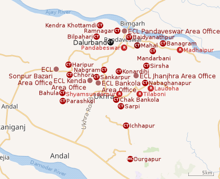 |
| Cities, towns and ECL Areas in the northern portion of Durgapur subdivision in Paschim Bardhaman district MC: Municipal Corporation, CT: census town, R: rural administrative centre Owing to space constraints in the small map, the actual locations in a larger map may vary slightly |
Location
The Asansol-Durgapur region is composed of undulating laterite soil. This area lies between two mighty rivers – the Damodar and the Ajay. They flow almost parallel to each other in the region – the average distance between the two rivers is around 30 km. For ages the area was heavily forested and infested with plunderers and marauders. The discovery of coal in the 18th century led to industrialisation of the area and most of the forests have been cleared.[1]
Mahal, Baidyanathpur, Dalurband, Ramnagar, Bilpahari and Kendra Khottamdi form a cluster of census towns in the northern portion of Pandabeswar CD block.[2]
Urbanisation
According to the 2011 census, 79.22% of the population of the Durgapur subdivision was urban and 20.78% was rural. The Durgapur subdivision has 1 municipal corporation at Durgapur and 38 (+1 partly) census towns (partly presented in the map alongside; all places marked on the map are linked in the full-screen map).[3]
Demographics
According to the 2011 Census of India, Dalurbandh had a total population of 15,107, of which 7,978 (53%) were males and 7,129 (47%) were females. Population in the age range 0-6 years was 1,951. The total number of literate persons in Dalurbandh was 9,475 (77.02% of the population over 6 years).[4]
*For language details see Pandabeswar (community development block)#Language and religion
As of 2001 India census,[5] Dalurband had a population of 14,978. Males constitute 56% of the population and females 44%. Dalurband has an average literacy rate of 59%, lower than the national average of 59.5%: male literacy is 68% and, female literacy is 47%. In Dalurband, 13% of the population is under 6 years of age.
Infrastructure
According to the District Census Handbook 2011, Bardhaman, Dalurbandh covered an area of 7.95 km2. Among the civic amenities, the protected water-supply involved service reservoir, tap water from treated sources, uncovered wells. It had 1,198 domestic electric connections. Among the medical facilities it had were 6 dispensaries/ health centres, 8 medicine shops. Among the educational facilities it had were 4 primary schools. Other education facilities at Pandabeswar 2/3 km away. Among the important commodities it produced were soap, coal, mustard oil.[6]
Economy
Collieries in the Pandaveswar Area of Eastern Coalfields are: Madaipur, Mandarbani, Nutandanga, Pandaveswar, Dalurbandh, Kendra, Samla, South Samla, Khottadih, Kankartala, Dalurbandh OCP, Palasthali OCP and Gangaramchak OCP.[7]
Education
Dalurband has two primary schools.[8]
Healthcare
Medical facilities (dispensaries) in the Pandaveswar Area of ECL are available at Pandaveswar Area PME Centre (PO Pandaveswar), Madhaipur (PO Nutundanga), Mandarboni (PO Nutundanga), South Samla (PO Pandaveswar), Pandaveswar (PO Pandaveswar), Dalurbandh (PO Pandaveswar), Khottadih (PO Khottadih), Area Dispensary (PO Pandaveswar).[9]
References
- Chattopadhyay, Akkori, Bardhaman Jelar Itihas O Lok Sanskriti (History and Folk lore of Bardhaman District.), (in Bengali), Vol I, pp 14-15, Radical Impression. ISBN 81-85459-36-3
- "District Census Handbook Bardhaman, Series 20, Part XII A, Census of India 2011" (PDF). Map of Pandabeswar CD Block, page 243. Directorate of Census Operations, West Bengal. Retrieved 7 September 2018.
- "District Statistical Handbook 2014 Burdwan". Table 2.2, 2.4(a). Department of Statistics and Programme Implementation, Government of West Bengal. Retrieved 15 September 2018.
- "2011 Census – Primary Census Abstract Data Tables". West Bengal – District-wise. Registrar General and Census Commissioner, India. Retrieved 20 February 2017.
- "Census of India 2001: Data from the 2001 Census, including cities, villages and towns (Provisional)". Census Commission of India. Archived from the original on 16 June 2004. Retrieved 1 November 2008.
- "District Census Handbook Barddhaman, Census of India 2011, Series 20, Part XII A" (PDF). Section II Town Directory, Pages 1179-1210; Statement I: Status and Growth History, Page 1179; Statement II: Physical Aspects and Location of Towns, Page 1188; Statement III: Civic and other Amenities, Page 1191; Statement IV: Medical Facilities, Page 1196; Statement V: Educational, Recreational and Cultural Facilities, Page 1200; Statement VI:Industry and Banking, Page 1209:. Directorate of census Operations V, West Bengal. Retrieved 14 May 2020.CS1 maint: extra punctuation (link)
- "Coalmining impact on the Environment" (PDF). Chapter V: Table 5.2. shodganga.infibnet. Retrieved 21 February 2017.
- 7th All-India School Education Survey 2003 Archived 2007-09-27 at the Wayback Machine
- "Details of medical facilities in CIL and its subsidiaries". ECL. CIL. Retrieved 15 May 2020.
Cities, towns and locations in Paschim Bardhaman district, West Bengal | |||||
|---|---|---|---|---|---|
| Cities, municipal and census towns | |||||
| Locations other than cities and towns |
| ||||
| Neighbourhoods in Asansol |
| ||||
| Related topics |
| ||||