Ballavpur
Ballavpur is a census town in the Raniganj CD block in the Asansol Sadar subdivision of the Paschim Bardhaman district in the state of West Bengal, India.
Ballavpur | |
|---|---|
Census Town | |
 Ballavpur Location in West Bengal, India  Ballavpur Ballavpur (India) | |
| Coordinates: 23.584293°N 87.116954°E | |
| Country | |
| State | West Bengal |
| District | Paschim Bardhaman |
| Area | |
| • Total | 1.67 km2 (0.64 sq mi) |
| Population (2011) | |
| • Total | 6,468 |
| • Density | 3,900/km2 (10,000/sq mi) |
| Languages* | |
| • Official | Bengali, Hindi, English |
| Time zone | UTC+5:30 (IST) |
| PIN | 713323 |
| Telephone/STD code | 0341 |
| Vehicle registration | WB |
| Website | paschimbardhaman |
Geography
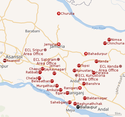 |
| Cities and towns in the eastern portion of Asansol Sadar subdivision in Paschim Bardhaman district MC: Municipal Corporation, CT: census town, N: neighbourhood, R: rural centre Owing to space constraints in the small map, the actual locations in a larger map may vary slightly |
Location
Ballavpur is located at 23.584293°N 87.116954°E.
The Asansol-Durgapur area is composed of undulating laterite region. This area lies between two mighty rivers – the Damodar and the Ajay. They flow almost parallel to each other in the region – the average distance between the two rivers is around 30 km. For ages the area was heavily forested and infested with plunderers and marauders. The discovery of coal in the 18th century led to industrialisation of the area and most of the forests have been cleared.[1]
Jemari (J.K. Nagar Township), Belebathan, Murgathaul, Amkula, Egara, Sahebganj, Raghunathchak and Ballavpur form a cluster of census towns on the western and southern side of Raniganj. Banshra and Baktarnagar are adjacent to Raniganj on the eastern side.[2]
Urbanisation
According to the 2011 census, 83.33% of the population of the Asansol Sadar subdivision was urban and 16.67% was rural.[3] In 2015, the municipal areas of Kulti, Raniganj and Jamuria were included within the jurisdiction of Asansol Municipal Corporation.[4]Asansol Sadar subdivision has 26 (+1 partly) Census Towns.(partly presented in the map alongside; all places marked on the map are linked in the full-screen map).
Demographics
According to the 2011 Census of India, Ballavpur had a total population of 6,468 of which 3,399 (53%) were males and 3,069 (47%) were females. Population in the age range 0-6 years was 687. The total number of literate persons in Ballavpur was 4,680 (80.95% of the population over 6 years).[5]
*For language details see Raniganj (community development block)#Language and religion
According to the 2011 census, the urban agglomeration (UA) centred upon Asansol had a population of 1,243,414. In addition to the erstwhile municipalities of Kulti, Jamuria, and Raniganj subsequently incorporated into the Asansol Municipal Corporation, the agglomeration included the census towns of Amkula, Baktarnagar, Ballavpur, Bhanowara, Domohani, Egara, Jemari (J.K. Nagar Township), Majiara, Murgathaul, Raghunathchak, Sahebganj and Topsi, and also Charanpur, an outgrowth of Jamuria.[6][4]
As of 2001 India census,[7] Ballavpur had a population of 5,391. Males constitute 53% of the population and females 47%. Ballavpur has an average literacy rate of 65%, higher than the national average of 59.5%; with 61% of the males and 39% of females literate. 10% of the population is under 6 years of age.
Infrastructure
According to the District Census Handbook 2011, Bardhaman, Ballavpur covered an area of 1.67 km2. Among the civic amenities, it had 14 km roads with open drains, the protected water-supply involved tap water from untreated sources. It had 342 domestic electric connections. Among the medical facilities it had were 1 family welfare centre, 1 maternity and child welfare centre. Among the educational facilities it had were 4 primary schools, 1 middle school, 1 secondary school, the nearest senior secondary school, general degree college at Raniganj 3 km away. It had 1 non-formal education centre (Sarba Siksha Abhiyan). Among the social, recreational and cultural facilities, it had 1 public library. It had the branch office of 1 nationalised bank.[8]
Economy
Bengal Paper Mills was set up at Ballavpur in 1887. At the time of independence it was producing 11,760 tonnes of paper.[9][10] The mill was closed in 1983. The EMTA Group of Kolkata has taken over the assets and properties of the Bengal Paper Mills Co Ltd. The deal cost the group Rs 25 crore. The Rs 350-crore turnover EMTA Group is engaged in the coal mining business.
Speaking to reporters at Writers' Buildings in 2005, Bansa Gopal Chowdhury, West Bengal's Minister for Cottage and Small Scale Industries, said, in 2005, a new company would be formed and an industrial complex would be set up at the plant complex in Raniganj. Outdated machinery and technology will be discarded and new machinery for manufacturing specialty paper set up. It has also been proposed to set up an integrated steel plant, and a 300 MW capacity thermal power plant within the existing complex. The total investment in these projects would be Rs 1,600 crore and would be commissioned in phases by April 2009.[11]
As of 2017, Bengal Paper Mills Co. Ltd. is under liquidation.[12] The EMTA group, which had taken over the assets of the closed paper mill, has renamed the company as Ballavpur Paper Manfg. Ltd., invested handsomely to revive production and is using the traditional Tiger brand. It started production in February 2009 and subsequently raised it.[13]
Education
Ballavpur Ramgopal Saraf Vidyapith is a Bengali-medium coeducational institution established in 1965. It has facilities for teaching from class V to class XII. The school has 11 computers, a library with 1,000 books and a playground.[14]
Ballavpur R.C. Junior High School is a Hindi-medium coeducational institution established in 2009. It has facilities for teaching from class V to class VIII.[15]
Ballavpur has Bengali-medium primary schools (Belunia Free Primary School, Ballavpur Free Primary School, Unit II, New Madanpur Free Primary School, Ballavpur Village Free Primary School, Unit I, Bengal Paper Mill Free Primary School, Nopur Junior Basic School, Nopur Majhipara Sishu Shiksha Kendra), Hindi-medium primary school (Adarsh Hindi School) and Urdu-medium primary school (Ballavpur Urdu Free Primary School). [16]
Healthcare
Ballavpur Rural Hospital, with 50 beds, is the major government medical facility in the Raniganj CD block. Raniganj Block Primary Health centre at Raniganj functions with 25 beds. There are primary health centres at Baktarnagar (with 6 beds) and Tirat (with 6 beds).[17][18]
References
- Chattopadhyay, Akkori, Bardhaman Jelar Itihas O Lok Sanskriti (History and Folk lore of Bardhaman District.), (in Bengali), Vol I, pp 14-15, Radical Impression. ISBN 81-85459-36-3
- "Census of India 2011, West Bengal: District Census Handbook, Barddhaman" (PDF). Map of Raniganj CD Block, page 215. Directorate of Census Operations, West Bengal. Retrieved 31 August 2018.
- "District Statistical Handbook 2014 Burdwan". Table 2.2, 2.4(a). Department of Statistics and Programme Implementation, Government of West Bengal. Archived from the original on 21 January 2019. Retrieved 4 September 2018.
- "The Kolkata Gazette" (PDF). Notification No. 335/MA/O/C-4/1M-36/2014 dated 3 June 2015. Department of Municipal Affairs, Government of West Bengal. Archived from the original (PDF) on 12 March 2017. Retrieved 4 September 2018.
- "2011 Census – Primary Census Abstract Data Tables". West Bengal – District-wise. Registrar General and Census Commissioner, India. Retrieved 18 February 2017.
- "Constituents of Urban Agglomerations having population 1 lakh and above" (PDF). Provisional Population Total, Census of India 2011. Government of India. Retrieved 27 August 2018.
- "Census of India 2001: Data from the 2001 Census, including cities, villages and towns (Provisional)". Census Commission of India. Archived from the original on 16 June 2004. Retrieved 1 November 2008.
- "District Census Handbook Barddhaman, Census of India 2011, Series 20, Part XII A" (PDF). Section II Town Directory, Pages 1179-1210; Statement I: Status and Growth History, Page 1179; Statement II: Physical Aspects and Location of Towns, Page 1188; Statement III: Civic and other Amenities, Page 1191; Statement IV: Medical Facilities, Page 1196; Statement V: Educational, Recreational and Cultural Facilities, Page 1200; Statement VI:Industry and Banking, Page 1209:. Directorate of census Operations V, West Bengal. Retrieved 14 May 2020.CS1 maint: extra punctuation (link)
- History of Paper Technology in India
- Chattopadhyay, Akkori, pp 494, 664
- The Hindu Business Line 8 June 2005 , The Telegraph 9 June 2005
- "Bengal Paper Mills Co. Ltd". Zauba Corp. Retrieved 7 July 2018.
- "Ballavpur Paper Mnfg. Ltd". BPML. Retrieved 7 July 2018.
- "Ballavpur R.S. Vidyapith". Schools.org.in. Retrieved 6 June 2020.
- "Ballavpur R.C.Junior High School". Schools.org.in. Retrieved 6 June 2020.
- "List of Schools in Adarsh Hindi Vidyalaya Cluster (Bardhaman)". Schools.org.in. Retrieved 6 June 2020.
- "Health & Family Welfare Department" (PDF). Health Statistics – Rural Hospitals. Government of West Bengal. Retrieved 12 May 2020.
- "Health & Family Welfare Department" (PDF). Health Statistics – Primary Health Centres. Government of West Bengal. Retrieved 12 May 2020.
Cities, towns and locations in Paschim Bardhaman district, West Bengal | |||||
|---|---|---|---|---|---|
| Cities, municipal and census towns | |||||
| Locations other than cities and towns |
| ||||
| Neighbourhoods in Asansol |
| ||||
| Related topics |
| ||||