Poplar-Cotton Center, California
Poplar- Cotton Center is a census-designated place (CDP) in Tulare County, California, United States. The population was 2,470 at the 2010 census, up from 1,496 at the 2000 census.
Poplar- Cotton Center | |
|---|---|
 Location in Tulare County and the state of California | |
 Poplar- Cotton Center Location in the United States | |
| Coordinates: 36°3′14″N 119°8′41″W | |
| Country | |
| State | |
| County | Tulare |
| Area | |
| • Total | 1.283 sq mi (3.324 km2) |
| • Land | 1.283 sq mi (3.324 km2) |
| • Water | 0 sq mi (0 km2) 0% |
| Population (2010) | |
| • Total | 2,470 |
| • Density | 1,900/sq mi (740/km2) |
| Time zone | UTC-8 (Pacific (PST)) |
| • Summer (DST) | UTC-7 (PDT) |
| ZIP code | 93257 |
| Area code(s) | 559 |
| FIPS code | 06-58191 |
Geography
Poplar- Cotton Center is located at 36°3′14″N 119°8′41″W (36.053936, -119.144796).[2]
According to the United States Census Bureau, the CDP has a total area of 1.3 square miles (3.4 km2), all of it land.
Demographics
2010
At the 2010 census Poplar-Cotton Center had a population of 2,470. The population density was 1,924.6 people per square mile (743.1/km²). The racial makeup of Poplar was 1,729 (70.0%) White, 1 (0.0%) African American, 15 (0.6%) Native American, 356 (14.4%) Asian, 0 (0.0%) Pacific Islander, 327 (13.2%) from other races, and 42 (1.7%) from two or more races. Hispanic or Latino of any race were 1,809 persons (73.2%).[3]
The whole population lived in households, no one lived in non-institutionalized group quarters and no one was institutionalized.
There were 576 households, 366 (63.5%) had children under the age of 18 living in them, 308 (53.5%) were opposite-sex married couples living together, 121 (21.0%) had a female householder with no husband present, 77 (13.4%) had a male householder with no wife present. There were 76 (13.2%) unmarried opposite-sex partnerships, and 9 (1.6%) same-sex married couples or partnerships. 48 households (8.3%) were one person and 27 (4.7%) had someone living alone who was 65 or older. The average household size was 4.29. There were 506 families (87.8% of households); the average family size was 4.48.
The age distribution was 958 people (38.8%) under the age of 18, 285 people (11.5%) aged 18 to 24, 616 people (24.9%) aged 25 to 44, 411 people (16.6%) aged 45 to 64, and 200 people (8.1%) who were 65 or older. The median age was 24.8 years. For every 100 females, there were 104.3 males. For every 100 females age 18 and over, there were 100.5 males.
There were 611 housing units at an average density of 476.1 per square mile, of the occupied units 262 (45.5%) were owner-occupied and 314 (54.5%) were rented.The homeowner vacancy rate was 1.9%; the rental vacancy rate was 5.1%. 1,132 people (45.8% of the population) lived in owner-occupied housing units and 1,338 people (54.2%) lived in rental housing units.
2000
At the 2000 census there were 1,496 people, 349 households, and 314 families in the CDP. The population density was 1,172.5 people per square mile (451.3/km²). There were 367 housing units at an average density of 287.6 per square mile (110.7/km²). The racial makeup of the CDP was 29.55% White, 1.60% Native American, 16.71% Asian, 0.40% Pacific Islander, 48.66% from other races, and 3.07% from two or more races. Hispanic or Latino of any race were 59.69%.[4]
Of the 349 households 57.0% had children under the age of 18 living with them, 64.8% were married couples living together, 18.1% had a female householder with no husband present, and 10.0% were non-families. 9.5% of households were one person and 4.9% were one person aged 65 or older. The average household size was 4.27 and the average family size was 4.46.
The age distribution was 40.4% under the age of 18, 11.2% from 18 to 24, 25.2% from 25 to 44, 15.5% from 45 to 64, and 7.6% 65 or older. The median age was 24 years. For every 100 females, there were 108.6 males. For every 100 females age 18 and over, there were 99.8 males.
The median household income was $24,519 and the median family income was $25,446. Males had a median income of $22,011 versus $19,306 for females. The per capita income for the CDP was $8,605. About 27.7% of families and 31.2% of the population were below the poverty line, including 41.0% of those under age 18 and 16.5% of those age 65 or over.
Politics
In the state legislature Poplar-Cotton Center is located in the 16th Senate District, represented by Democrat Dean Florez, and in the 30th Assembly District, represented by Republican Danny Gilmore.
In the United States House of Representatives, Poplar-Cotton Center is in California's 23rd congressional district, represented by Republican Kevin McCarthy[5]
References
- "2010 Census U.S. Gazetteer Files – Places – California". United States Census Bureau.
- "US Gazetteer files: 2010, 2000, and 1990". United States Census Bureau. 2011-02-12. Retrieved 2011-04-23.
- "2010 Census Interactive Population Search: CA - Poplar CDP". U.S. Census Bureau. Archived from the original on July 15, 2014. Retrieved July 12, 2014.
- "U.S. Census website". United States Census Bureau. Retrieved 2008-01-31.
- "California's 23rd Congressional District - Representatives & District Map". Civic Impulse, LLC. Retrieved October 6, 2014.
Municipalities and communities of Tulare County, California, United States | ||
|---|---|---|
| Cities | 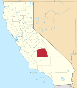 Tulare County map | |
| CDPs |
| |
| Unincorporated communities | ||
| Ghost towns |
| |
| Indian reservation | ||