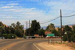
Lemon Cove, California
Lemon Cove is a census-designated place (CDP) in the San Joaquin Valley in Tulare County, California, United States. The population was 308 at the 2010 census, up from 298 at the 2000 census.
Lemon Cove | |
|---|---|
Census designated place | |
 | |
 Location in Tulare County and the state of California | |
 Lemon Cove Location in the United States | |
| Coordinates: 36°22′53″N 119°1′33″W | |
| Country | |
| State | |
| County | Tulare |
| Area | |
| • Total | 0.834 sq mi (2.159 km2) |
| • Land | 0.834 sq mi (2.159 km2) |
| • Water | 0 sq mi (0 km2) 0% |
| Elevation | 502 ft (153 m) |
| Population | |
| • Total | 308 |
| • Density | 370/sq mi (140/km2) |
| Time zone | UTC-8 (Pacific) |
| • Summer (DST) | UTC-7 (PDT) |
| ZIP code | 93244 |
| Area code | 559 |
| FIPS code | 06-41110 |
| GNIS feature IDs | 244733, 2408598 |
Geography and ecology
Lemon Cove is located at 36°22′53″N 119°1′33″W (36.381425, -119.025917)[3] near the confluence of Lime Kiln Creek and the Kaweah River.
There are numerous flora and fauna species in the vicinity of Lemon Cove. The local Lime Kiln Creek watershed contains many wildflowers of numerous taxa; included in these are the yellow mariposa lily, Calochortus luteus.[4]
According to the United States Census Bureau, the CDP has a total area of 0.8 square miles (2.1 km2), all of it land.
Demographics
| Historical population | |||
|---|---|---|---|
| Census | Pop. | %± | |
| U.S. Decennial Census[5] | |||
2010
At the 2010 census Lemon Cove had a population of 308. The population density was 369.5 people per square mile (142.7/km²). The racial makeup of Lemon Cove was 261 (84.7%) White, 0 (0.0%) African American, 5 (1.6%) Native American, 3 (1.0%) Asian, 2 (0.6%) Pacific Islander, 12 (3.9%) from other races, and 25 (8.1%) from two or more races. Hispanic or Latino of any race were 76 people (24.7%).[6]
The whole population lived in households, no one lived in non-institutionalized group quarters and no one was institutionalized.
There were 120 households, 39 (32.5%) had children under the age of 18 living in them, 53 (44.2%) were opposite-sex married couples living together, 19 (15.8%) had a female householder with no husband present, 7 (5.8%) had a male householder with no wife present. There were 4 (3.3%) unmarried opposite-sex partnerships, and 0 (0%) same-sex married couples or partnerships. 37 households (30.8%) were one person and 10 (8.3%) had someone living alone who was 65 or older. The average household size was 2.57. There were 79 families (65.8% of households); the average family size was 3.16.
The age distribution was 82 people (26.6%) under the age of 18, 32 people (10.4%) aged 18 to 24, 58 people (18.8%) aged 25 to 44, 92 people (29.9%) aged 45 to 64, and 44 people (14.3%) who were 65 or older. The median age was 39.6 years. For every 100 females, there were 106.7 males. For every 100 females age 18 and over, there were 107.3 males.
There were 153 housing units at an average density of 183.5 per square mile, of the occupied units 77 (64.2%) were owner-occupied and 43 (35.8%) were rented.The homeowner vacancy rate was 0%; the rental vacancy rate was 6.0%. 202 people (65.6% of the population) lived in owner-occupied housing units and 106 people (34.4%) lived in rental housing units.
2000
At the 2000 census there were 298 people, 121 households, and 76 families in the CDP. The population density was 355.5 people per square mile (137.0/km²). There were 145 housing units at an average density of 173.0 per square mile (66.6/km²). The racial makeup of the CDP was 87.25% White, 0.67% African American, 4.70% Native American, 2.01% Asian, 4.70% from other races, and 0.67% from two or more races. Hispanic or Latino of any race were 12.08%.[7]
Of the 121 households 26.4% had children under the age of 18 living with them, 52.1% were married couples living together, 7.4% had a female householder with no husband present, and 36.4% were non-families. 34.7% of households were one person and 9.1% were one person aged 65 or older. The average household size was 2.46 and the average family size was 3.18.
The age distribution was 26.2% under the age of 18, 6.7% from 18 to 24, 26.8% from 25 to 44, 24.8% from 45 to 64, and 15.4% 65 or older. The median age was 39 years. For every 100 females, there were 101.4 males. For every 100 females age 18 and over, there were 98.2 males.
The median household income was $28,333 and the median family income was $36,607. Males had a median income of $20,938 versus $30,625 for females. The per capita income for the CDP was $16,200. About 21.9% of families and 32.6% of the population were below the poverty line, including 54.2% of those under the age of eighteen and 16.7% of those sixty five or over.
Government
In the California State Senate, Lemon Cove is split between the 8th Senate District, represented by Republican Andreas Borgeas, and the 16th Senate District, represented by Republican Shannon Grove, and in the California State Assembly it is split between the 23rd Assembly District, represented by Republican Jim Patterson, and the 26th Assembly District, represented by Republican Devon Mathis.[8]
In the United States House of Representatives, Lemon Cove is in California's 23rd congressional district, represented by Republican Kevin McCarthy[9]
Notable people
- Willard Hershberger, baseball player.
References
- "2010 Census Gazetteer Files – Places – California". United States Census Bureau. Retrieved March 26, 2015.
- "Lemon Cove Census Designated Place". Geographic Names Information System. United States Geological Survey. Retrieved March 15, 2015.
- "US Gazetteer files: 2010, 2000, and 1990". United States Census Bureau. 2011-02-12. Retrieved 2011-04-23.
- C. Michael Hogan. 2009. Yellow Mariposa Lily: Calochortus luteus, GlobalTwitcher.com, ed. N. Stromberg Archived 2011-10-04 at the Wayback Machine
- "Census of Population and Housing". Census.gov. Retrieved June 4, 2016.
- "2010 Census Interactive Population Search: CA - Lemon Cove CDP". U.S. Census Bureau. Archived from the original on July 15, 2014. Retrieved July 12, 2014.
- "U.S. Census website". United States Census Bureau. Retrieved 2008-01-31.
- "Statewide Database". Regents of the University of California. Archived from the original on February 1, 2015. Retrieved March 15, 2015.
- "California's 23rd Congressional District - Representatives & District Map". Civic Impulse, LLC. Retrieved October 6, 2014.
Municipalities and communities of Tulare County, California, United States | ||
|---|---|---|
| Cities | 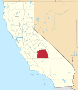 Tulare County map | |
| CDPs |
| |
| Unincorporated communities | ||
| Ghost towns |
| |
| Indian reservation | ||