Po Toi Islands
The Po Toi Islands are a small group of islands with a population of around 200, south-east of Hong Kong Island, off Stanley, in Hong Kong. The main island of the group is Po Toi Island. Administratively, they are part of Islands District.[1]
| 蒲台羣島 | |
|---|---|
 Aerial view of Waglan Island (foreground), Po Toi (left), Lo Chau and Sung Kong from the east | |
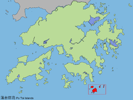 Location of Po Toi Islands within Hong Kong. | |
| Geography | |
| Location | South-east of Hong Kong Island |
| Coordinates | 22.1742°N 114.2705°E |
| Major islands | Po Toi Island |
| Administration | |
| District | Islands District |
| Demographics | |
| Population | 200 |
| Po Toi Islands | |||||||||||||
|---|---|---|---|---|---|---|---|---|---|---|---|---|---|
| Traditional Chinese | 蒲台羣島/ 蒲苔羣島 | ||||||||||||
| Simplified Chinese | 蒲台群岛/ 蒲苔群岛 | ||||||||||||
| |||||||||||||
Tin Hau Temple at Tai Wan (大灣) Bay, Po Toi

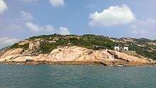
The southwest-facing slope of Beaufort Island (Lo Chau)
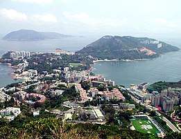
View of Stanley Peninsula in the southeast of Hong Kong Island. On the left, Beaufort Island and Po Toi Island (behind Beaufort), are visible.
The islands are notable for interesting rock formations and open-air seafood restaurants. Po Toi Island has a "haunted house", and some rock carvings supposed to be the epitaph of an emperor who died on or near Po Toi. Waglan Island has one of the five surviving pre-war lighthouses in Hong Kong.[2]
Geography
Po Toi Islands include:
- Lo Chau Pak Pai (螺洲白排)
- Beaufort Island (螺洲)
- Mat Chau (墨洲), an islet off Po Toi island
- Mat Chau Pai (墨洲排), an islet off Mat Chau
- Po Toi (蒲台), 3.69 km²
- Sai Pai (細排)
- San Pai (散排)
- Sung Kong (宋崗)
- Tai Pai (大排)
- Waglan Island (橫瀾島)
Name
For the origin of the name, see Po Toi.
Transport
The islands are accessible by private ferry (kai-to) or water taxi. Scheduled ferries connect Po Toi island with Aberdeen and Stanley.[3]
See also
- Islands of Hong Kong
- List of buildings, sites and areas in Hong Kong
References
This article is issued from Wikipedia. The text is licensed under Creative Commons - Attribution - Sharealike. Additional terms may apply for the media files.