Phu Kamyao District
Phu Kamyao (Thai: ภูกามยาว, pronounced [pʰūː kāːm.jāːw]) is a district (amphoe) of Phayao Province in northern Thailand.
Phu Kamyao ภูกามยาว | |
|---|---|
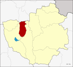 District location in Phayao Province | |
| Coordinates: 19°16′18″N 99°58′12″E | |
| Country | Thailand |
| Province | Phayao |
| Seat | Huai Kaeo |
| Area | |
| • Total | 213.8 km2 (82.5 sq mi) |
| Population (2005) | |
| • Total | 22,659 |
| • Density | 106.0/km2 (275/sq mi) |
| Time zone | UTC+7 (ICT) |
| Postal code | 56000 |
| Geocode | 5609 |
Geography
Neighboring districts are (from the north clockwise): Pa Daet of Chiang Rai Province; Dok Khamtai, Mueang Phayao, and Mae Chai of Phayao Province.
The mountains of the Phi Pan Nam Range dominate the landscape of the district.
History
The minor district was established on 1 July 1997, when it was split off from Mueang Phayao District.[1]
The Thai government on 15 May 2007, upgraded all of 81 minor districts to full districts.[2] With publication in the Royal Gazette on 24 August the upgrade became official.[3]
Administration
The district is divided into three sub-districts (tambons), which are further subdivided into 40 villages (mubans). Dong Chen is a township (thesaban tambon) which covers parts of tambons Dong Chen and Mae Ing. There are a further three tambon administrative organization (TAO).
| No. | Name | Thai name | Pop. | ||
|---|---|---|---|---|---|
| 1. | Huai Kaeo | ห้วยแก้ว | 8,917 | ||
| 2. | Dong Chen | ดงเจน | 9,217 | ||
| 3. | Mae Ing | แม่อิง | 4,525 |
References
- ประกาศกระทรวงมหาดไทย เรื่อง แบ่งเขตท้องที่อำเภอเมืองพะเยา จังหวัดพะเยา ตั้งเป็นกิ่งอำเภอภูกามยาว (PDF). Royal Gazette (in Thai). 114 (Special 51 ง): 14. June 26, 1997.
- แถลงผลการประชุม ครม. ประจำวันที่ 15 พ.ค. 2550 (in Thai). Manager Online.
- พระราชกฤษฎีกาตั้งอำเภอฆ้องชัย...และอำเภอเหล่าเสือโก้ก พ.ศ. ๒๕๕๐ (PDF). Royal Gazette (in Thai). 124 (46 ก): 14–21. August 24, 2007.