Penn Township, Parke County, Indiana
Penn Township is one of thirteen townships in Parke County, Indiana, United States. As of the 2010 census, its population was 810 and it contained 368 housing units.[2]
Penn Township | |
|---|---|
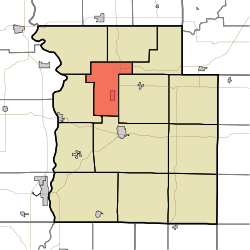 Location in Parke County | |
| Coordinates: 39°51′09″N 87°15′30″W | |
| Country | |
| State | |
| County | Parke |
| Government | |
| • Type | Indiana township |
| Area | |
| • Total | 23.78 sq mi (61.6 km2) |
| • Land | 23.73 sq mi (61.5 km2) |
| • Water | 0.05 sq mi (0.1 km2) 0.21% |
| Elevation | 633 ft (193 m) |
| Population (2010) | |
| • Total | 810 |
| • Density | 34.1/sq mi (13.2/km2) |
| Time zone | UTC-5 (Eastern (EST)) |
| • Summer (DST) | UTC-4 (EDT) |
| ZIP codes | 47832, 47859, 47862, 47872, 47952 |
| Area code(s) | 765 |
| GNIS feature ID | 453713 |
History
Penn Township was organized in 1854, and was originally built up chiefly by Quakers.[3]
The Cox Ford Covered Bridge, Joseph Finney House, and Jackson Covered Bridge are listed on the National Register of Historic Places.[4]
Geography
According to the 2010 census, the township has a total area of 23.78 square miles (61.6 km2), of which 23.73 square miles (61.5 km2) (or 99.79%) is land and 0.05 square miles (0.13 km2) (or 0.21%) is water.[2] The township includes the southwest quarter of Turkey Run State Park.
Cities, towns, villages
Unincorporated towns
- Annapolis at 39.852540°N 87.250569°W
- Coke Oven Hollow at 39.853095°N 87.291958°W
- Rockport at 39.880873°N 87.278902°W
- Stumptown at 39.852262°N 87.274458°W
(This list is based on USGS data and may include former settlements.)
Extinct towns
- Pottertown at 39.830873°N 87.262236°W
(These towns are listed as "historical" by the USGS.)
Cemeteries
The township contains these four cemeteries: Bloomingdale, Coffin, DeBaun and Hethcoe.
Major highways


School districts
- Turkey Run Community School Corporation
Political districts
- State House District 41
- State Senate District 38
References
- "Penn Township, Parke County, Indiana". Geographic Names Information System. United States Geological Survey. Retrieved 2009-11-01.
- United States Census Bureau 2009 TIGER/Line Shapefiles
- IndianaMap
- "US Board on Geographic Names". United States Geological Survey. October 25, 2007. Retrieved 2017-05-09.
- "Population, Housing Units, Area, and Density: 2010 - County -- County Subdivision and Place -- 2010 Census Summary File 1". United States Census. Archived from the original on 2020-02-12. Retrieved 2013-05-10.
- History of Parke and Vermillion Counties, Indiana. B.F. Bowen & Cos. 1913. p. 195.
- "National Register Information System". National Register of Historic Places. National Park Service. July 9, 2010.
External links
- Indiana Township Association
- United Township Association of Indiana
- City-Data.com page for Penn Township
Places adjacent to Penn Township, Parke County, Indiana | |
|---|---|
Municipalities and communities of Parke County, Indiana, United States | ||
|---|---|---|
| Towns | Map of Indiana highlighting Parke County | |
| Townships | ||
| Unincorporated communities |
| |
| Ghost town | ||
| Footnotes | ‡This populated place also has portions in an adjacent county or counties | |