Armiesburg, Indiana
Armiesburg (also called Armiesburg Mills, Armiesburgh or Stringtown) is an unincorporated community in Wabash Township, Parke County, in Indiana.[2]
Armiesburg, Indiana | |
|---|---|
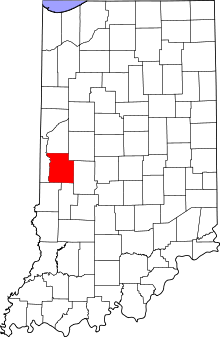 Parke County's location in Indiana | |
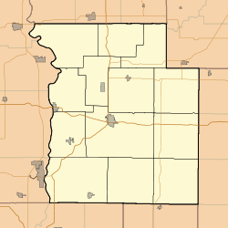 Armiesburg Location in Parke County | |
| Coordinates: 39°45′48″N 87°21′04″W | |
| Country | United States |
| State | Indiana |
| County | Parke |
| Township | Wabash |
| Elevation | 525 ft (160 m) |
| Time zone | UTC-5 (Eastern (EST)) |
| • Summer (DST) | UTC-4 (EDT) |
| ZIP code | 47862 |
| Area code(s) | 765 |
| GNIS feature ID | 449613 |
History
When General William Henry Harrison took an army from Vincennes to the Battle of Tippecanoe in late 1811, Zachariah Cicott served as a scout. Cicott was familiar with the area because of his time trading up and down the Wabash River, starting circa 1801. The trail taken by Harrison's army passed through the area that later became Parke County on its way to and from the battle site in Tippecanoe County. The settlement of Armiesburg was so named because Harrison and his army crossed the Raccoon Creek and camped near there on their way to the battle.[3] After the county was established in 1821, the county seat was located first at Roseville, and second at Armiesburg where at least two court sessions were held. The county seat was finally located at Rockville in 1822.[4] The original plat of the town was destroyed along with many other records in an 1832 fire in Rockville;[5] the town was platted again in 1833.[6]
A post office was established at Armiesburg in 1844, and remained in operation until it was discontinued in 1902.[7]
Geography
Armiesburg is located in the western part of the county, just over 1 mile (1.6 km) to the east of the confluence of the Big Raccoon Creek and the Wabash River, and about 1.5 miles (2.4 km) southeast of Montezuma. Its elevation is 525 feet (160 m).[2]
See also
References
- "US Board on Geographic Names". United States Geological Survey. October 25, 2007. Retrieved 2017-04-16.
- "Armiesburg, Indiana". Geographic Names Information System. United States Geological Survey. Retrieved 2010-11-01.
- Bowen 1913, pp. 52–53, 221.
- Bowen 1913, p. 62.
- Bowen 1913, p. 152.
- Baker, Ronald L.; Carmony, Marvin (1975). Indiana Place Names. Bloomington, Indiana: Indiana University Press. p. 5.
- "Parke County". Jim Forte Postal History. Retrieved April 16, 2017.
Bibliography
- History of Parke and Vermillion Counties Indiana. Indianapolis: B. F. Bowen and Company. 1913. pp. 25–225. Retrieved 2010-12-17.
Municipalities and communities of Parke County, Indiana, United States | ||
|---|---|---|
| Towns | Map of Indiana highlighting Parke County | |
| Townships | ||
| Unincorporated communities |
| |
| Ghost town | ||
| Footnotes | ‡This populated place also has portions in an adjacent county or counties | |