Panay Gulf
Panay Gulf is an extension of the Sulu Sea, reaching between the islands of Panay and Negros in the Philippines. The gulf contains the island-province of Guimaras and extends into the Santa Anna Bay between Panay and Guimaras and into Guimaras Strait, between Guimaras and Negros. Guimaras Strait connects Panay Gulf with the Visayan Sea.
| Panay Gulf | |
|---|---|
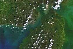 Satellite view of Iloilo City and Guimaras Island, with the gulf at the lower left | |
.svg.png) Panay Gulf Location within the Philippines .svg.png) Panay Gulf Panay Gulf (Philippines) | |
| Location | |
| Coordinates | 10°15′00″N 122°14′55″E |
| Type | gulf |
| Etymology | Panay |
| Part of | Sulu Sea |
| Settlements | |
The Port of Iloilo is the busiest port on the gulf, which is a major route used by ships plying the areas between Iloilo City, Bacolod City, and Zamboanga further to the south.
The Panay Landing during World War II occurred from the Panay Gulf.

A map in German of the Visayas Sea showing the Panay Gulf (Golf von Panay) in the bottom left
Seas of the Philippines | ||
|---|---|---|
| Ocean |  | |
| Sea | ||
| Strait |
| |
| Gulf | ||
See also: Bodies of water of the Philippines | ||
This article is issued from Wikipedia. The text is licensed under Creative Commons - Attribution - Sharealike. Additional terms may apply for the media files.