Hinigaran
Hinigaran, officially the Municipality of Hinigaran, is a 1st class municipality in the province of Negros Occidental, Philippines. According to the 2015 census, it has a population of 85,602 people.[3]
Hinigaran | |
|---|---|
| Municipality of Hinigaran | |
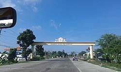 Welcome arch | |
| Nickname(s): "The Gateway to Southern Negros" "The Firecrackers Capital of Negros Occidental" | |
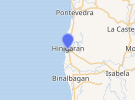
 Map of Negros Occidental with Hinigaran highlighted | |
| |
.svg.png) Hinigaran Location within the Philippines | |
| Coordinates: 10°16′N 122°51′E | |
| Country | |
| Region | Western Visayas (Region VI) |
| Province | Negros Occidental |
| District | 5th district of Negros Occidental |
| Founded | 1768 |
| Barangays | 24 (see Barangays) |
| Government | |
| • Type | Sangguniang Bayan |
| • Mayor | Jose Nadie P. Arceo |
| • Vice Mayor | Teresita G. Gabrido |
| • Congressman | Maria Lourdes A. Lesaca |
| • Electorate | 53,437 voters (2019) |
| Area | |
| • Total | 154.92 km2 (59.81 sq mi) |
| Elevation | 7.9 m (25.9 ft) |
| Population (2015 census)[3] | |
| • Total | 85,602 |
| • Density | 550/km2 (1,400/sq mi) |
| • Households | 20,421 |
| Economy | |
| • Income class | 1st municipal income class |
| • Poverty incidence | 16.58% (2015)[4] |
| • Revenue (₱) | 196,015,291.33 (2016) |
| Time zone | UTC+8 (PST) |
| ZIP code | 6106 |
| PSGC | |
| IDD : area code | +63 (0)34 |
| Climate type | tropical climate |
| Native languages | Hiligaynon Tagalog |
| Website | www |
It is about 54 kilometres (34 mi) south from Bacolod City.
History
The early inhabitants of this town were the semi-primitive people called "Mundos" and "Ambaks". When traders and settlers from Panay started moving in, the natives were driven to the mountains. The new settlers were called "Tagahigad" and when the Spaniards came the place was called "Ginigaran" from the word "higad" but it was later spelled and pronounced as Hinigaran.
The town was founded in 1765 and Captain Basilio Mongcal was appointed as the first president in 1806. Among its first settlers were the families of Mongcal, Lagtapon, Cosio,Sario, David, Orin, Pido, Pabalinas, Luntayao, Javier, Vargas, Lucasan, Grijaldo, and Dano-og—some of whom were from Panay.
The Spaniards established the seat of the "pueblo" in Jacinto and Zamora Streets, and the town was governed by "Capitanes Municipales", Tenientes Absolato" and Cabeza de Barangays". When revolt against the Spanish Government broke out, Capitan Bibiano Gelvosa and his followers fought bravely against the Spaniards. He was the last "Capitan Municipal" when the Americans arrived.
Barangays
Hinigaran is politically subdivided into 24 barangays.
Climate
| Climate data for Hinigaran, Negros Occidental | |||||||||||||
|---|---|---|---|---|---|---|---|---|---|---|---|---|---|
| Month | Jan | Feb | Mar | Apr | May | Jun | Jul | Aug | Sep | Oct | Nov | Dec | Year |
| Average high °C (°F) | 30 (86) |
31 (88) |
32 (90) |
33 (91) |
32 (90) |
30 (86) |
29 (84) |
29 (84) |
29 (84) |
29 (84) |
30 (86) |
30 (86) |
30 (87) |
| Average low °C (°F) | 22 (72) |
22 (72) |
22 (72) |
24 (75) |
25 (77) |
25 (77) |
25 (77) |
25 (77) |
24 (75) |
24 (75) |
23 (73) |
23 (73) |
24 (75) |
| Average precipitation mm (inches) | 38 (1.5) |
29 (1.1) |
55 (2.2) |
65 (2.6) |
141 (5.6) |
210 (8.3) |
212 (8.3) |
176 (6.9) |
180 (7.1) |
180 (7.1) |
130 (5.1) |
70 (2.8) |
1,486 (58.6) |
| Average rainy days | 9.0 | 7.2 | 11.1 | 13.5 | 25.6 | 28.4 | 28.9 | 27.3 | 26.9 | 27.7 | 21.8 | 13.8 | 241.2 |
| Source: Meteoblue [5] | |||||||||||||
Demographics

| Population census of Hinigaran | ||
|---|---|---|
| Year | Pop. | ±% p.a. |
| 1903 | 14,256 | — |
| 1918 | 16,097 | +0.81% |
| 1939 | 27,438 | +2.57% |
| 1948 | 29,017 | +0.62% |
| 1960 | 36,240 | +1.87% |
| 1970 | 46,010 | +2.41% |
| 1975 | 52,018 | +2.49% |
| 1980 | 54,717 | +1.02% |
| 1990 | 68,739 | +2.31% |
| 1995 | 71,519 | +0.75% |
| 2000 | 74,997 | +1.02% |
| 2007 | 80,528 | +0.99% |
| 2010 | 81,925 | +0.63% |
| 2015 | 85,602 | +0.84% |
| Source: Philippine Statistics Authority[3][6][7][8] | ||
The people in the city speak the Hiligaynon language (often called Ilonggo). Filipino and English are generally understood.
Economy
Economic profile
- Total Internal Revenue Allotment: Php P180,762,087 (2018)
- Total Income: Php 158,600,789.72 (2015)
- Major Industry: Agriculture and fishing
- Products: Nylon shell, Capiz shell, Talaba, firecrackers manufacturing
- Market Days: Thursdays and Sunday
- Town Fiesta: April 30 (Hinugyaw Festival)
- Patronal Fiesta: July 22
- Patron Saint: Saint Mary Magdalene
Malls/supermarkets
- Lopues Value Store
- Prince Hypermart
- Puregold
- Melva's Grocery
- D'Garisson Mini Mart
- Negros Grace Pharmacy Grocery Store
- Mercury Drug Store w/ Grocery Store
- KJ Fairmart
Upcoming malls/supermarkets
- Metro Gaisano Mall
- Savemore (Coming Soon)
- Citymall (Coming Soon)
- Gaisano Grand Mall (Coming Soon)
Banking institutions
- BDO
- RCBC
- Producers Bank
- Banko (a subsidiary of BPI)
- Land Bank (Coming Soon)
Education
- Number of Elementary Schools : 25
- Number of Secondary Schools : 7
- Number of College : 1 — Central Philippines State University – Hinigaran/Cong. Mariano M. Yulo Campus
Landmarks
- San Jose Muscovado Sugar Mill
- Barangay Pilar World War II Marker
- Mary Magdalene Church
- Talabahan Plantation
- Paradiso Beach Resort
- Mini Rizal Park
- Canonoy Beach Resort
- Senator Esperidion Guanco Bridge
- Espiso Beach Resort
- Tagda Pier
- Linao Lake Farm Resort
References
- "Municipality". Quezon City, Philippines: Department of the Interior and Local Government. Retrieved 31 May 2013.
- "Province:". PSGC Interactive. Quezon City, Philippines: Philippine Statistics Authority. Retrieved 12 November 2016.
- Census of Population (2015). "Region VI (Western Visayas)". Total Population by Province, City, Municipality and Barangay. PSA. Retrieved 20 June 2016.
- "PSA releases the 2015 Municipal and City Level Poverty Estimates". Quezon City, Philippines. Retrieved 12 October 2019.
- "Hinigaran: Average Temperatures and Rainfall". Meteoblue. Retrieved 7 May 2020.
- Census of Population and Housing (2010). "Region VI (Western Visayas)". Total Population by Province, City, Municipality and Barangay. NSO. Retrieved 29 June 2016.
- Censuses of Population (1903–2007). "Region VI (Western Visayas)". Table 1. Population Enumerated in Various Censuses by Province/Highly Urbanized City: 1903 to 2007. NSO.
- "Province of". Municipality Population Data. Local Water Utilities Administration Research Division. Retrieved 17 December 2016.
External links
- Hinigaran Profile at PhilAtlas.com
- Hinigaran Profile at the Official Website of Negros Occidental
- Philippine Standard Geographic Code
- Philippine Census Information
- "Banana plant with five hearts" in Hinigaran
- Local Governance Performance Management System
Places adjacent to Hinigaran | ||||||||||
|---|---|---|---|---|---|---|---|---|---|---|
| ||||||||||
Bacolod (capital) | |
| Municipalities | |
| Component cities | |
| Highly urbanized city |
|