Palmer River
The Palmer River is a river located in Far North Queensland, Australia. The area surrounding the river was the site of a gold rush in the late 19th century which started in 1873.
| Palmer | |
|---|---|
 A gold mining dredge on the Palmer River. | |
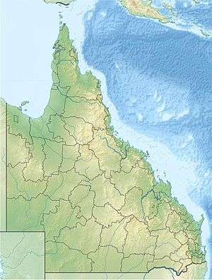 Location of Palmer River mouth in Queensland | |
| Etymology | In honour of Sir Arthur Hunter Palmer[1] |
| Location | |
| Country | Australia |
| State | Queensland |
| Region | Far North Queensland |
| Physical characteristics | |
| Source | Sussex Range, Great Dividing Range |
| Source confluence | Prospect Creek and Campbell Creek |
| ⁃ location | near Palmer River Roadhouse |
| ⁃ coordinates | 16°06′18″S 144°46′52″E |
| ⁃ elevation | 429 m (1,407 ft) |
| Mouth | confluence with the Mitchell River |
⁃ location | northeast of Staaten River National Park |
⁃ coordinates | 16°04′52″S 142°42′49″E |
⁃ elevation | 64 m (210 ft) |
| Length | 327 km (203 mi) |
| Basin size | 8,335 km2 (3,218 sq mi) |
| Basin features | |
| River system | Mitchell River catchment |
| Tributaries | |
| ⁃ left | South Palmer River |
| ⁃ right | Little Palmer River, North Palmer River |
| [2] | |
Course and features
The headwaters of the Palmer River rise in the Sussex Range, part of the Great Dividing Range southwest of Cooktown. The river is formed by the confluence of the Prospect Creek and Campbell Creek, near Palmer River Roadhouse, south of Lakeland. The Palmer River flows west across the Cape York Peninsula towards the Gulf of Carpentaria joined by 29 tributaries including the South Palmer River, Little Palmer River and North Palmer River, before reaching its confluence with the Mitchell River northeast of Staaten River National Park. The river descends 365 metres (1,198 ft) over its 327-kilometre (203 mi) course[2] and has a catchment area of 8,335 square kilometres (3,218 sq mi).[3]
History
Yalanji (also known as Kuku Yalanji, Kuku Yalaja, Kuku Yelandji, and Gugu Yalanji) is an Australian Aboriginal language of Far North Queensland. The traditional language region is Mossman River in the south to the Annan River in the north, bordered by the Pacific Ocean in the east and extending inland to west of Mount Mulgrave. This includes the local government boundaries of the Shire of Douglas, the Shire of Cook and the Aboriginal Shire of Wujal Wujal and the towns and localities of Cooktown, Mossman, Daintree, Cape Tribulation and Wujal Wujal. It includes the head of the Palmer River, the Bloomfield River, China Camp, Maytown, and Palmerville.[4]
Palmer River was one of Australia's major gold rush locations. William Hann and geologist Norman Taylor found gold in a sandy bed of the river in 1872.[5] Hann named the river after Arthur Hunter Palmer the Premier of Queensland at that time.[1]
The main settlement of the gold field was Maytown replacing Palmerville after some months. The settlement began as a camp in 1873, then grew into a town which served as the administration centre for the former Hann Local Government Area. The settlements of Byerstown and Idatown were also established along the river.[1]
Palmerville Post Office opened on 11 May 1874 (closed 1965); Maytown Post Office opened on 7 June 1874 (closed 1945); Byerstown Post Office opened on 1 April 1876 (closed around 1884).[6]
There were several confrontations between the settlers and the Aborigines from the area, including one at Battle Camp.
The miners in the Palmer River included Chinese, mostly from the Guangdong Province in southern China.[7] The Chinese miners would re-work the diggings of Europeans as they moved on to find richer diggings.[8] In 1876, with the rush to the Hodgkinson River,[9] Chinese miners occupied most of the Palmer Gold Field. As gold reserves were extracted, anti-Chinese sentiment grew.
Although most of the surface gold has long since been prospected, there remain a handful of deeper mine projects in the area.
References
- "Palmer River". Queensland Places. entre for the Government of Queensland. Retrieved 26 October 2011.
- "Map of Palmer River, QLD". Bonzle Digital Atlas of Australia. Retrieved 2 December 2015.
- "Palmer River drainage sub-basin". WetlandInfo. Queensland Government. 2015. Retrieved 3 December 2015.
-

- "Gold!". Cairns Museum. Archived from the original on 11 September 2011. Retrieved 26 October 2011.
- Premier Postal History. "Post Office List". Premier Postal Auctions. Retrieved 24 December 2015.
- Kirkman, Noreen (1993). From minority to majority: Chinese on the Palmer River Gold-field, 1873-1876, in Race Relations in North Queensland, edited by Henry Reynolds. Townsville: James Cook University. pp. 243–257. ISBN 978-0-86443-484-5.
- "Palmer Goldfield Resources Reserve: Nature, culture and history". Department of Environment and Resource Management. 9 June 2011. Archived from the original on 25 June 2010. Retrieved 26 October 2011.
- Kirkman, Noreen (1982). Mining on the Hodgkinson." In Readings in North Queensland Mining History, edited by K.H. Kennedy. Townsville: James Cook University. pp. 171–194. ISBN 0864430612.
Rivers of Queensland | |||||||||||||||
|---|---|---|---|---|---|---|---|---|---|---|---|---|---|---|---|
| |||||||||||||||
| |||||||||||||||
| |||||||||||||||
| |||||||||||||||
| |||||||||||||||
| |||||||||||||||