Ross Creek (Townsville, North Queensland)
The Ross Creek, part of the Ross River catchment, is the small estuarine portion of the Ross River, as it serves as a bay inlet that separates the Townsville central business district from Ross Island. The creek is located in the lower reaches of the river catchment, in the city confines of Townsville, in North Queensland, Australia.
| Ross | |
|---|---|
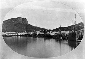 Ross Creek circa 1878 with Castle Hill in the background | |
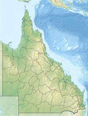 Location of Ross Creek river mouth in Queensland | |
| Etymology | W. A. Ross, a colonial settler[1] |
| Location | |
| Country | Australia |
| State | Queensland |
| Region | North Queensland |
| City | Townsville |
| Physical characteristics | |
| Source | Ross River |
| ⁃ location | Bicentennial Park, Townsville |
| ⁃ coordinates | 19°16′53″S 146°48′37″E |
| Mouth | Port of Townsville |
⁃ location | South Townsville |
⁃ coordinates | 19°15′59″S 146°49′56″E |
⁃ elevation | 0 m (0 ft) |
| Basin size | 2,225 km2 (859 sq mi) |
| Basin features | |
| River system | Ross River catchment |
| [2] | |
Course and features
The only passage across Ross Creek was by ferry until Victoria Bridge was completed in 1889. Ross Creek was the only port for Townsville until 1892, at which time the outer harbour was constructed. Vessels from interstate and overseas moored in Cleveland Bay and passengers were transferred to the northern shore of the creek by lighters.
See also
- Rivers of Queensland
References
- "Our story, our vision". About the Port. Port of Townsville. 31 July 2015. Retrieved 15 October 2015.
- Australian Government; Queensland Government; Townsville City Council. "Lower Ross River: Sub-Basin Fact Sheet 6" (PDF). Black Ross (ToWnsville) Water Quality Improvement Plan. Townsville City Council. Archived from the original (PDF) on 10 March 2015. Retrieved 15 October 2015.
Rivers of Queensland | |||||||||||||||
|---|---|---|---|---|---|---|---|---|---|---|---|---|---|---|---|
| |||||||||||||||
| |||||||||||||||
| |||||||||||||||
| |||||||||||||||
| |||||||||||||||
| |||||||||||||||
This article is issued from Wikipedia. The text is licensed under Creative Commons - Attribution - Sharealike. Additional terms may apply for the media files.