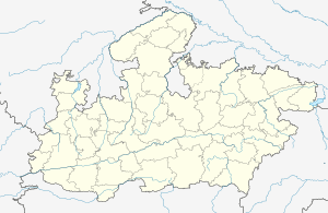
Niwali, Madhya Pradesh
Niwali, Madhya Pradesh is a village & Tehsil in Barwani district[1][2] in the Indian state of Madhya Pradesh.[3]
Niwali | |
|---|---|
village | |
 Niwali Location in Madhya Pradesh, India | |
| Coordinates: 21.68°N 74.92°E | |
| Country | |
| State | Madhya Pradesh |
| District | Barwani |
| Languages | |
| • Official | Hindi |
| Time zone | UTC+5:30 (IST) |
| ISO 3166 code | IN-MP |
Geography
Niwali is located in the Narmada Valley, at 21.68°N 74.92°E. It has an average elevation of 508 m (1,667 ft).[4] Situated on MP SH 36,[5] Niwali lies 21 km (13 mi) from Sendhwa. It is a Tehsil of Barwani district.[6]
References
- Sharma, Kapilesh (7 December 2014). "Two accused sent to jail, absconding engineer held". The Free Press Journal. Archived from the original on 2 April 2015. Retrieved 25 March 2015.
- Ayub, Jamal (26 November 2012). "Now, English medium schools for tribals in Madhya Pradesh". The Times of India. TNN. Retrieved 25 March 2015.
- "निवाली में मंगलवार को दो घंटे झमाझम बारिश हुई". Dainik Bhaskar. Bhaskar News Network. 27 August 2014. Retrieved 25 March 2015.
- "Nivali, India Page". www.fallingrain.com. Falling Rain Genomics. Retrieved 25 March 2015.
- "The State Highway Panseml, Ketia and Niwali off today". Patrika. Rajasthan Patrika. 4 February 2015. Retrieved 25 March 2015.
- "फुटबॉल-बॉलीबाल में निवाली की बालिकाएं आगे". Dainik Bhaskar. Bhaskar News Network. 19 November 2014. Retrieved 25 March 2015.
This article is issued from Wikipedia. The text is licensed under Creative Commons - Attribution - Sharealike. Additional terms may apply for the media files.