Badnawar
Badnawar (or Badnavar) is a Town, former pargana and a Nagar Parishad of the Dhar district in the state of Madhya Pradesh, India.
Badnawar Budnavar | |
|---|---|
Town | |
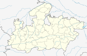 Badnawar Location in Madhya Pradesh, India  Badnawar Badnawar (India) | |
| Coordinates: 23.02°N 75.22°E | |
| Country | |
| State | Madhya Pradesh |
| District | Dhar |
| Elevation | 506 m (1,660 ft) |
| Population (2011) | |
| • Total | 20,928 |
| Languages | |
| • Official | Hindi |
| Time zone | UTC+5:30 (IST) |
| PIN | 454660 |
| Telephone code | 07295 |
| ISO 3166 code | IN-MP |
| Vehicle registration | MP 11 XX XXXX |
| Website | no official website |
It was once known as Vardhamanapur, Acharya Jinasena started the composition of Harivamsa Purana here in AD 783. [1] It remained a major Jain center until mid 13th century.
Geography
Badnawar is located at 23.02°N 75.22°E.[2] It has an average elevation of 506 metres (1,660 feet).
History
Acharya Jinasena started the composition of Harivamsa Purana here in AD 783. [3][4] Jayavarmadeva, A Paramara ruler, had issued a grant mentioning Vardhamanapur, which was found at Ujjain. Some of the ancient Jain images found here are now displayed in the Digambar Jain Museum Ujjain. Approximately twenty inscribed images have been found here that date from Samvat 1122 to 1308.[5] Several of them mention Vardhanapur or Vardhamanapura as the name of the city and some mention a Jain community named Vardhamanapuranvaya (now called Badanera). Ancient Jain images continue to be found here.[6]
There is a very ancient Dharmaraja temple here. There is an old Jinda Samadhi in the temple complex. There is a very old gymnasium in the temple complex.
Badnawar was a pargana given to Raja Rai Singh, second son of Maharaja Ratan Singh Rathore of Ratlam and governor of 16 parganas of north Malwa in 1658, before the fatel battle of Dharmat against Mughal Aurangzab where Ratan Singh was killed and Rai Singh escaped wounded, in 1733 it came under Maratha rule by the conquest of Malwa by Peshwa Bajirao. Dhar State was formed under the Maratha ruler Puar. In 1818 Raja Bhagwant Singh was compelled to move to Kachhi Baroda and a settlement was made by Sir John Malcome of the British East India Company. Dhar district, included at least 4 jagirs (feudatory (e)states), all held by Rajput Thakurs: Multhan (29 villages), Kachhi Baroda (18 villages), Bakhatgarh, Dotrea and Bidwal (eight villages).
Demographics
As of 2011 India census,[7] Badnawar has a population of 20,928. Males constitute 52.03% of the population and the females 47.97%. Badnawar has an literacy rate of 81.3%, with 88.7% of the males and 41% of females literate.
Religious places
- Chintaman Ganesh Temple
- Ekveera Mata Mandir
- Bejnatha mahadev (Udiya Mandir)
- Shree Ganesh Mandir, Panwar Mohalla
- Yati Dham
- Nageshwar Mahadev Mandir
- Ram mandir, Nagar Palika
- Siyajeet hanumanji
- Sakal bavdi, Mathur Colony
- Pipleshwar mandir
- Naag Mandir (Yaati Dhamm)
- Pataleshwar Mahadev mandir
- Pandrinath Temple
- Seetla mata mandir
- Shri Dharmaj Mandir (Vyayam Shala)
- Shani Mandir (Nageshwar)
- Shri Satyanarayan Mandir (Mali Pura)
- Shree Charbhuja Nath temple, Kheda Badnawar
- Shree Patal Vijay Hanumanji mandir, Kheda Badnawar
Schools
- Kashyap vidhya peeth
- Unnati Public School
- Unnati Academy
- Jagrati Vidhya Mandir
- Suraj Vidhya Vihar
- Shri Sardar Patel Vidhyapeeth
- Pratap Vidhya Niketan
- Shri Aaiji Public School
References
- Literary and Historical Studies in Indology, Vasudev Vishnu Mirashi, pp. 139-144
- Falling Rain Genomics, Inc - Badnawar
- Literary and Historical Studies in Indology, Vasudev Vishnu Mirashi, pp. 139-144
- [Malwa Through The Ages, Kailash Chand Jain, Motilal Banarsidass, Publ., 1972 p. 486]
- Kasturchand Jain Suman, Bharatiya Digambar Jain Abhilekh aur Tirth Parichay, Madhya-Pradesh: 13 vi shati tak, Delhi, 2001
- आज भी यहां खनन के दौरान जैन तीर्थंकरों की प्रतिमाएं मिलती हैं, Dainik Bhaskar, Sep 15, 2018
- "Census of India 2001: Data from the 2001 Census, including cities, villages and towns (Provisional)". Census Commission of India. Archived from the original on 16 June 2004. Retrieved 1 November 2008.