Dharampuri
Dharampuri is a town and headquarters of a tehsil in Dhar district in the state of Madhya Pradesh, India. It is situated on banks of river Narmada. It is a place of some historical and archaeological interest.[1]
Dharampuri | |
|---|---|
Town | |
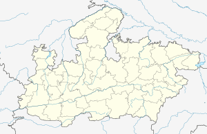 Dharampuri Location in Madhya Pradesh, India  Dharampuri Dharampuri (India) | |
| Coordinates: 22.17°N 75.35°E | |
| Country | |
| State | Madhya Pradesh |
| District | Dhar |
| Elevation | 139 m (456 ft) |
| Population (2011) | |
| • Total | 16,363 |
| Languages | |
| • Official | Hindi |
| Time zone | UTC+5:30 (IST) |
| ISO 3166 code | IN-MP |
| Vehicle registration | MP |
Geography
Dharampuri is located at 22.17°N 75.35°E,[2] on the north bank of the Narmada river. It has an average elevation of 139 metres (456 feet).
History
Dharampuri is that it is at the river side of Narmada and was the birthplace of Rani Roop Mati who is mythologically the daughter of Maa Narmada and was wedded at Mandu with the emperor Baj Bahadoor. It was also the place of worship of Maharshi Dadheechi who donated his bones to Devas for fighting with the daityas.
Of historical importance is a copper-plate charter issued in V.S. 1031 (975 A.D.) by the Paramara king Vakpati Munja, which were reportedly dug out by a farmer in his field at Dharampuri.[3] It records the gift of tax-free land to a Brahmin philosopher named Vasantacharya, son of Pandita Dhanika, who had migrated from Ahicchatra to Malwa. The continued religious importance of the town into the Sultanate period is attested by the Tal Masjid, which preserves an inscription recording its construction by Shaikh Idrak in 910 H. (1504-05 A.D.).[4]
Demographics
As of 2001 India census,[5] Dharampuri had a population of 13,229. Males constitute 51% of the population and females 49%. Dharampuri has an average literacy rate of 62%, higher than the national average of 59.5%: male literacy is 70% and, female literacy is 53%. In Dharampuri, 16% of the population is under 6 years of age.
References
- Luard, C.E. (1908). Western States (Malwa) Gazetteer. The Central India State Gazetteer Series. 5A. Byculla: British India Press. p. 500.
- Falling Rain Genomics, Inc – Dharampuri
- Harihar Vitthal Trivedi (1991). Inscriptions of the Paramāras (Part 2). Corpus Inscriptionum Indicarum Volume VII: Inscriptions of the Paramāras, Chandēllas, Kachchapaghātas, and two minor dynasties. Archaeological Survey of India. pp. 10–14. doi:10.5281/zenodo.1451755.
- Hasan, Zafar (1912). "The inscriptions of Dhar and Mandu", Epigraphia Indo-Moslemica, 1909-10 (Calcutta: Superintendent Government Printing), p. 24
- "Census of India 2001: Data from the 2001 Census, including cities, villages and towns (Provisional)". Census Commission of India. Archived from the original on 16 June 2004. Retrieved 1 November 2008.