Depalpur, India
Depalpur is a town and a Nagar panchayat in Indore district in the state of Madhya Pradesh, India. Depalpur is around 41.7Km from Indore.
Depalpur Deypaulpoor | |
|---|---|
City | |
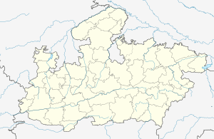 Depalpur Location in Madhya Pradesh, India  Depalpur Depalpur (India) | |
| Coordinates: 22.85°N 75.55°E | |
| Country | |
| State | Madhya Pradesh |
| District | Indore |
| Government | |
| • Type | Municipal corporation |
| Elevation | 533 m (1,749 ft) |
| Population (2011) | |
| • Total | 25,300 |
| Languages | |
| • Official | Hindi,Malawi |
| Time zone | UTC+5:30 (IST) |
| ISO 3166 code | IN-MP |
| Vehicle registration | MP |
Origin of name
According to tradition, the town is named after the Paramara dynasty ruler Devapala (reigned 1216–40).
History
In the Ain-i-Akbari, Depalpur is mentioned as one of the 10 mahals of the Ujjain sarkar in Malwa Subah.[1] Later, it became part of the Princely state of Indore. The Zagirdar of Depalpur was Rai bahadur Nanak Chand Airen (1840-1920). After his demise, his descendants distributed the family property to the farmers of Depalpur and currently, they are living in Indore. [2]
Geography
Depalpur is located at 22.85°N 75.55°E.[3] It has an average elevation of 533 metres (1748 feet).
Demographics
As of 2001 India census,[4] Depalpur had a population of 15,200. Males constitute 51% of the population while the females constitute the remaining 49%. Depalpur has an average literacy rate of 57%, lower than the national average of 59.5%. Male literacy rate is at 69%, while the female literacy rate is at 45%. In Depalpur, 16% of the population is under 6 years of age.
References
- Abul Fazl-i-Allami (1949, reprint 1993). Ain-i-Akbari, Vol.II (English tr. by H.S. Jarrett, rev. by J.N. Sarkar), Calcutta: The Asiatic Society, p.209
- indore state
- Falling Rain Genomics, Inc - Depalpur
- "Census of India 2001: Data from the 2001 Census, including cities, villages and towns (Provisional)". Census Commission of India. Archived from the original on 16 June 2004. Retrieved 1 November 2008.