Nieuw Amsterdam, Suriname
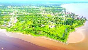
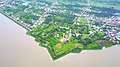
Nieuw Amsterdam (Dutch pronunciation: [ˌniʋɑmstərˈdɑm] or [ˌniuʔɑms-]) is the capital of the Commewijne District in Suriname. It is a small coastal town situated at the confluence of the Suriname River and Commewijne River, just across from Paramaribo, the country's capital. Its population at the 2012 census was 5,650,[1] with around 1,200 people living in the main town, most of whom are of Javanese and East Indian origin.[2] It is the location of the historical Fort Nieuw-Amsterdam, today an open-air museum. The town of Mariënburg with former sugarcane factory is located 3 km from Nieuw Amsterdam and part of the resort.[3]
Nieuw Amsterdam | |
|---|---|
Resort and town | |
 | |
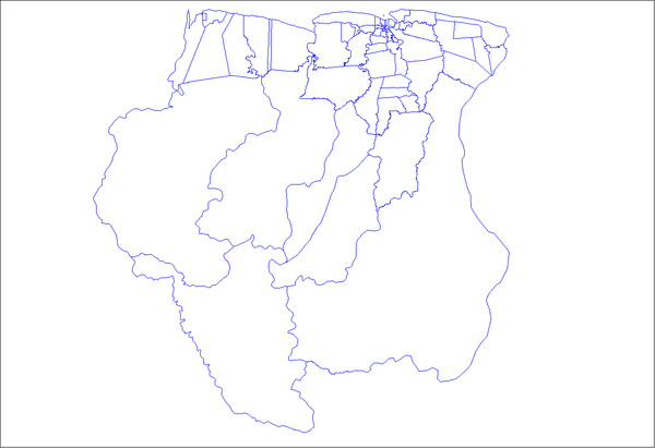
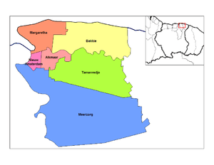 Map showing the resorts of Commewijne District.
Nieuw Amsterdam | |
| Coordinates: 5°52′51″N 55°05′04″W | |
| Country | |
| District | Commewijne District |
| Area | |
| • Total | 48 km2 (19 sq mi) |
| Elevation | 0 m (0 ft) |
| Population (2012 census) | |
| • Total | 5,650 |
| • Density | 120/km2 (300/sq mi) |
| Time zone | UTC-3 (AST) |
| Climate | Af |
History
In 1734, the Society of Suriname decided to build a fort near the confluence of the Commewijne and Suriname River to defend the Colony of Suriname and the capital Paramaribo.[4] On 8 October 1834, Nieuw-Amsterdam became the capital of the newly formed District of Upper Commewijne.[5] Between 1843 and 1854, Nieuw Amsterdam was designated as the location where incoming ships had to quarantine.[6] In 1872, part of the fort was converted to a jail, and would remain the only jail in Suriname until 1967.[4] In 1873 the local population started a program of independent agriculture which was encouraged by governor van Sypesteyn who designated Nieuw Amsterdam and Domburg as suitable locations.[7] On 17 January 1888, a decision was taken to lay the first telephone line between Nieuw-Amsterdam and Paramaribo with branches to redoubts Leiden and Frederiksdorp, and to operate the network from Nieuw-Amsterdam, because it was expected to mainly for military purposes.[8]
With the completion of the Jules Wijdenbosch Bridge on 20 May 2000, the East-West Link was further expanded to Commewijne and Marowijne.[9]
Gallery


References
- Statoids.com
- "Census 2012" (PDF). Stang Makandra. Retrieved 9 May 2020.
- "Marienburg suikerfabriek Nieuw Amsterdam Commewijne District". Trip Advisor (in Dutch). Retrieved 17 May 2020.
- "Geschiedenis". Fort Nieuw Amsterdam (in Dutch). Retrieved 9 May 2020.
- "Districts of Suriname". Statoids. Retrieved 9 May 2020.
- "Encyclopaedie van Nederlandsch West-Indië - Page 594 - Quarantaine" (PDF). Digital Library for Dutch Literature (in Dutch). 1916. Retrieved 9 May 2020.
- "Encyclopaedie van Nederlandsch West-Indië - Page 441 - Landbouw" (PDF). Digital Library for Dutch Literature (in Dutch). 1916. Retrieved 5 May 2020.
- "Encyclopaedie van Nederlandsch West-Indië - Page 587 - Telefonie" (PDF). Digital Library for Dutch Literature (in Dutch). 1916. Retrieved 9 May 2020.
- "Wijdenboschbrug". Canon van Nederland (in Dutch). Retrieved 9 May 2020.
External links