Para District
Para is a district of northern Suriname. Para's capital city is Onverwacht, with other towns including Paranam, and Zanderij. Para has a population of 24,700 and an area of 5,393 km².[1] The district is the mining and forestry centre of Suriname, with many large bauxite mining operations operating. The district is a mixture of forest and savannas.[2]
Para District | |
|---|---|
 Resorts in Para | |
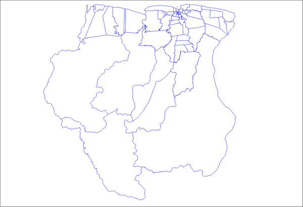
 Map of Suriname showing Para district | |
| Coordinates: 5°26′N 55°13′W | |
| Country | Suriname |
| District | Para |
| Capital | Onverwacht |
| Area | |
| • Total | 5,393 km2 (2,082 sq mi) |
| Population (2012 census)[1] | |
| • Total | 24,700 |
| • Density | 4.6/km2 (12/sq mi) |
| ISO 3166 code | SR-PR |
History
The district used to be only accessible by boat. The discovery of gold in Brokopondo and Sipaliwini lead to the construction of the Lawa Railway and growth of the villages next to the railway line.[3] The railway line was decommissioned in 1986.[4]
During World War 2 Suriname came under American control. The existing airport at Zorg en Hoop was insufficient, and the airstrip at Zanderij, was ungraded to a major airport.[5] In 1936,[6] a road, currently named Indira Gandhiweg, had been built parallel to the railway line to connect Paramaribo with Onverwacht, which was extended to the airport.[3] In the 1960s, the Afobakaweg was constructed to provide access to the south of the country.[7]
The ruins of the city of Jodensavanne are in Para district. Jews fleeing the Spanish Inquisition established Jodensavanne in the 17th century, but it was destroyed in 1832 by a fire.[8] Jodensavanne was an internment camp for suspected Nazi supporters in Suriname during the Second World War.[9]
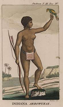
Para is home to several indigenous villages from the Carib, and Arawak tribe.[10]
Economy
The main part of the economy is the bauxite mining.[2] Gold also plays a major role in the economy of Para. The main roads, and airport have resulted into companies moving into Para. Agriculture is mainly focused on cassava, asparagus bean and pineapples.[10] Tourism has seen a steady growth over the 20th and 21st century. There are several holiday resorts in the district, and White Beach in Oost is becoming a main attraction.[10]
Demographics
In the 2004 census, Para had 18,749 inhabitants. This rose in the 2012 census to 24,700 inhabitants, a 31.1% increase.[11]
References
- "Resorts in Suriname Census 2012" (PDF). Retrieved 26 May 2020.
- "Distrikt Para 1" (in Dutch). Retrieved 28 May 2020.
- "Distrikt Para 2". Anda Suriname (in Dutch). Retrieved 28 May 2020.
- Armand Snijders: De flop van Lely. Parbode, Surinames Magazine, 1 April 2008.
- "Suriname in de Tweede Wereldoorlog". Werkgroup Caraïbische Letteren (in Dutch). Retrieved 28 May 2020.
- "De Gids. Almanak voor Suriname 1937". Digital Library for Dutch Literature (in Dutch). 1936. Retrieved 13 May 2020.
- "REGIONAAL PLAN BROKOPONDO" (PDF). Planning Office Suriname (in Dutch). Retrieved 13 May 2020.
- "Marchano Stuger wint verkiezing dorpsbestuur Redidoti". De Boodschap.today (in Dutch). Retrieved 18 May 2020.
- "Kamp Jodensavanne zwarte bladzijde". Straf Kolonie (in Dutch). Retrieved 18 May 2020.
- "Structuur Analyse" (PDF). Planning Office Suriname (in Dutch). Retrieved 28 May 2020.
- "Suriname Districts". Statoids. Retrieved 28 May 2020.