Limavady
Limavady (/lɪməˈvædi/; from Irish Léim a' Mhadaidh, meaning 'leap of the dog') is a market town in County Londonderry, Northern Ireland, with Binevenagh as a backdrop. Lying 17 miles (27 km) east of Derry and 14 miles (23 km) southwest of Coleraine, Limavady had a population of 12,032 people at the 2011 Census.[2] In the 40 years between 1971 and 2011, Limavady's population nearly doubled.[3] Limavady is within Causeway Coast and Glens Borough.
| Limavady | |
|---|---|
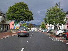 Main Street | |
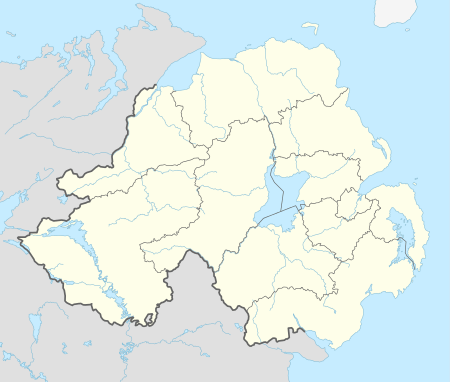 Limavady Location within Northern Ireland | |
| Population | 12,032 (United Kingdom Census 2011) |
| District | |
| County | |
| Country | Northern Ireland |
| Sovereign state | United Kingdom |
| Post town | LIMAVADY |
| Postcode district | BT49 |
| Dialling code | 028 |
| Police | Northern Ireland |
| Fire | Northern Ireland |
| Ambulance | Northern Ireland |
| UK Parliament | |
| NI Assembly | |
| Website | www.limavady.gov.uk |
From 1988 to 2004, a total of 1,332 dwellings were built in the town, mainly at Bovally along the south eastern edge of the town. The large industrial estate at Aghanloo is 2 miles (3 km) north of the town.[3]
History
Limavady and its surrounding settlements derive from Celtic roots, although no-one is sure about the exact date of Limavady's origins. Estimates date from around 5 CE. Early records tell of Saint Columba, who presided over a meeting of the Kings at Mullagh Hill near Limavady in 575 CE, a location which is now part of the Roe Park Resort.[4]
Gaelic Ireland was divided into kingdoms, each ruled by its own family or clan. In the Limavady area, the predominate family was the O'Cahans. Their mark is found everywhere in the town and surrounding area. O'Cahan's Rock is one of Limavady's main historical points. This is where, according to local myth, a dog belonging to one of the Chiefs jumped the river to get help from nearby clans after a surprise enemy attack. This gave Limavady its name, Limavady being the anglicised version of Leim an Mhadaidh, which means leap of the dog.[4] This rock, along with other relics of Limavady's history, can be seen at Roe Valley Country Park.
The town developed from a small Plantation settlement founded by Sir Thomas Phillips. In 1610 Sir Thomas Phillips was granted 13,100 acres of land at Limavady which included an O’Cahan castle. He commenced the building of the ‘Newtown of Limavady’ which was laid out in a cruciform road pattern. Newtown Limavady was incorporated, with the appointment of a Provost and 12 Burgesses, on 31 March 1613 with a charter granted by King James I. By 1622, 18 one-storey houses and an inn had been built and they were centred on the crossroads which contained a flagpole, a cross and stocks.
Limavady had an early association with the linen and Irish whiskey industries. In 1608, a licence was granted to Sir Thomas Phillips by King James I to distil whiskey.[5]
for the next seven years, within the countie of Colrane, otherwise called O Cahanes countrey, or within the territorie called Rowte, in Co. Antrim, by himselfe or his servauntes, to make, drawe, and distil such and soe great quantities of aquavite, usquabagh and aqua composita, as he or his assignes shall thinke fitt; and the same to sell, vent, and dispose of to any persons, yeeldinge yerelie the somme 13s 4d...
The Limavady Distillery was founded in 1750 on the banks of the River Roe. Limavady, however, did not benefit from subsequent expansion of linen manufacturing in the 19th century. As a result, it remained a modest sized market town until the late 20th century.[3]
In 1941 RAF Limavady, a base for air patrols over the Atlantic during World War II, was opened just to the north of the town. The RAF left the base in 1945 but it continued as a naval air station until 1958, when the land was returned to agricultural use.
During the Troubles in Northern Ireland, four people were killed in or near Limavady by the Provisional Irish Republican Army. Two were members of the security forces and two were civilians who were killed by a bomb as they drove past Limavady Royal Ulster Constabulary station.
In 1987, Limavady became famous as the unintended arrival point for the world's first transatlantic hot air balloon crossing by Richard Branson and Per Lindstrand.[6]
Townlands
Limavady sprang up within the townland of Rathbrady Beg in the parish of Drumachose and was original known as Newtown Limavady.[7] Over time, the urban area has expanded into the surrounding townlands. These include:[8][9]
- Bovally (from Irish Bó Bhaile, meaning 'townland of cows')
- Coolessan (from Irish Cúil Leasáin, meaning 'nook of the little fort')
- Enagh (from Irish Eanach, meaning 'marsh')
- Killane (from Irish Coill Leathan, meaning 'broad wood')
- Rathbrady Beg (from Irish Ráth Brighde Beag, meaning 'little fort of St. Brigid')
- Rathbrady More (from Irish Ráth Brighde Mór, meaning 'great fort of St. Brigid')
Politics
Limavady is in both the Causeway Coast and Glens Borough Council area and the East Londonderry constituency for elections to the Westminster Parliament and Northern Ireland Assembly. In 2014, the residents of Limavady district elected 3 Democratic Unionist Party, 1 Social Democratic and Labour Party and 1 Sinn Féin councillors to the borough council.
Places of interest
- Limavady lies in the scenic Roe Valley area and the Roe Valley Country Park on the River Roe lies to the southwest of the town.
- The birthplace of New Zealand Prime Minister Rt. Hon. William Massey is on Irish Green Street. Nearby Massey Avenue is named after him.
- The archaeologically significant Broighter Gold collection was found nearby in 1896. It is currently in the National Museum in Dublin.
- Jane Ross, who first transcribed Londonderry Air, was born and lived in Limavady. A plaque is shown above her old house on Main Street.
Popular culture
Danny Boy
Limavady is most famous for the tune "Londonderry Air" collected by Jane Ross in the mid-19th century from a local fiddle player. The tune was later (ca. 1913) used for the song "Danny Boy".[4]
Between the 12th and 17th centuries, the area was ruled by the O'Cahan clan. "Danny Boy" is taken from a melody composed by O'Cahan bard Rory Dall O'Cahan. The original version concerns the passing of the Chief Cooey-na-Gall whose death brought an end to a long line of O'Cahan chiefs in Ireland.[10]
Events
The town hosts events such as the NI Super Cup, the Danny Boy Jazz and Blues Festival, the Roe Valley Folk Festival the Stendhal Festival of Art, and the Bishop Hervey International Summer School.[11]
Transport
Limavady is in close proximity to City of Derry Airport, 9 miles (15 km) to the west, and the Port of Londonderry, 13 miles (22 km) to the west.[3]
Road
Rail
- The Limavady Railway was a branch line to the main Derry – Belfast line. Limavady railway station opened on 29 December 1852, closed for passenger traffic on 3 July 1950 and finally closed altogether on 2 May 1955. Limavady Junction railway station opened on 1 March 1855 and finally closed on 17 October 1976.[13] Limavady is no longer served by the branch line – the nearest station is at Bellarena, approximately 5 miles (8.0 km) from the town.
Bellarena railway station has direct trains west to Derry and east to Castlerock, Coleraine (for stations to Portrush), and stations to Belfast Central and Belfast Great Victoria Street.
Canal
- The Broharris Canal was constructed in the 1820s when a cut, some 2 miles (3.2 km) long on the south shore of Lough Foyle near Ballykelly was made in the direction of Limavady. The inhabitants of Limavady appealed for the building of a canal from Lough Foyle to the town but were turned down, and the Broharris Canal was the nearest they came to achieving such a navigable link.
Education
There are four primary schools, three secondary schools, a regional college and a special needs school in Limavady. Limavady's schools are closely located in an 'education circle'. The three secondary schools are all located along the same stretch of road (Ballyquin Road and Irish Green Street), with Limegrove Special School opposite Limavady Grammar School, Termoncanice Primary opposite Limavady High School and St. Mary's High School. Limavady Central Primary School is located a short distance from the other schools.
Primary schools
- Termoncanice Primary School
- Roe Valley Integrated Primary
- Limavady Central Primary School
- Drumachose Primary School
- Gaelscoil Leim an mhadaidh
Secondary schools
- St Mary's High School
- Limavady Grammar School
- Limavady High School
Regional college
Special needs schools
- Rossmar Special School (formerly Limegrove/Greystone Hall)
Sport
- Wolfhounds GAC is the local Gaelic Athletic Association club
- Limavady United F.C.
- Roe Valley F.C.
- Roe Rovers F.C.
- Newtowne F.C.
- Drummond Cricket Club
Demography
On Census day (27 March 2011) there were 12,032 people living in Limavady (4,759 households), accounting for 0.66% of the NI total.[2] Of these:
- 21.52% were aged under 16 years and 13.54% were aged 65 and over;
- 51.37% of the usually resident population were female and 48.63% were male;
- 51.83% belong to or were brought up in a 'Protestant and Other Christian (including Christian related)' religion and 44.41% belong to or were brought up in the Catholic religion;
- 56.27% indicated that they had a British national identity, 31.08% had a Northern Irish national identity and 18.47% had an Irish national identity (respondents could indicate more than one national identity);
- 37 years was the average (median) age of the population;
- 9.20% had some knowledge of Ulster-Scots and 6.43% had some knowledge of Irish (Gaelic).
Notable people
- Rev. Robert Bradford MP - Methodist Minister and MP for South Belfast. Murdered by the Provisional IRA on 14 November 1981.
- David Brewster LLB - noted Solicitor and former UUP Forum member for East Londonderry 1996.
- John Deighan – Derry GAA Gaelic footballer and SDLP Councillor.
- William Douglas - Flight lieutenant in the Royal Air Force during World War II. He rose to prominence as Limavady District Master in the Orange Order. From 1960 to 1973, he served on Limavady Rural District Council. He was then elected in Londonderry for the Ulster Unionist Party at the 1973 Northern Ireland Assembly election, and held his seat on the Constitutional Convention and at the 1982 Assembly.
- Very. Rev. Victor Griffin – formerly Dean of St. Patrick's Cathedral, Dublin
- Ruth Kelly – Labour MP and former Cabinet Minister.
- Senator John Andrew Long - Former Chairman of Limavady Rural Council and Northern Ireland Senator 1921-d1941 (elected) Deputy Speaker 1927-28; Deputy Leader 1930–41, Parliamentary Secretary in the Department of the Prime Minister from 1930–41.
- Rt. Hon. William Lowry MP - (19 March 1884–14 December 1949) was an Irish barrister, judge, Ulster Unionist Party Member of Parliament, and Attorney General for Northern Ireland.
- William Ferguson Massey – 19th Prime Minister of New Zealand (from 1912 to 1925) was born and educated in the town before migrating.
- Rt. Hon. Maurice Marcus McCausland - He was High Sheriff of County Londonderry in 1908, and in 1926, he was appointed as Lord Lieutenant of County Londonderry, serving until his death. In 1934, he was appointed to the Privy Council of Northern Ireland.
- Jimmy McCurry (1830–1910) – folk musician, traditionally associated with the Londonderry Air.
- Gerry Mullan – Former Glentoran, Everton and Northern Ireland footballer.
- Dr. Muriel Robertson FRS - was a protozoologist and bacteriologist at the Lister Institute, London from 1915 to 1961. She made key discoveries of the life cycle of trypanosomes.
- Willie Ross - Former Limavady Councillor and MP for Londonderry then East Londonderry 1974–2001.
- Thomas Teevan LLB MP - West Belfast MP and youngest Limavady Urban Council Chairman.
- Bronagh Waugh- Actress, most notably from Hollyoaks.
- Samuel Young (1822–1918), MP, was Limavady Brewery founder.
See also
| Wikimedia Commons has media related to Limavady. |
References
- Banagher and Boveagh Churches (Ulster-Scots translation) Archived 30 August 2011 at the Wayback Machine Department of the Environment.
- "Census 2011 Population Statistics for Limavady Settlement". Northern Ireland Statistics and Research Agency (NISRA). Retrieved 10 August 2019.
- "Limavady". Planning Service – Draft Northern Area Plan 2016. Retrieved 15 July 2008.
- "Limavady". Culture Northern Ireland. Archived from the original on 9 June 2008. Retrieved 15 July 2008.
- George Hill (1877). An historical account of the plantation in Ulster at the commencement of the seventeenth century, 1608-1620. M'Caw, Stevenson & Orr. p. 393. Retrieved 31 October 2010.
- O'Halloran, Seán (4 July 2017). "When Branson's balloon hit a Limavady wall". BBC News. Retrieved 1 April 2018.
- Parish of Drumachose Archived 6 October 2011 at the Wayback Machine www.ulsterancestry.com Retrieved 28 June 2010
- "Northern Ireland Placenames Project". Archived from the original on 1 October 2010. Retrieved 12 June 2010.
- "OSI Limavady". Ordnance Survey Ireland. Archived from the original on 29 August 2012. Retrieved 2 July 2010.
- "Dungiven". Culture Northern Ireland. Archived from the original on 9 June 2008. Retrieved 15 July 2008.
- "Archived copy". Archived from the original on 14 September 2013. Retrieved 5 September 2013.CS1 maint: archived copy as title (link)
- "A2 Limavady bypass". Retrieved 29 December 2007.
- "Limavady and Limavady Junction stations" (PDF). Railscot – Irish Railways. Retrieved 28 October 2007.
External links

- Borough of Limavady
- Limavady and the Roe Valley by Jochen Lueg
List of towns by population | ||
| Large |  | |
| Medium | ||
| Small | ||
Italics denote settlements that are classed as towns but also have city status
| ||
| Authority control |
|
|---|