Needles Airport
Needles Airport (IATA: EED, ICAO: KEED, FAA LID: EED) is a county-owned public airport in San Bernardino County, California, five miles (9 km) south of Needles.[1]
Needles Airport Needles Army Airfield | |||||||||||||||
|---|---|---|---|---|---|---|---|---|---|---|---|---|---|---|---|
 2006 USGS Photo | |||||||||||||||
| Summary | |||||||||||||||
| Airport type | Public | ||||||||||||||
| Owner | County of San Bernardino | ||||||||||||||
| Serves | Needles, California | ||||||||||||||
| Elevation AMSL | 983 ft / 300 m | ||||||||||||||
| Coordinates | 34°45′59″N 114°37′24″W | ||||||||||||||
| Website | www.sbcounty.gov/... | ||||||||||||||
| Map | |||||||||||||||
 KEED Location of Needles Airport | |||||||||||||||
| Runways | |||||||||||||||
| |||||||||||||||
| Statistics (2006) | |||||||||||||||
| |||||||||||||||
It opened in May 1941. During World War II the airfield was known as Needles Army Airfield[2] and was used by the United States Army Air Forces Fourth Air Force. With the end of the war the base returned to civil control.
Facilities and aircraft
Needles Airport covers 796 acres (322 ha) at an elevation of 983 feet (300 m) above mean sea level. It has two asphalt runways: 2/20 is 4,235 by 100 feet (1,291 x 30 m) and 11/29 is 5,005 by 100 feet.[1]
In the year ending February 17, 2006 the airport had 10,500 general aviation aircraft operations, an average of 28 per day. 8 aircraft were then based at this airport: 62.5% single-engine and 37.5% ultralight.[1]
References
![]()
- FAA Airport Master Record for EED (Form 5010 PDF). Federal Aviation Administration. Effective 8 April 2010.
- U.S. Geological Survey Geographic Names Information System: Needles Army Air Field (historical) at coordinates 34°46′00″N 114°37′20″W
External links
- Needles Airport at San Bernardino County website
- Aerial image as of 21 May 1994 from USGS The National Map
- FAA Terminal Procedures for EED, effective June 18, 2020
- Resources for this airport:
- FAA airport information for EED
- AirNav airport information for KEED
- ASN accident history for EED
- FlightAware airport information and live flight tracker
- NOAA/NWS weather observations: current, past three days
- SkyVector aeronautical chart, Terminal Procedures
Airports in the Inland Empire | ||
|---|---|---|
| Commercial airports | 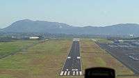 | |
| Towered general aviation airports | ||
| Non-towered general aviation airports | ||
| Military airports | ||
| Units |
| .svg.png) | ||||||||||||||
|---|---|---|---|---|---|---|---|---|---|---|---|---|---|---|---|---|