French Valley Airport
French Valley Airport (IATA: RBK, FAA LID: F70) is a county-owned public-use airport in southwestern Riverside County, California, located on Highway 79 near the cities of Murrieta and Temecula.[1][2]
French Valley Airport | |||||||||||
|---|---|---|---|---|---|---|---|---|---|---|---|
 | |||||||||||
| Summary | |||||||||||
| Airport type | Public | ||||||||||
| Owner | County of Riverside | ||||||||||
| Operator | Riverside County Economic Development Agency | ||||||||||
| Serves | Murrieta, Temecula, French Valley, Winchester | ||||||||||
| Location | Murrieta | ||||||||||
| Elevation AMSL | 1,350 ft / 411 m | ||||||||||
| Coordinates | 33°34′27″N 117°07′43″W | ||||||||||
| Website | http://www.rcfva.com/ | ||||||||||
| Maps | |||||||||||
 FAA Airport Sketch | |||||||||||
 F70 Location within Southern California | |||||||||||
| Runways | |||||||||||
| |||||||||||
| Statistics (2009) | |||||||||||
| |||||||||||
Facilities and aircraft
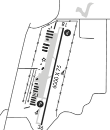
French Valley Airport covers an area of 261 acres (106 ha) which contains one asphalt paved runway which is designated as 18/36 and measures 6,000 x 75 ft (1,829 x 23 m).[1]
For the 12-month period ending December 30, 2009, the airport had 98,185 aircraft operations, an average of 269 per day, all of which were general aviation. There are 170 aircraft based at this airport: 82% single engine, 12% multi-engine, 1% jet aircraft, 2% helicopters and 1% ultralights.[1]
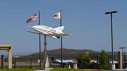
There is also Wings and Rotors Air Museum in hangar 7 (Bld 31), with military displays, flyable helicopters and an F-4 Phantom II in restoration to fly.
References
- FAA Airport Master Record for F70 (Form 5010 PDF), effective 2007-07-05
- French Valley Airport page at Riverside County EDA web site.
External links
- Resources for this airport:
- FAA airport information for F70
- AirNav airport information for F70
- ASN accident history for RBK
- FlightAware airport information and live flight tracker
- SkyVector aeronautical chart for F70
Airports in the Inland Empire | ||
|---|---|---|
| Commercial airports | 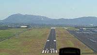 | |
| Towered general aviation airports | ||
| Non-towered general aviation airports | ||
| Military airports | ||