National Register of Historic Places listings in Stanislaus County, California
This is a list of the National Register of Historic Places listings in Stanislaus County, California.
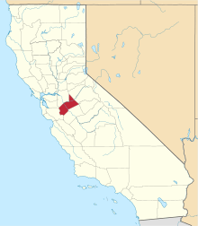
Location of Stanislaus County in California
This is intended to be a complete list of the properties and districts on the National Register of Historic Places in Stanislaus County, California, United States. Latitude and longitude coordinates are provided for many National Register properties and districts; these locations may be seen together in a Google map.[1]
There are 24 properties and districts listed on the National Register in the county, including 1 National Historic Landmark.
- This National Park Service list is complete through NPS recent listings posted June 19, 2020.[2]
Current listings
| [3] | Name on the Register[4] | Image | Date listed[5] | Location | City or town | Description |
|---|---|---|---|---|---|---|
| 1 | Bald Eagle Ranch House | January 15, 2014 (#13001069) |
511 Crawford Rd. 37°43′08″N 120°59′15″W |
Modesto | ||
| 2 | First National Bank of Oakdale Building | 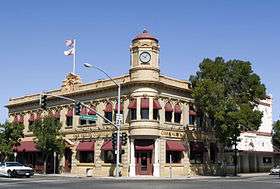 First National Bank of Oakdale Building |
April 6, 2000 (#00000320) |
338 East F St. 37°46′01″N 120°50′48″W |
Oakdale | |
| 3 | Gold Dredge | 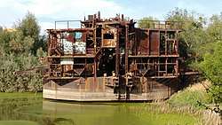 Gold Dredge |
December 16, 1971 (#71000208) |
S of La Grange 37°38′00″N 120°28′35″W |
La Grange | |
| 4 | Hotel Covell | December 29, 1994 (#94001501) |
1023 J St. 37°38′28″N 120°59′58″W |
Modesto | ||
| 5 | Kingen Hotel | 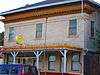 Kingen Hotel |
August 24, 1979 (#79003465) |
30054 Yosemite Blvd. 37°39′49″N 120°27′37″W |
La Grange | |
| 6 | Knights Ferry | 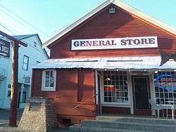 Knights Ferry |
April 23, 1975 (#75000490) |
On the Stanislaus River, 2 miles (3.2 km) from Stanislaus 37°49′11″N 120°39′52″W |
Knights Ferry | |
| 7 | Knight's Ferry Bridge |  Knight's Ferry Bridge |
October 16, 2012 (#12001014) |
Spanning Stanislaus River at bypassed section of Sonora Rd., approximately .75 miles (1.21 km) north of CA 108/120 37°39′48″N 120°27′44″W |
Knights Ferry | |
| 8 | Louie's Place | 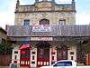 Louie's Place |
August 24, 1979 (#79003466) |
30048 Yosemite Blvd. 37°39′48″N 120°27′44″W |
La Grange | |
| 9 | McHenry Mansion |  McHenry Mansion |
April 4, 1978 (#78000805) |
906 15th St. 37°38′37″N 120°59′37″W |
Modesto | |
| 10 | Odd Fellows Hall | 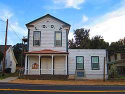 Odd Fellows Hall |
August 24, 1979 (#79003467) |
Yosemite Blvd. 37°39′48″N 120°27′41″W |
La Grange | |
| 11 | Old Adobe Barn | 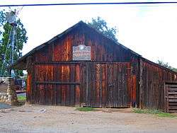 Old Adobe Barn |
August 24, 1979 (#79003462) |
Yosemite Blvd. and La Grange Rd. 37°39′50″N 120°27′34″W |
La Grange | |
| 12 | Old La Grange Schoolhouse | 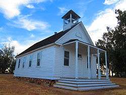 Old La Grange Schoolhouse |
August 24, 1979 (#79003461) |
La Grange Rd. and Floto St. 37°39′44″N 120°27′35″W |
La Grange | |
| 13 | Patterson Branch Library | 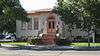 Patterson Branch Library |
December 10, 1990 (#90001812) |
355 W. Las Palmas Ave. 37°28′16″N 121°08′31″W |
Patterson | |
| 14 | Plaza Building | 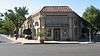 Plaza Building |
January 6, 2004 (#03001359) |
Plaza #2 37°28′17″N 121°07′44″W |
Patterson | |
| 15 | Riverbank Branch Library | 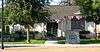 Riverbank Branch Library |
October 10, 1996 (#96001077) |
3237 Santa Fe St. 37°44′11″N 120°56′05″W |
Riverbank | |
| 16 | Shell Gas Station | 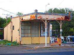 Shell Gas Station |
August 24, 1979 (#79003464) |
Yosemite Blvd. 37°39′50″N 120°27′41″W |
La Grange | |
| 17 | St. Louis Catholic Church | 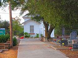 St. Louis Catholic Church |
August 24, 1979 (#79003460) |
La Grange Rd. and Floto St. 37°39′46″N 120°27′39″W |
La Grange | |
| 18 | Stage Stop | 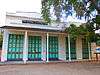 Stage Stop |
August 24, 1979 (#79003463) |
Yosemite Blvd. and La Grange Rd. 37°39′49″N 120°27′35″W |
La Grange | |
| 19 | Turlock Carnegie Library | 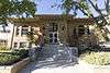 Turlock Carnegie Library |
January 7, 1993 (#92001753) |
250 N. Broadway 37°29′43″N 120°50′57″W |
Turlock | |
| 20 | Turlock High School Auditorium and Gymnasium | 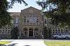 Turlock High School Auditorium and Gymnasium |
January 11, 1991 (#90002141) |
1574 E. Canal Dr. 37°29′54″N 120°49′52″W |
Turlock | |
| 21 | U.S. Post Office | 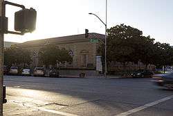 U.S. Post Office |
February 10, 1983 (#83001246) |
Twelfth and I Sts. 37°38′28″N 120°59′48″W |
Modesto | |
| 22 | Dr. Robert and Mary Walton House | December 14, 2006 (#06001133) |
417 Hogue Dr. 37°44′55″N 120°59′36″W |
Modesto | ||
| 23 | Daniel Whitmore House | 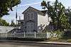 Daniel Whitmore House |
April 5, 1989 (#89000230) |
2928 Fifth St. 37°35′28″N 120°57′03″W |
Ceres | |
| 24 | Walter B. Wood House | 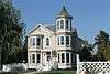 Walter B. Wood House |
May 20, 1988 (#88000551) |
814 Twelfth St. 37°38′27″N 120°59′44″W |
Modesto |
See also
| Wikimedia Commons has media related to National Register of Historic Places in Stanislaus County, California. |
References
- The latitude and longitude information provided in this table was derived originally from the National Register Information System, which has been found to be fairly accurate for about 99% of listings. Some locations in this table may have been corrected to current GPS standards.
- "National Register of Historic Places: Weekly List Actions". National Park Service, United States Department of the Interior. Retrieved on June 19, 2020.
- Numbers represent an ordering by significant words. Various colorings, defined here, differentiate National Historic Landmarks and historic districts from other NRHP buildings, structures, sites or objects.
- "National Register Information System". National Register of Historic Places. National Park Service. July 9, 2010.
- The eight-digit number below each date is the number assigned to each location in the National Register Information System database, which can be viewed by clicking the number.
| Topics | |
|---|---|
| Lists by state |
|
| Lists by insular areas | |
| Lists by associated state | |
| Other areas | |
| Related | |
| |
Municipalities and communities of Stanislaus County, California, United States | ||
|---|---|---|
| Cities | Stanislaus County map | |
| CDPs | ||
| Unincorporated communities | ||
| Ghost towns | ||
This article is issued from Wikipedia. The text is licensed under Creative Commons - Attribution - Sharealike. Additional terms may apply for the media files.