Grayson, California
Grayson is a census-designated place (CDP) in Stanislaus County, California, United States. The population was 952 at the 2010 census, down from 1,077 at the 2000 census. It is part of the Modesto Metropolitan Statistical Area.
Grayson | |
|---|---|
 Location in Stanislaus County and the state of California | |
| Coordinates: 37°33′53″N 121°10′51″W | |
| Country | |
| State | |
| County | Stanislaus |
| Area | |
| • Total | 2.549 sq mi (6.602 km2) |
| • Land | 2.549 sq mi (6.602 km2) |
| • Water | 0 sq mi (0 km2) 0% |
| Elevation | 52 ft (16 m) |
| Population (2010) | |
| • Total | 952 |
| • Density | 370/sq mi (140/km2) |
| Time zone | UTC-8 (Pacific (PST)) |
| • Summer (DST) | UTC-7 (PDT) |
| ZIP code | 95363 |
| Area code(s) | 209 |
| FIPS code | 06-30882 |
| GNIS feature ID | 1658661 |
Geography
Grayson is located at 37°33′53″N 121°10′51″W (37.564732, -121.180914).[2]
According to the United States Census Bureau, the CDP has a total area of 2.5 square miles (6.5 km2), all of it land.
History
Grayson or Graysonville or Grayson City was founded by a company of seven men, which included Andrew Jackson Grayson (1818–1869).[3] Grayson, a native of Louisiana, brought his family to California in 1846, and was active in the Mexican–American War. He was a self-taught watercolor painter and an authority of Pacific Coast birds.[4]
Graysonville was a steamboat landing on the San Joaquin River from the time of the California Gold Rush until river traffic ended as the water was taken for agriculture.[5]:81,145
Demographics
| Historical population | |||
|---|---|---|---|
| Census | Pop. | %± | |
| U.S. Decennial Census[6] | |||
2010
At the 2010 census Grayson had a population of 952. The population density was 373.5 people per square mile (144.2/km²). The racial makeup of Grayson was 455 (47.8%) White, 17 (1.8%) African American, 4 (0.4%) Native American, 3 (0.3%) Asian, 0 (0.0%) Pacific Islander, 417 (43.8%) from other races, and 56 (5.9%) from two or more races. Hispanic or Latino of any race were 819 people (86.0%).[7]
The whole population lived in households, no one lived in non-institutionalized group quarters and no one was institutionalized.
There were 250 households, 143 (57.2%) had children under the age of 18 living in them, 154 (61.6%) were opposite-sex married couples living together, 38 (15.2%) had a female householder with no husband present, 25 (10.0%) had a male householder with no wife present. There were 18 (7.2%) unmarried opposite-sex partnerships, and 0 (0%) same-sex married couples or partnerships. 22 households (8.8%) were one person and 6 (2.4%) had someone living alone who was 65 or older. The average household size was 3.81. There were 217 families (86.8% of households); the average family size was 4.03.
The age distribution was 318 people (33.4%) under the age of 18, 104 people (10.9%) aged 18 to 24, 260 people (27.3%) aged 25 to 44, 204 people (21.4%) aged 45 to 64, and 66 people (6.9%) who were 65 or older. The median age was 29.0 years. For every 100 females, there were 114.4 males. For every 100 females age 18 and over, there were 108.6 males.
There were 280 housing units at an average density of 109.9 per square mile, of the occupied units 161 (64.4%) were owner-occupied and 89 (35.6%) were rented.The homeowner vacancy rate was 4.7%; the rental vacancy rate was 11.9%. 578 people (60.7% of the population) lived in owner-occupied housing units and 374 people (39.3%) lived in rental housing units.
2000
At the 2000 census there were 1,077 people, 274 households, and 243 families in the CDP. The population density was 401.5 people per square mile (155.2/km²). There were 290 housing units at an average density of 108.1 per square mile (41.8/km²). The racial makeup of the CDP was 41.69% White, 1.11% African American, 1.21% Native American, 0.56% Asian, 0.09% Pacific Islander, 50.14% from other races, and 5.20% from two or more races. Hispanic or Latino of any race were 72.14%.[8]
Of the 274 households 54.4% had children under the age of 18 living with them, 69.7% were married couples living together, 12.0% had a female householder with no husband present, and 11.3% were non-families. 8.8% of households were one person and 4.0% were one person aged 65 or older. The average household size was 3.93 and the average family size was 4.12.
The age distribution was 35.8% under the age of 18, 9.6% from 18 to 24, 31.8% from 25 to 44, 16.5% from 45 to 64, and 6.2% 65 or older. The median age was 28 years. For every 100 females, there were 102.1 males. For every 100 females age 18 and over, there were 105.0 males.
The median household income was $47,841 and the median family income was $48,693. Males had a median income of $48,250 versus $21,250 for females. The per capita income for the CDP was $11,710. About 14.0% of families and 14.9% of the population were below the poverty line, including 8.9% of those under age 18 and none of those age 65 or over.
Government
In the California State Legislature, Grayson is in the 12th Senate District, represented by Democrat Anna Caballero, and the 21st Assembly District, represented by Democrat Adam Gray.[9]
In the United States House of Representatives, Grayson is in California's 10th congressional district, represented by Democrat Josh Harder.[10]
References
- "2010 Census Gazetteer Files - Places - California". United States Census Bureau. Retrieved March 26, 2015.
- "US Gazetteer files: 2010, 2000, and 1990". United States Census Bureau. 2011-02-12. Retrieved 2011-04-23.
- George Henry Tinkham, 1821, History of Stanislaus County California, Historic Record Company, Los Angeles
- "Audubon of the West: Andrew Jackson Grayson". Archived from the original on 2010-10-31. Retrieved 2010-05-15.
- Jerry MacMullen, Paddlewheel Days In California, Stanford University Press, Stanford, 1970.
- "Census of Population and Housing". Census.gov. Retrieved June 4, 2016.
- "2010 Census Interactive Population Search: CA - Grayson CDP". U.S. Census Bureau. Archived from the original on July 15, 2014. Retrieved July 12, 2014.
- "U.S. Census website". United States Census Bureau. Retrieved 2008-01-31.
- "Statewide Database". Regents of the University of California. Archived from the original on February 1, 2015. Retrieved March 19, 2015.
- "California's 10th Congressional District - Representatives & District Map". Civic Impulse, LLC. Retrieved September 28, 2014.
Municipalities and communities of Stanislaus County, California, United States | ||
|---|---|---|
| Cities | 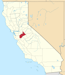 Stanislaus County map | |
| CDPs | ||
| Unincorporated communities | ||
| Ghost towns | ||