National Register of Historic Places listings in Santa Clara County, California
This is a list of the National Register of Historic Places listings in Santa Clara County, California.
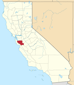
Location of Santa Clara County in California
This is intended to be a complete list of the properties and districts on the National Register of Historic Places in Santa Clara County, California, United States. Latitude and longitude coordinates are provided for many National Register properties and districts; these locations may be seen together in an online map.[1]
There are 118 properties and districts listed on the National Register in the county, including 6 National Historic Landmarks. Another property was once listed but has been removed.
- This National Park Service list is complete through NPS recent listings posted June 19, 2020.[2]
Current listings
| [3] | Name on the Register[4] | Image | Date listed[5] | Location | City or town | Description |
|---|---|---|---|---|---|---|
| 1 | Agnews Insane Asylum |  Agnews Insane Asylum |
August 13, 1997 (#97000829) |
4000 Lafayette Ave. 37°23′38″N 121°57′10″W |
Santa Clara | |
| 2 | John Colpitts Ainsley House No. 3 | John Colpitts Ainsley House No. 3 |
October 3, 2005 (#05001086) |
300 Grant St. 37°17′26″N 121°56′37″W |
Campbell | |
| 3 | Theophilus Allen House |  Theophilus Allen House |
May 20, 1999 (#99000580) |
601 Melville Ave. 37°26′37″N 122°08′53″W |
Palo Alto | |
| 4 | Alviso Historic District |  Alviso Historic District |
October 9, 1973 (#73000449) |
Generally bounded by the Alviso Marina County Park, Guadalupe River/Alviso Slough, Moffat St. and El Dorado St.[6] 37°25′30″N 121°58′00″W |
Alviso | |
| 5 | Jose Maria Alviso Adobe |  Jose Maria Alviso Adobe |
October 7, 1997 (#97001190) |
92 Piedmont Rd. 37°26′17″N 121°52′08″W |
Milpitas | |
| 6 | Ames Administration Building | January 11, 2017 (#100000467) |
Bush Cir., NASA Ames Research Center 37°24′43″N 122°03′44″W |
Moffett Field | ||
| 7 | Arc Jet Complex | January 11, 2017 (#100000466) |
980 Mark Ave., NASA Ames Research Center 37°25′08″N 122°03′32″W |
Moffett Field | ||
| 8 | Ashworth-Remillard House |  Ashworth-Remillard House |
December 12, 1976 (#76000529) |
755 Story Rd. 37°19′43″N 121°51′34″W |
San Jose | |
| 9 | Building at 27-29 Fountain Alley | 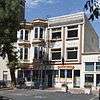 Building at 27-29 Fountain Alley |
March 2, 1982 (#82002265) |
27-29 Fountain Alley 37°20′10″N 121°53′23″W |
San Jose | |
| 10 | Campbell Union Grammar School | 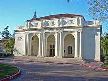 Campbell Union Grammar School |
July 20, 1979 (#79000544) |
11 E. Campbell Ave. 37°17′16″N 121°56′52″W |
Campbell | |
| 11 | Campbell Union High School Historic District |  Campbell Union High School Historic District |
August 17, 1989 (#89001048) |
1 W. Campbell Ave. 37°17′13″N 121°57′14″W |
Campbell | |
| 12 | Christian Church of Gilroy |  Christian Church of Gilroy |
April 1, 1982 (#82002261) |
160 5th St. 37°00′28″N 121°34′14″W |
Gilroy | |
| 13 | Civic Art Gallery | 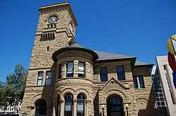 Civic Art Gallery |
January 29, 1973 (#73000453) |
110 Market St. 37°20′01″N 121°53′21″W |
San Jose | |
| 14 | Coyote Creek Archeological District | October 14, 1971 (#71000192) |
Address Restricted |
Gilroy Hot Springs | ||
| 15 | De Anza Hotel | 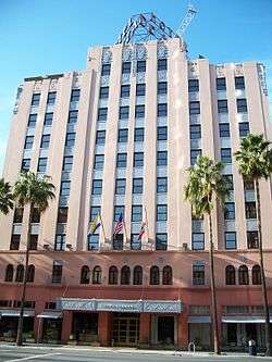 De Anza Hotel |
January 21, 1982 (#82002266) |
233 W. Santa Clara St. 37°20′04″N 121°53′38″W |
San Jose | |
| 16 | Pedro de Lemos House |  Pedro de Lemos House |
January 10, 1980 (#80000863) |
100-110 Waverley Oaks 37°26′01″N 122°08′24″W |
Palo Alto | |
| 17 | Dohrmann Building |  Dohrmann Building |
February 20, 1986 (#86000264) |
325 S. First St. 37°19′52″N 121°53′09″W |
San Jose | |
| 18 | T. B. Downing House |  T. B. Downing House |
October 30, 1973 (#73000452) |
706 Cowper St. 37°26′48″N 122°09′24″W |
Palo Alto | |
| 19 | Dunker House |  Dunker House |
February 19, 1982 (#82002264) |
420 Maple St. 37°27′25″N 122°08′59″W |
Palo Alto | |
| 20 | East San Jose Carnegie Library |  East San Jose Carnegie Library |
December 10, 1990 (#90001813) |
1102 E. Santa Clara St. 37°20′49″N 121°52′03″W |
San Jose | |
| 21 | Fairglen Additions (Unit 1, Unit 2, and Unit 3) | June 6, 2019 (#100004036) |
Booksin, Fairvalley, Fairhill, Fairwood, Fairlawn, Fairorchard, Fairdell, and Andalusia Aves., Fairlawn, Fairvalley, Fairoak, and Fairgrove Courts, and Fairglen Dr. 37°16′53″N 121°54′12″W |
San Jose | ||
| 22 | First Unitarian Universalist Church | 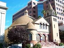 First Unitarian Universalist Church |
November 17, 1977 (#77000343) |
160 N. 3rd St. 37°20′23″N 121°53′20″W |
San Jose | |
| 23 | Flight And Guidance Simulation Laboratory | January 11, 2017 (#100000469) |
655 Cooper Ln., NASA Ames Research Center 37°24′55″N 122°03′24″W |
Moffett Field | ||
| 24 | Forbes Mill Annex | 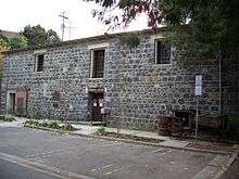 Forbes Mill Annex |
July 31, 1978 (#78000776) |
75 Church St. 37°13′20″N 121°58′50″W |
Los Gatos | |
| 25 | Fraternal Hall Building | 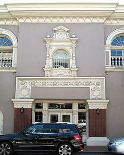 Fraternal Hall Building |
February 15, 1990 (#90000119) |
140 University Ave. and 514 High St. 37°26′40″N 122°09′45″W |
Palo Alto | |
| 26 | Arthur Monroe Free House | 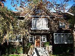 Arthur Monroe Free House |
April 26, 2002 (#02000384) |
66 S. 14th St. 37°20′32″N 121°52′31″W |
San Jose | |
| 27 | Galindo-Leigh House |  Galindo-Leigh House |
August 22, 1980 (#80000857) |
140 S. Peter Dr. 37°17′06″N 121°55′21″W |
Campbell | |
| 28 | Gilroy Free Library |  Gilroy Free Library |
June 23, 1988 (#88000923) |
195 Fifth St. 37°00′29″N 121°34′18″W |
Gilroy | |
| 29 | Gilroy Southern Pacific Railroad Depot |  Gilroy Southern Pacific Railroad Depot |
July 12, 2019 (#100004192) |
7250 Monterey St. 37°00′16″N 121°34′01″W |
Gilroy | |
| 30 | Gilroy Yamato Hot Springs | August 21, 1995 (#95000996) |
9.5 miles (15.3 km) northeast of the junction of New Ave. and Roop Rd. 37°06′30″N 121°28′39″W |
Gilroy | ||
| 31 | Green Gables |  Green Gables |
July 28, 2005 (#04000863) |
Channing Ave., Ivy Ln., Greer Rd., Wildwood Ln. 37°26′45″N 122°07′27″W |
Palo Alto | community of Eichler homes |
| 32 | Greenmeadow | 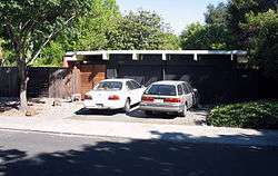 Greenmeadow |
July 28, 2005 (#04000862) |
Nelson Dr., El Capitan Pl., Adobe Pl., Creekside Dr. 37°24′53″N 122°06′45″W |
Palo Alto | community of Eichler homes |
| 33 | Willard Griffin House and Carriage House |  Willard Griffin House and Carriage House |
April 13, 1977 (#77000342) |
12345 S. El Monte Ave. 37°21′43″N 122°07′30″W |
Los Altos | |
| 34 | Hakone Historic District | 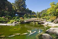 Hakone Historic District |
April 23, 2013 (#13000181) |
21000 Big Basin Way 37°15′15″N 122°02′22″W |
Saratoga | |
| 35 | Capt. James A. Hamilton House | 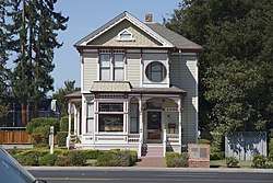 Capt. James A. Hamilton House |
June 9, 1980 (#80000864) |
2295 S. Bascom Ave. 37°16′54″N 121°55′52″W |
San Jose | |
| 36 | Hanna-Honeycomb House |  Hanna-Honeycomb House |
November 7, 1978 (#78000780) |
737 Frenchman's Rd. 37°25′00″N 122°09′45″W |
Stanford | 1937 house by Frank Lloyd Wright |
| 37 | Hayes Mansion | 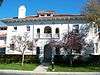 Hayes Mansion |
August 1, 1975 (#75000481) |
200 Edenvale Ave. 37°15′45″N 121°49′11″W |
San Jose | |
| 38 | Hensley Historic District |  Hensley Historic District |
June 21, 1983 (#83001238) |
Roughly bounded by Julian, 1st, 7th, and Empire Sts. 37°20′40″N 121°53′29″W |
San Jose | |
| 39 | Hewlett-Packard House and Garage |  Hewlett-Packard House and Garage |
April 20, 2007 (#07000307) |
367 Addison Ave. 37°26′35″N 122°09′17″W |
Palo Alto | |
| 40 | Highway 152 Tree Row | 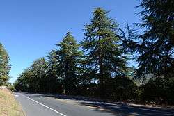 Highway 152 Tree Row |
July 3, 2007 (#07000635) |
California State Route 152 between Uvas Creek Bridge and Santa Teresa Blvd 37°00′43″N 121°36′47″W |
Gilroy | |
| 41 | Edgar Holloway House | 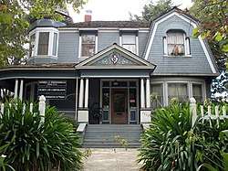 Edgar Holloway House |
January 28, 1982 (#82002262) |
7539 Eigleberry St. 37°00′31″N 121°34′16″W |
Gilroy | |
| 42 | Lou Henry Hoover House | 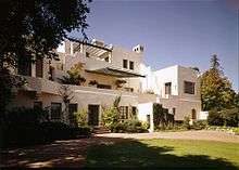 Lou Henry Hoover House |
January 30, 1978 (#78000786) |
623 Mirada Rd. 37°25′05″N 122°10′04″W |
Stanford | |
| 43 | Hostess House | 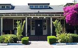 Hostess House |
July 30, 1976 (#76000528) |
University Ave. at El Camino Real 37°26′35″N 122°09′56″W |
Palo Alto | |
| 44 | Hotel Montgomery | 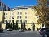 Hotel Montgomery |
April 20, 2006 (#06000328) |
211 SW First St. 37°19′57″N 121°53′15″W |
San Jose | |
| 45 | Hotel Sainte Claire | 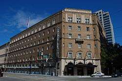 Hotel Sainte Claire |
June 3, 1980 (#80000865) |
302 and 320 S. Market St. 37°20′13″N 121°52′58″W |
San Jose | |
| 46 | Warner Hutton House | 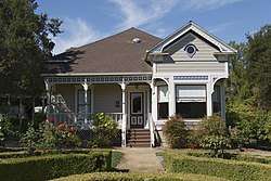 Warner Hutton House |
March 17, 2006 (#06000189) |
13777a Fruitvale Ave. 37°16′05″N 122°00′52″W |
Saratoga | |
| 47 | Kee House |  Kee House |
April 11, 1985 (#85000715) |
2310 Yale St. 37°25′28″N 122°08′51″W |
Palo Alto | 1889 Eastlake-style house |
| 48 | Kotani-En Garden | November 7, 1976 (#76000527) |
15891 Ravine Road[7] 37°14′14″N 122°00′41″W |
Los Gatos | ||
| 49 | Andrew J. Landrum House |  Andrew J. Landrum House |
February 19, 1982 (#82002271) |
1219 Santa Clara St. 37°20′50″N 121°56′52″W |
Santa Clara | |
| 50 | Lantarnam Hall | December 19, 1985 (#85003189) |
12335 Stonebrook Ct. 37°21′24″N 122°07′31″W |
Los Altos Hills | ||
| 51 | Le Petit Trianon |  Le Petit Trianon |
November 15, 1972 (#72001552) |
De Anza College campus 37°19′15″N 122°02′50″W |
Cupertino | |
| 52 | Leib Carriage House | 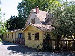 Leib Carriage House |
June 2, 1980 (#80000866) |
60 N. Keeble Ave. 37°19′59″N 121°54′29″W |
San Jose | |
| 53 | James Lick Mill | 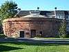 James Lick Mill |
March 2, 1982 (#82002272) |
305 Montague Expwy. 37°23′59″N 121°56′30″W |
Santa Clara | |
| 54 | Live Oak Creamery | 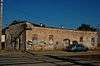 Live Oak Creamery |
March 11, 1982 (#82002263) |
88 Martin St. 37°00′30″N 121°34′05″W |
Gilroy | |
| 55 | Los Gatos Historic Commercial District | 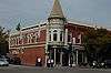 Los Gatos Historic Commercial District |
September 13, 1991 (#91001382) |
1-24 N. Santa Cruz Ave., 9-15 University Ave. and 14-198 W. Main St. 37°13′19″N 121°58′58″W |
Los Gatos | |
| 56 | MacFarland House | 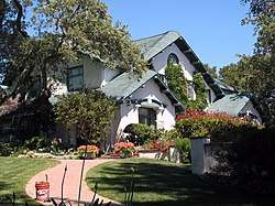 MacFarland House |
July 21, 2006 (#06000659) |
775 Santa Ynez St. 37°25′01″N 122°10′07″W |
Stanford | |
| 57 | Malaguerra Winery |  Malaguerra Winery |
October 23, 1980 (#80000858) |
N. of Morgan Hill on Burnett Ave. 37°10′09″N 121°39′19″W |
Morgan Hill | |
| 58 | Paul Masson Mountain Winery |  Paul Masson Mountain Winery |
June 9, 1983 (#83001239) |
Pierce Rd. 37°15′37″N 122°03′53″W |
Saratoga | |
| 59 | McCullagh-Jones House |  McCullagh-Jones House |
October 29, 1974 (#74000558) |
18000 Overlook Rd. 37°13′37″N 121°59′37″W |
Los Gatos | |
| 60 | Messina Orchard | April 9, 2018 (#100002288) |
721-781 N. Capitol Ave. 37°22′40″N 121°51′03″W |
San Jose | ||
| 61 | Miller Red Barn |  Miller Red Barn |
September 26, 2016 (#16000665) |
7049 Miller Ave. 36°59′54″N 121°35′18″W |
Gilroy | |
| 62 | Miller-Melone Ranch |  Miller-Melone Ranch |
April 1, 1993 (#93000260) |
12795 Saratoga-Sunnyvale Rd. 37°16′57″N 122°01′58″W |
Saratoga | |
| 63 | Milpitas Grammar School |  Milpitas Grammar School |
July 22, 1993 (#93000667) |
160 N. Main St. 37°25′59″N 121°54′21″W |
Milpitas | |
| 64 | Moir Building |  Moir Building |
October 29, 1982 (#82000991) |
227-247 N. 1st St. 37°20′23″N 121°53′32″W |
San Jose | |
| 65 | Charles Copeland Morse House |  Charles Copeland Morse House |
April 13, 1977 (#77000347) |
981 Fremont St. 37°21′08″N 121°56′41″W |
Santa Clara | |
| 66 | Mountain View Adobe |  Mountain View Adobe |
October 28, 2002 (#02001256) |
157 Moffett Blvd. 37°23′45″N 122°04′37″W |
Mountain View | |
| 67 | NASA Ames Wind Tunnel Historic District |  NASA Ames Wind Tunnel Historic District |
January 11, 2017 (#100000470) |
NASA Ames Research Center 37°24′55″N 122°03′46″W |
Moffett Field | |
| 68 | New Almaden | 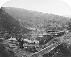 New Almaden |
October 15, 1966 (#66000236) |
14 miles (23 km) south of San Jose on CR G8 37°10′48″N 121°50′08″W |
San Jose | |
| 69 | Norris House |  Norris House |
July 24, 1980 (#80000859) |
1247 Cowper St. 37°26′33″N 122°08′57″W |
Palo Alto | |
| 70 | Frank Norris Cabin | .jpg) Frank Norris Cabin |
October 15, 1966 (#66000235) |
10 miles (16 km) west of Gilroy off CA 152 37°02′11″N 121°42′45″W |
Gilroy | |
| 71 | Old City Hall |  Old City Hall |
April 16, 1975 (#75000480) |
7410 Monterey St. 37°00′26″N 121°34′07″W |
Gilroy | |
| 72 | Our Lady of Guadalupe Mission Chapel (1953-1960) |  Our Lady of Guadalupe Mission Chapel (1953-1960) |
December 23, 2016 (#100000836) |
2020 East San Antonio St. 37°21′09″N 121°50′41″W |
San Jose | |
| 73 | Palo Alto Medical Clinic |  Palo Alto Medical Clinic |
June 21, 2010 (#10000357) |
300 Homer Ave. 37°26′37″N 122°09′26″W |
Palo Alto | |
| 74 | Palo Alto Southern Pacific Railroad Depot | 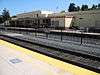 Palo Alto Southern Pacific Railroad Depot |
April 18, 1996 (#96000425) |
95 University Ave. 37°26′37″N 122°09′55″W |
Palo Alto | |
| 75 | Palo Alto Stock Farm Horse Barn | 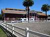 Palo Alto Stock Farm Horse Barn |
December 12, 1985 (#85003325) |
Fremont Rd. 37°25′29″N 122°11′00″W |
Stanford | |
| 76 | Luis Maria Peralta Adobe |  Luis Maria Peralta Adobe |
October 15, 1973 (#73000454) |
184 W. St. John St. 37°20′11″N 121°53′36″W |
San Jose | |
| 77 | Pettigrew House |  Pettigrew House |
November 25, 1980 (#80000860) |
1336 Cowpers St. 37°26′30″N 122°08′55″W |
Palo Alto | |
| 78 | Picchetti Brothers Winery |  Picchetti Brothers Winery |
May 10, 1979 (#79000545) |
Southwest of Cupertino at 13100 Montebello Rd. 37°17′40″N 122°05′26″W |
Cupertino | |
| 79 | Poverty Flat Site | February 23, 1972 (#72000254) |
Address Restricted |
Morgan Hill | ||
| 80 | Professorville Historic District |  Professorville Historic District |
October 3, 1980 (#80000861) |
Roughly bounded by Embarcadero Rd., Addison Ave., Emerson and Cowper Sts. 37°26′29″N 122°09′05″W |
Palo Alto | |
| 81 | Ramona Street Architectural District |  Ramona Street Architectural District |
March 27, 1986 (#86000592) |
518-581 Ramona St. and 255-267 Hamilton Ave. 37°26′42″N 122°09′42″W |
Palo Alto | |
| 82 | Henry A. Rengstorff House | 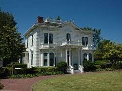 Henry A. Rengstorff House |
June 13, 1978 (#78000778) |
3070 N. Shoreline Blvd. 37°25′54″N 122°05′13″W |
Mountain View | |
| 83 | Ernest & Emily Renzel House | 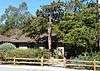 Ernest & Emily Renzel House |
September 23, 2010 (#10000773) |
120 Arroyo Way 37°20′32″N 121°52′18″W |
San Jose | |
| 84 | Rhoades Ranch | April 17, 2013 (#13000158) |
2290-A Cochrane Road 37°09′51″N 121°37′54″W |
Morgan Hill | ||
| 85 | Roberto-Sunol Adobe | 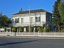 Roberto-Sunol Adobe |
March 17, 1977 (#77000344) |
770 Lincoln Ave. 37°18′59″N 121°54′22″W |
San Jose | |
| 86 | Roma Bakery | 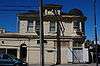 Roma Bakery |
January 21, 1982 (#82002267) |
655 Almaden Ave. 37°20′33″N 121°53′07″W |
San Jose | |
| 87 | Ross House | 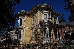 Ross House |
October 29, 1982 (#82000992) |
693 S. 2nd St. 37°19′35″N 121°52′51″W |
San Jose | |
| 88 | St. James Square Historic District | 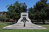 St. James Square Historic District |
November 27, 1979 (#79000546) |
Roughly bounded by N. 1st, N. 4th, E. St. James, and E. St. John Sts. 37°20′20″N 121°53′25″W |
San Jose | |
| 89 | St. Joseph's Roman Catholic Church |  St. Joseph's Roman Catholic Church |
August 26, 1977 (#77000345) |
Market and San Fernando Sts. 37°20′03″N 121°53′22″W |
San Jose | |
| 90 | San Jose Central Fire Station | 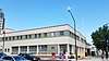 San Jose Central Fire Station |
January 7, 2015 (#14001113) |
201 N. Market St. 37°20′19″N 121°53′40″W |
San Jose | |
| 91 | San Jose Downtown Historic District |  San Jose Downtown Historic District |
May 26, 1983 (#83003822) |
E. Santa Clara, South First, Second, Third and E. San Fernando Sts. 37°20′10″N 121°53′15″W |
San Jose | |
| 92 | Santa Clara Depot | 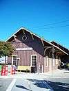 Santa Clara Depot |
February 28, 1985 (#85000359) |
1 Railroad Ave. 37°21′11″N 121°56′06″W |
Santa Clara | |
| 93 | Santa Clara Verein |  Santa Clara Verein |
January 19, 1984 (#84001199) |
1082 Alviso St. 37°21′05″N 121°56′29″W |
Santa Clara | Demolished in 1991 |
| 94 | Saratoga Foothill Club | 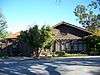 Saratoga Foothill Club |
February 27, 2005 (#05000069) |
20399 Park Place 37°15′33″N 122°01′48″W |
Saratoga | 1915 Arts and Crafts-style clubhouse designed by Julia Morgan |
| 95 | Saratoga Village Library |  Saratoga Village Library |
January 17, 2007 (#06001238) |
14410 Oak St. 37°15′28″N 122°01′53″W |
Saratoga | now a used book store benefiting the Saratoga Library |
| 96 | Paul Shoup House |  Paul Shoup House |
September 23, 2011 (#11000696) |
500 University Ave. 37°22′25″N 122°07′07″W |
Los Altos | |
| 97 | Southern Pacific Depot | 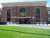 Southern Pacific Depot |
April 1, 1993 (#93000274) |
65 Cahill St. 37°19′49″N 121°54′06″W |
San Jose | |
| 98 | Spillman Engineering 3-Abreast Carousel | April 13, 2000 (#00000366) |
139 B Eastridge Mall 37°19′33″N 121°48′47″W |
San Jose | Carousel made c. 1920 by Allan Herschell Company, restored and located in the Eastridge Mall. | |
| 99 | John Adam Squire House | 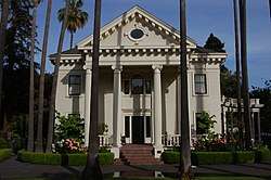 John Adam Squire House |
March 6, 1972 (#72000255) |
900 University Ave. 37°27′11″N 122°09′14″W |
Palo Alto | |
| 100 | John Steinbeck House | December 28, 1989 (#89002117) |
16250 Greenwood Ln. 37°13′55″N 122°00′07″W |
Monte Sereno | ||
| 101 | Troy Laundry | January 28, 1982 (#82002268) |
722 Almaden Ave. 37°19′26″N 121°53′04″W |
San Jose | no longer exists; Troy Apartments now occupy this location | |
| 102 | Twohy Building |  Twohy Building |
October 6, 2003 (#03000989) |
210 S. First St. 37°19′59″N 121°53′12″W |
San Jose | |
| 103 | U.S. Post Office | 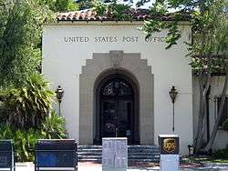 U.S. Post Office |
April 5, 1981 (#81000175) |
380 Hamilton Ave. 37°26′45″N 122°09′33″W |
Palo Alto | |
| 104 | Unitary Plan Wind Tunnel | 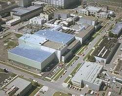 Unitary Plan Wind Tunnel |
October 3, 1985 (#85002799) |
Ames Research Center 37°25′03″N 122°03′35″W |
Moffett Field | |
| 105 | US Naval Air Station Sunnyvale, California, Historic District | 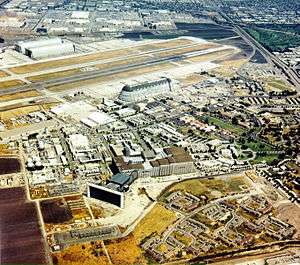 US Naval Air Station Sunnyvale, California, Historic District |
February 24, 1994 (#94000045) |
Moffett Federal Airfield 37°24′46″N 122°03′13″W |
Sunnyvale | NASA Ames Historic Properties[8] |
| 106 | Veterans Affairs (VA) Hospital Site | October 21, 2019 (#100004526) |
Address Restricted |
Palo Alto | ||
| 107 | Villa Mira Monte |  Villa Mira Monte |
May 25, 1978 (#78000777) |
17860 Monterey Rd. 37°08′05″N 121°39′26″W |
Morgan Hill | |
| 108 | Villa Montalvo | Villa Montalvo |
May 1, 1978 (#78000784) |
14800 Montalvo Rd. 37°14′38″N 122°01′52″W |
Saratoga | |
| 109 | We and Our Neighbors Clubhouse | 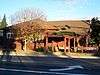 We and Our Neighbors Clubhouse |
December 20, 1978 (#78000781) |
South of San Jose at 15460 Union Ave. 37°14′37″N 121°55′52″W |
San Jose | |
| 110 | Welch-Hurst | 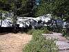 Welch-Hurst |
September 18, 1978 (#78000785) |
15800 Sanborn Rd. 37°14′22″N 122°04′22″W |
Saratoga | most recently known as the Sanborn Park Hostel; closed in March 2010[9] |
| 111 | Wheeler Hospital | 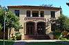 Wheeler Hospital |
September 13, 1990 (#90001442) |
650 Fifth St. 37°00′23″N 121°34′38″W |
Gilroy | |
| 112 | Wilson House |  Wilson House |
January 2, 1980 (#80000862) |
860 University St. 37°27′09″N 122°09′16″W |
Palo Alto | |
| 113 | Winchester House | 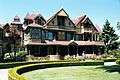 Winchester House |
August 7, 1974 (#74000559) |
525 S. Winchester Blvd. 37°19′05″N 121°57′00″W |
San Jose | Also known as Winchester Mystery House |
| 114 | Woman's Club of Palo Alto |  Woman's Club of Palo Alto |
January 7, 2015 (#14001114) |
475 Homer Ave. 37°26′45″N 122°09′20″W |
Palo Alto | |
| 115 | Woodhills | %2C_Prospect_Rd.%2C_Cupertino%2C_CA_9-16-2012_2-23-48_PM.JPG) Woodhills |
December 20, 1978 (#78000773) |
South of Cupertino on Prospect Rd. 37°17′12″N 122°03′35″W |
Cupertino | Also known as Fremont Older House |
| 116 | Earl and Virginia Young House |  Earl and Virginia Young House |
January 8, 2009 (#08001279) |
1888 White Oaks Road 37°15′39″N 121°56′55″W |
Campbell | |
| 117 | Yung See San Fong House | 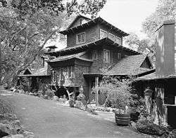 Yung See San Fong House |
September 8, 1983 (#83001240) |
16660 Cypress Way 37°12′58″N 121°57′36″W |
Los Gatos | |
| 118 | Theodore Zschokke Cottages | May 26, 2020 (#100005218) |
617 and 621 High St. 37°26′35″N 122°09′42″W |
Palo Alto |
Former listing
| [3] | Name on the Register | Image | Date listed | Date removed | Location | City or town | Summary |
|---|---|---|---|---|---|---|---|
| 1 | Donner-Houghton House |  Donner-Houghton House |
January 24, 2002 (#01001483) | July 17, 2013 | 156 E. St. John 37°20′26″N 121°53′19″W |
San Jose | Destroyed by fire July 19, 2007[10] |
| 2 | Murphy Building | 1975 (#75002133) | Unknown | 36 S. Market St. |
San Jose | Demolished January 12, 1976.[11][12] |
See also
| Wikimedia Commons has media related to National Register of Historic Places in Santa Clara County, California. |
References
- The latitude and longitude information provided in this table was derived originally from the National Register Information System, which has been found to be fairly accurate for about 99% of listings. Some locations in this table may have been corrected to current GPS standards.
- "National Register of Historic Places: Weekly List Actions". National Park Service, United States Department of the Interior. Retrieved on June 19, 2020.
- Numbers represent an ordering by significant words. Various colorings, defined here, differentiate National Historic Landmarks and historic districts from other NRHP buildings, structures, sites or objects.
- "National Register Information System". National Register of Historic Places. National Park Service. July 9, 2010.
- The eight-digit number below each date is the number assigned to each location in the National Register Information System database, which can be viewed by clicking the number.
- Alviso Master Plan: A Specific Plan for the Alviso Community (PDF), San Jose, California: Department of Planning, Building and Code Enforcement, December 1998, archived from the original (PDF) on May 15, 2012, retrieved May 26, 2012
- "California Historical Landmarks: Santa Clara". Office of Historic Preservation. Retrieved June 18, 2014.
- http://historicproperties.arc.nasa.gov/shenandoah.html
- "Summer Retreat to Hostel—100 Years and Still Standing" (PDF). Saratoga Historical Foundation Newsletter. Saratoga, California. May 2010. p. 5. Retrieved September 24, 2012.
- Emmer, Jennifer (September 4, 2007). ""The Most Historic Building in San Jose" burns to the ground". Retrieved September 22, 2012.
- Gilbert, Lauren Miranda; Johnson, Bob (2004). San Jose's Historic Downtown. Arcadia Publishing. p. 36. ISBN 0738529222.
| Topics | |
|---|---|
| Lists by state |
|
| Lists by insular areas | |
| Lists by associated state | |
| Other areas | |
| Related | |
| |
Municipalities and communities of Santa Clara County, California, United States | ||
|---|---|---|
| Cities | Santa Clara County map | |
| Towns | ||
| CDPs | ||
| Unincorporated communities | ||
| CCDs | ||
| Ghost towns | ||
This article is issued from Wikipedia. The text is licensed under Creative Commons - Attribution - Sharealike. Additional terms may apply for the media files.