National Register of Historic Places listings in Old Louisville, Kentucky
This is a list of properties and historic districts on the National Register of Historic Places in Old Louisville, Kentucky (roughly bounded by York St. and E. Jacob St. on the north; S. Floyd St. and I-65 on the east; E. Brandeis St. on the south; and S. 5th St., S. 7th St. and the CSX Railroad tracks on the west). Latitude and longitude coordinates of the 33 sites listed on this page may be displayed in a map or exported in several formats by clicking on one of the links in the adjacent box.[1]
National Register sites elsewhere in Jefferson County are listed separately.
- This National Park Service list is complete through NPS recent listings posted June 19, 2020.[2]
Current listings
| [3] | Name on the Register | Image | Date listed[4] | Location | Description |
|---|---|---|---|---|---|
| 1 | Adath Israel Temple |  Adath Israel Temple |
December 31, 1974 (#74000882) |
834 S. 3rd St. 38°14′35″N 85°45′27″W |
|
| 2 | Bayly-Schroering House |  Bayly-Schroering House |
November 14, 1978 (#78001345) |
1012 S. 4th St. 38°14′18″N 85°45′37″W |
|
| 3 | Board of Extension of the Methodist Episcopal Church, South | 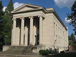 Board of Extension of the Methodist Episcopal Church, South |
June 3, 1983 (#83002636) |
1115 S. 4th St. 38°14′13″N 85°45′33″W |
|
| 4 | Calvary Episcopal Church | 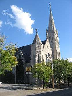 Calvary Episcopal Church |
January 18, 1978 (#78001347) |
821 S. 4th St. 38°14′36″N 85°45′31″W |
|
| 5 | Church of the Messiah | 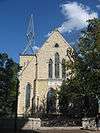 Church of the Messiah |
April 21, 1976 (#76000903) |
805 S. 4th St. 38°14′38″N 85°45′30″W |
|
| 6 | College Street Presbyterian Church |  College Street Presbyterian Church |
November 29, 1978 (#78001350) |
113 W. College St. 38°14′36″N 85°45′17″W |
|
| 7 | Cornwall and Brown Houses |  Cornwall and Brown Houses |
July 19, 1978 (#78001351) |
957 S. 4th St. 38°14′23″N 85°45′33″W |
|
| 8 | District #1 | 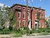 District #1 |
June 3, 1983 (#83002655) |
S. Brook and E. Breckinridge St. 38°14′29″N 85°45′05″W |
|
| 9 | District #2 |  District #2 |
June 3, 1983 (#83002656) |
W. Breckinridge St. and S. 2nd St. 38°14′31″N 85°45′22″W |
|
| 10 | William J. Dodd Residence | 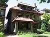 William J. Dodd Residence |
August 5, 2010 (#10000530) |
1448 St. James Court 38°13′39″N 85°45′50″W |
|
| 11 | D.H. Ewing & Sons Creamery |  D.H. Ewing & Sons Creamery |
June 3, 1983 (#83002662) |
981 S. 3rd St. 38°14′20″N 85°45′28″W |
|
| 12 | The Filson Club | 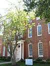 The Filson Club |
June 20, 2013 (#13000476) |
118 W. Breckinridge St. 38°14′28″N 85°45′19″W |
|
| 13 | First Christian Church |  First Christian Church |
July 16, 1979 (#79001005) |
850 S. 4th St. 38°14′32″N 85°45′34″W |
|
| 14 | First Street District | 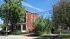 First Street District |
July 14, 1984 (#84001555) |
Roughly bounded by E. Breckinridge, E. Kentucky, and Interstate 65 38°14′26″N 85°45′15″W |
|
| 15 | Fourth Avenue Methodist Episcopal Church | 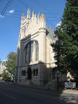 Fourth Avenue Methodist Episcopal Church |
July 16, 1979 (#79001006) |
318 W. St. Catherine St. 38°14′14″N 85°45′35″W |
|
| 16 | Harig, Koop & Company-Columbia Mantel Company | 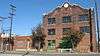 Harig, Koop & Company-Columbia Mantel Company |
March 14, 1996 (#96000279) |
845 S. 9th St. 38°14′36″N 85°46′01″W |
|
| 17 | Jewish Hospital Complex | 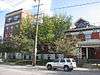 Jewish Hospital Complex |
July 22, 1994 (#94000732) |
236 E. Kentucky St. 38°14′16″N 85°45′05″W |
|
| 18 | Kentucky Street School |  Kentucky Street School |
June 3, 1983 (#83002691) |
119 E. Kentucky St. 38°14′19″N 85°45′13″W |
|
| 19 | Landward House | 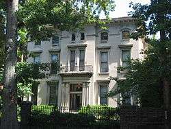 Landward House |
September 20, 1973 (#73000809) |
1385-1387 S. 4th St. 38°13′46″N 85°45′39″W |
|
| 20 | Louisville Gas and Electric Company Service Station Complex | 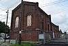 Louisville Gas and Electric Company Service Station Complex |
March 17, 2015 (#15000082) |
1228 S. 7th St. 38°14′03″N 85°45′56″W |
|
| 21 | Louisville Male High School | 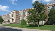 Louisville Male High School |
April 18, 1979 (#79001011) |
911 S. Brook St. 38°14′26″N 85°45′08″W |
|
| 22 | Louisville War Memorial Auditorium | 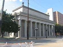 Louisville War Memorial Auditorium |
December 27, 1977 (#77000625) |
970 S. 4th St. 38°14′22″N 85°45′36″W |
|
| 23 | Dr. J.B. Marvin House | 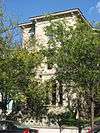 Dr. J.B. Marvin House |
June 3, 1983 (#83002700) |
809 S. 4th St. 38°14′38″N 85°45′31″W |
|
| 24 | Old Louisville Residential District | 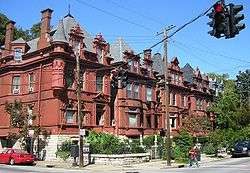 Old Louisville Residential District |
February 7, 1975 (#75000772) |
Irregular pattern roughly bounded by S. 7th St. on the west, North-South Expressway (Interstate 65) on the east, Kentucky St. on the north, and Avery St. on the south; also roughly bounded by Interstate 65 and 7th, Kentucky, and Avery Sts. 38°13′46″N 85°45′33″W |
Second set of boundaries represents a boundary increase of July 12, 1984 |
| 25 | The Olympic |  The Olympic |
July 9, 2007 (#07000677) |
223 W. Breckinridge St. 38°14′31″N 85°45′26″W |
|
| 26 | Porter-Todd House |  Porter-Todd House |
April 30, 1979 (#79001013) |
929 S. 4th St. 38°14′24″N 85°45′33″W |
|
| 27 | Presentation Academy | 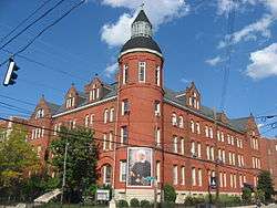 Presentation Academy |
December 22, 1978 (#78001364) |
861 S. 4th St. 38°14′32″N 85°45′32″W |
|
| 28 | Puritan Apartment Hotel | February 28, 2019 (#100003475) |
1244 S. Fourth St. 38°14′02″N 85°45′38″W |
||
| 29 | Rauchfuss Houses |  Rauchfuss Houses |
August 12, 1982 (#82002716) |
837-847 S. Brook St. 38°14′29″N 85°45′08″W |
|
| 30 | St. James-Belgravia Historic District | 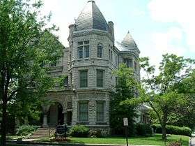 St. James-Belgravia Historic District |
December 5, 1972 (#72000538) |
Roughly bounded by Central Park, S. 4th, S. 6th, and Hill Sts. 38°13′40″N 85°45′48″W |
|
| 31 | Steam Engine Company No. 7 | 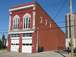 Steam Engine Company No. 7 |
November 7, 1980 (#80001631) |
821 S. 6th St. 38°14′38″N 85°45′43″W |
|
| 32 | Thierman Apartments | 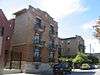 Thierman Apartments |
June 3, 1983 (#83002740) |
416-420 W. Breckinridge St. 38°14′30″N 85°45′36″W |
|
| 33 | Tompkins-Buchanan House | 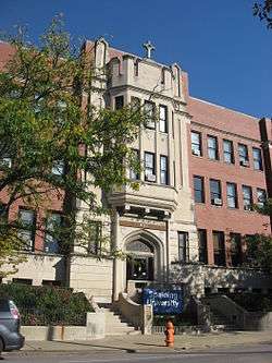 Tompkins-Buchanan House |
April 27, 1977 (#77000628) |
851 S. 4th St. 38°14′33″N 85°45′32″W |
See also
| Wikimedia Commons has media related to National Register of Historic Places in Louisville, Kentucky. |
References
- The latitude and longitude information provided in this table was derived originally from the National Register Information System, which has been found to be fairly accurate for about 99% of listings. Some locations in this table may have been corrected to current GPS standards.
- "National Register of Historic Places: Weekly List Actions". National Park Service, United States Department of the Interior. Retrieved on June 19, 2020.
- Numbers represent an ordering by significant words. Various colorings, defined here, differentiate National Historic Landmarks and historic districts from other NRHP buildings, structures, sites or objects.
- The eight-digit number below each date is the number assigned to each location in the National Register Information System database, which can be viewed by clicking the number.
| Topics | |
|---|---|
| Lists by state |
|
| Lists by insular areas | |
| Lists by associated state | |
| Other areas | |
| Related | |
| |

This article is issued from Wikipedia. The text is licensed under Creative Commons - Attribution - Sharealike. Additional terms may apply for the media files.