Bellewood, Kentucky
Bellewood is a home rule-class city in Jefferson County, Kentucky, United States. The city was formally incorporated by the state assembly in 1950.[2] The population was 321 at the 2010 census.[3]
Bellewood, Kentucky | |
|---|---|
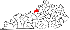
 Location of Bellewood in Jefferson County, Kentucky | |
 Bellewood Location within the state of Kentucky  Bellewood Bellewood (the United States) | |
| Coordinates: 38°15′38″N 85°39′33″W | |
| Country | United States |
| State | Kentucky |
| County | Jefferson |
| Area | |
| • Total | 0.08 sq mi (0.21 km2) |
| • Land | 0.08 sq mi (0.21 km2) |
| • Water | 0.0 sq mi (0.0 km2) |
| Elevation | 558 ft (170 m) |
| Population (2010) | |
| • Total | 321 |
| • Estimate (2016)[1] | 332 |
| • Density | 3,963/sq mi (1,530.2/km2) |
| Time zone | UTC-5 (Eastern (EST)) |
| • Summer (DST) | UTC-4 (EDT) |
| ZIP Code | 40207 |
| FIPS code | 21-05464 |
| GNIS feature ID | 0486814 |
Geography
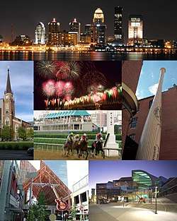
Bellewood is located in northern Jefferson County at 38°15′38″N 85°39′33″W (38.260455, -85.659092).[4] It is bordered by Brownsboro Village to the northwest, Druid Hills to the north, a portion of Louisville to the northeast, and St. Matthews to the east, south, and west. Downtown Louisville is 6 miles (10 km) to the west.
According to the United States Census Bureau, the city has a total area of 0.081 square miles (0.21 km2), all land.[3]
Bellewood lies between U.S. Routes 42 and 60.
Demographics
| Historical population | |||
|---|---|---|---|
| Census | Pop. | %± | |
| 1960 | 426 | — | |
| 1970 | 410 | −3.8% | |
| 1980 | 307 | −25.1% | |
| 1990 | 329 | 7.2% | |
| 2000 | 300 | −8.8% | |
| 2010 | 321 | 7.0% | |
| Est. 2016 | 332 | [1] | 3.4% |
| U.S. Decennial Census[5] | |||
At the 2000 census there were 300 people in 121 households, including 80 families, in the city. The population density was 3,910.8 people per square mile (1,447.9/km²). There were 126 housing units at an average density of 1,642.5 per square mile (608.1/km²). The racial makeup of the city was 98.67% White, 0.33% Asian, and 1.00% from two or more races.[6] Of the 121 households 35.5% had children under the age of 18 living with them, 57.0% were married couples living together, 9.9% had a female householder with no husband present, and 33.1% were non-families. 30.6% of households were one person and 11.6% were one person aged 65 or older. The average household size was 2.48 and the average family size was 3.17.
The age distribution was 30.3% under the age of 18, 4.7% from 18 to 24, 30.3% from 25 to 44, 21.7% from 45 to 64, and 13.0% 65 or older. The median age was 36 years. For every 100 females, there were 81.8 males. For every 100 females age 18 and over, there were 77.1 males.
The median household income was $88,708 and the median family income was $97,197. Males had a median income of $60,500 versus $36,000 for females. The per capita income for the city was $39,498. None of the families and 0.3% of the population were living below the poverty line.
References
- "Population and Housing Unit Estimates". Retrieved June 9, 2017.
- Commonwealth of Kentucky. Office of the Secretary of State. Land Office. "Bellewood, Kentucky". Accessed 15 July 2013.
- "Geographic Identifiers: 2010 Census Summary File 1 (G001): Bellewood city, Kentucky". American Factfinder. U.S. Census Bureau. Archived from the original on February 13, 2020. Retrieved May 24, 2018.
- "US Gazetteer files: 2010, 2000, and 1990". United States Census Bureau. 2011-02-12. Retrieved 2011-04-23.
- "Census of Population and Housing". Census.gov. Retrieved June 4, 2015.
- "U.S. Census website". United States Census Bureau. Retrieved 2008-01-31.
City of Louisville and metro area | ||
|---|---|---|
| History |
|  |
| Geography |
| |
| Government |
| |
| Transportation | ||
| Other subject areas | ||
| Top subjects | ||
| National Historic Landmarks | ||
| Prominent suburbs (over 10K pop.) | ||
| ||