National Register of Historic Places listings in Lexington County, South Carolina
This is a list of the National Register of Historic Places listings in Lexington County, South Carolina.
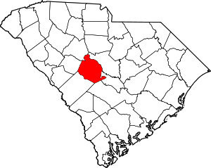
Location of Lexington County in South Carolina
This is intended to be a complete list of the properties and districts on the National Register of Historic Places in Lexington County, South Carolina, United States. The locations of National Register properties and districts for which the latitude and longitude coordinates are included below, may be seen in a map.[1]
There are 61 properties and districts listed on the National Register in the county. Another 2 properties were once listed but have been removed.
- This National Park Service list is complete through NPS recent listings posted June 19, 2020.[2]
Current listings
| [3] | Name on the Register[4] | Image | Date listed[5] | Location | City or town | Description |
|---|---|---|---|---|---|---|
| 1 | Ballentine-Shealy House | 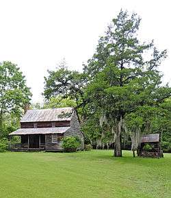 Ballentine-Shealy House |
November 22, 1983 (#83003858) |
South Carolina Highway 1323 34°06′17″N 81°22′55″W |
Lexington | Late 18th- or early 19th- century log home, sheathed in weatherboard; with ancillary buildings. |
| 2 | Bank of Western Carolina | 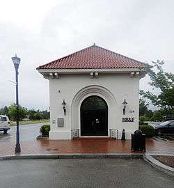 Bank of Western Carolina |
November 22, 1983 (#83003860) |
126 Main St. 33°58′53″N 81°14′12″W |
Lexington | |
| 3 | D. D. D. Barr House | 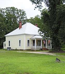 D. D. D. Barr House |
November 22, 1983 (#83003866) |
Off South Carolina Highway 245 33°56′12″N 81°31′38″W |
Batesburg-Leesville | |
| 4 | Batesburg Commercial Historic District | 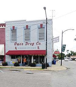 Batesburg Commercial Historic District |
July 6, 1982 (#82003875) |
Granite, Oak, Pine, and Church Sts., and Rutland and N. Railroad Aves. 33°54′25″N 81°32′54″W |
Batesburg-Leesville | |
| 5 | W. Q. M. Berly House | 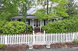 W. Q. M. Berly House |
November 22, 1983 (#83003870) |
122 Berly St. 33°59′14″N 81°14′30″W |
Lexington | |
| 6 | William Berly House | 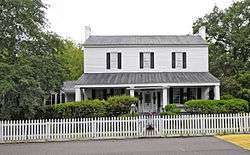 William Berly House |
November 23, 1977 (#77001230) |
121 Berly St. 33°59′14″N 81°14′29″W |
Lexington | |
| 7 | Lemuel Boozer House | 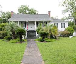 Lemuel Boozer House |
August 16, 1977 (#77001231) |
320 W. Main St. 33°59′06″N 81°14′32″W |
Lexington | |
| 8 | Simon Bouknight House |  Simon Bouknight House |
July 6, 1982 (#82003876) |
Saluda Ave. 33°54′32″N 81°33′10″W |
Batesburg-Leesville | |
| 9 | Cartledge House |  Cartledge House |
July 6, 1982 (#82003879) |
305 Saluda Ave. 33°54′31″N 81°33′08″W |
Batesburg-Leesville | |
| 10 | William J. Cayce House |  William J. Cayce House |
April 16, 1975 (#75001703) |
517 Holland Ave. 33°58′31″N 81°03′13″W |
Cayce | |
| 11 | Cedar Grove Lutheran Church |  Cedar Grove Lutheran Church |
November 17, 2010 (#10000922) |
1220 Cedar Grove Rd. 33°59′13″N 81°27′35″W |
Batesburg-Leesville | |
| 12 | Chapin Commercial Historic District | October 7, 2019 (#100004495) |
Bounded by Lexington Ave., Beaufort St., Chapin Rd., and the rear lots along Columbia Ave. 34°09′59″N 81°20′58″W |
Chapin | ||
| 13 | Church Street Historic District | 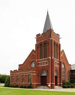 Church Street Historic District |
July 6, 1982 (#82003884) |
Church St. 33°55′09″N 81°30′24″W |
Batesburg-Leesville | |
| 14 | Colonial-Hites Company | 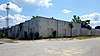 Colonial-Hites Company |
May 24, 2018 (#100002526) |
228 N Parson St. 33°59′18″N 81°04′39″W |
West Columbia | |
| 15 | "Congarees" Site | December 31, 1974 (#74002261) |
Address Restricted |
Cayce | ||
| 16 | C.E. Corley House | 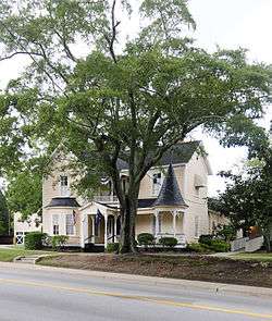 C.E. Corley House |
November 22, 1983 (#83003872) |
808 S. Lake Dr. 33°58′00″N 81°14′02″W |
Lexington | |
| 17 | Jacob Wingard Dreher House | 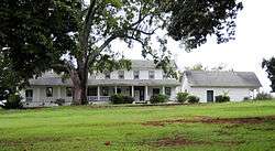 Jacob Wingard Dreher House |
November 22, 1983 (#83003875) |
Off South Carolina Highway 6 34°04′13″N 81°14′27″W |
Irmo | |
| 18 | Broadus Edwards House | 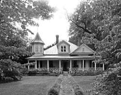 Broadus Edwards House |
July 6, 1982 (#82003877) |
12 Peachtree St. 33°54′12″N 81°33′03″W |
Batesburg-Leesville | |
| 19 | Fox House | 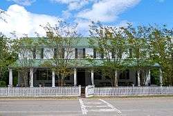 Fox House |
July 1, 1970 (#70000893) |
232 Fox St. 33°59′14″N 81°14′23″W |
Lexington | |
| 20 | Gervais Street Bridge | .jpg) Gervais Street Bridge |
November 25, 1980 (#80003676) |
Spans the Congaree River 33°59′47″N 81°02′55″W |
West Columbia | Extends into Columbia in Richland County |
| 21 | David Jefferson Griffith House | November 22, 1983 (#83003879) |
Address Restricted |
Gilbert | ||
| 22 | Guignard Brick Works | 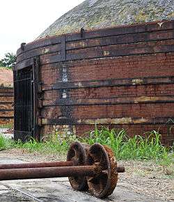 Guignard Brick Works |
February 13, 1995 (#95000019) |
100 Granby Crossing at Knox Abbot Dr. 33°59′16″N 81°03′02″W |
Cayce | |
| 23 | Gunter-Summers House | 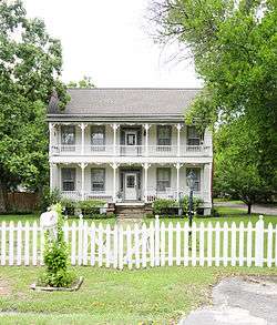 Gunter-Summers House |
November 10, 1987 (#87001988) |
841 Center St. 33°59′24″N 81°04′00″W |
Lexington | |
| 24 | Hampton Hendrix Office | July 6, 1982 (#82003885) |
Leesville Ave. 33°55′05″N 81°30′50″W |
Batesburg-Leesville | ||
| 25 | James Harman Building | 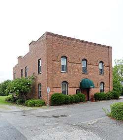 James Harman Building |
November 22, 1983 (#83003903) |
Gantt St. 33°58′55″N 81°14′09″W |
Lexington | |
| 26 | Hartley House | 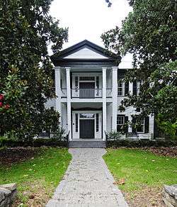 Hartley House |
July 9, 1982 (#82003878) |
305 E. Columbia Ave. 33°54′23″N 81°32′27″W |
Batesburg-Leesville | |
| 27 | Ernest L. Hazelius House | 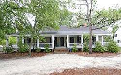 Ernest L. Hazelius House |
May 11, 1973 (#73001717) |
Fox St. 33°59′14″N 81°14′26″W |
Lexington | |
| 28 | Henry Franklin Hendrix House | 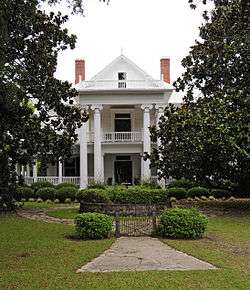 Henry Franklin Hendrix House |
July 6, 1982 (#82003886) |
Hendrix Heights Plantation 33°54′56″N 81°31′33″W |
Batesburg-Leesville | |
| 29 | John Solomon Hendrix House |  John Solomon Hendrix House |
November 22, 1983 (#83003904) |
Old Cherokee Rd. 34°00′14″N 81°17′09″W |
Lexington | |
| 30 | Thomas Galbraith Herbert House |  Thomas Galbraith Herbert House |
July 6, 1982 (#82003887) |
506 Trotter St. 33°55′32″N 81°31′05″W |
Batesburg-Leesville | |
| 31 | John Jacob Hite Farm | November 22, 1983 (#83003908) |
Address Restricted |
Lexington | ||
| 32 | J.B. Holman House |  J.B. Holman House |
July 6, 1982 (#82003888) |
N. Peachtree St. 33°54′18″N 81°33′07″W |
Batesburg-Leesville | |
| 33 | Home National Bank |  Home National Bank |
November 22, 1983 (#83003909) |
Main St. and North Lake Dr. 33°58′52″N 81°14′09″W |
Lexington | |
| 34 | A.C. Jones House | 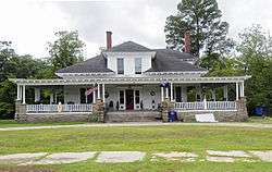 A.C. Jones House |
July 6, 1982 (#82003880) |
104 Fair Ave. 33°54′22″N 81°32′33″W |
Batesburg-Leesville | |
| 35 | Leesville College Historic District | 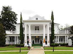 Leesville College Historic District |
July 6, 1982 (#82003889) |
Railroad Ave. and College, Peachtree, King, and Lee Sts. 33°55′14″N 81°30′55″W |
Batesburg-Leesville | |
| 36 | Lexington County Courthouse | 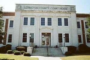 Lexington County Courthouse |
April 21, 2014 (#14000164) |
139 E. Main St. 33°58′53″N 81°14′11″W |
Lexington | |
| 37 | Henry Lybrand Farm | November 22, 1983 (#83003911) |
Address Restricted |
Lexington | ||
| 38 | Manning Archeological Site | December 14, 1978 (#78002522) |
Address Restricted |
Cayce | ||
| 39 | Maj. Henry A. Meetze House | 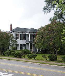 Maj. Henry A. Meetze House |
July 13, 1979 (#79002387) |
South of Lexington at 723 S. Lake Dr. 33°58′06″N 81°14′04″W |
Lexington | |
| 40 | Crowell Mitchell House | July 6, 1982 (#82003890) |
Church St. 33°55′02″N 81°30′40″W |
Batesburg-Leesville | ||
| 41 | McKendree Mitchell House | 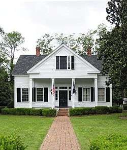 McKendree Mitchell House |
July 6, 1982 (#82003881) |
310 Saluda Ave. 33°54′35″N 81°33′09″W |
Batesburg-Leesville | |
| 42 | Mitchell-Shealy House | 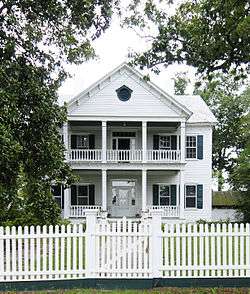 Mitchell-Shealy House |
July 6, 1982 (#82003891) |
419 W. Church St. 33°54′39″N 81°31′37″W |
Batesburg-Leesville | |
| 43 | Mount Hebron Temperance Hall | 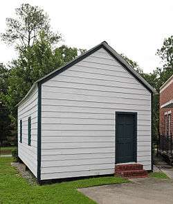 Mount Hebron Temperance Hall |
November 24, 1980 (#80003677) |
3041 Leaphart Rd. 33°59′58″N 81°07′29″W |
West Columbia | |
| 44 | Music Hall Evangelical Lutheran Church | November 22, 1983 (#83003913) |
Address Restricted |
Gilbert | ||
| 45 | New Brookland Historic District |  New Brookland Historic District |
October 10, 1978 (#78002524) |
Roughly bounded by Alexander Rd. and Augusta, State, Spring, and Meeting Sts. 33°59′34″N 81°03′17″W |
West Columbia | |
| 46 | Old Batesburg Grade School | 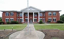 Old Batesburg Grade School |
May 27, 1983 (#83002201) |
306 E. Columbia Ave 33°54′23″N 81°32′23″W |
Batesburg-Leesville | |
| 47 | Old Batesburg-Leesville High School | 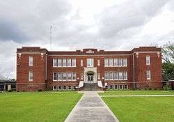 Old Batesburg-Leesville High School |
July 6, 1982 (#82003893) |
Columbia Ave at Shealy Rd 33°54′39″N 81°32′24″W |
Batesburg-Leesville | |
| 48 | Charlton Rauch House | 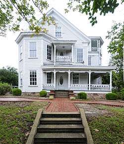 Charlton Rauch House |
November 22, 1983 (#83003914) |
Main and Cedar Sts. 33°59′03″N 81°14′26″W |
Lexington | |
| 49 | David Rawl House | 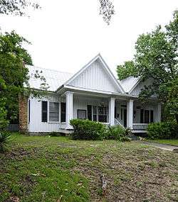 David Rawl House |
November 22, 1983 (#83003915) |
201 W. Main St. 33°58′59″N 81°14′21″W |
Lexington | |
| 50 | John Jacob Rawl House | 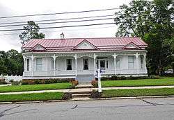 John Jacob Rawl House |
July 6, 1982 (#82003882) |
Line St. 33°54′33″N 81°32′53″W |
Batesburg-Leesville | |
| 51 | Rawl-Couch House | 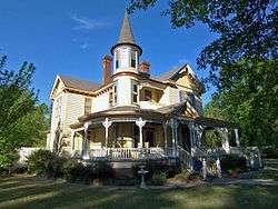 Rawl-Couch House |
July 6, 1982 (#82003883) |
22 Short St. 33°54′29″N 81°33′14″W |
Batesburg-Leesville | |
| 52 | Robinson-Hiller House | 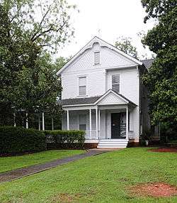 Robinson-Hiller House |
May 18, 1998 (#98000420) |
113 Virginia St. 34°09′57″N 81°21′20″W |
Chapin | |
| 53 | Saluda Factory Historic District | May 25, 1973 (#73001718) |
Along the Saluda River southeast of the junction of Interstates 26 and 126 34°01′05″N 81°05′13″W |
West Columbia | ||
| 54 | SAM Site | December 6, 1978 (#78002523) |
Address Restricted |
Cayce | A South Appalachian Mississippian site | |
| 55 | Simmons-Harth House | 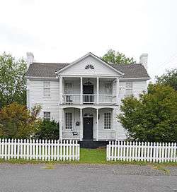 Simmons-Harth House |
November 22, 1983 (#83003916) |
102 Gantt St. 33°58′54″N 81°14′09″W |
Lexington | |
| 56 | Southern Railway Depot | 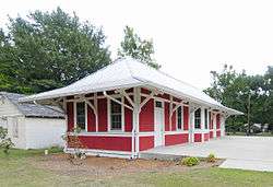 Southern Railway Depot |
May 27, 1983 (#83002202) |
Southeast corner of Perry and Wilson Sts. 33°54′22″N 81°32′33″W |
Batesburg-Leesville | |
| 57 | James Stewart House | November 22, 1983 (#83003917) |
Address Restricted |
Lexington | ||
| 58 | Still Hopes |  Still Hopes |
November 22, 1983 (#83003921) |
Off 7th St. 33°59′08″N 81°03′44″W |
Cayce | Also known as the G. A. Guignard House |
| 59 | Taylor Site | November 21, 1974 (#74001864) |
Address Restricted |
Cayce | ||
| 60 | Vastine Wessinger House | November 22, 1983 (#83003923) |
Address Restricted |
Lexington | ||
| 61 | Rev. Frank Yarborough House |  Rev. Frank Yarborough House |
July 6, 1982 (#82003892) |
810 Bernard St. 33°55′30″N 81°30′57″W |
Batesburg-Leesville |
Former listings
| [3] | Name on the Register | Image | Date listed | Date removed | Location | City or town | Summary |
|---|---|---|---|---|---|---|---|
| 1 | George's Grist and Flour Mill | November 22, 1983 (#83003877) | March 15, 2005 | Gibson’s Pond Rd. |
Lexington | Burned[6] | |
| 2 | Timmerman Law Office | November 22, 1983 (#83003922) | December 8, 2005 | 207 E. Main St. |
Lexington | Moved[7] |
See also
| Wikimedia Commons has media related to National Register of Historic Places in Lexington County, South Carolina. |
References
- The latitude and longitude information provided in this table was derived originally from the National Register Information System, which has been found to be fairly accurate for about 99% of listings. Some locations in this table may have been corrected to current GPS standards.
- "National Register of Historic Places: Weekly List Actions". National Park Service, United States Department of the Interior. Retrieved on June 19, 2020.
- Numbers represent an ordering by significant words. Various colorings, defined here, differentiate National Historic Landmarks and historic districts from other NRHP buildings, structures, sites or objects.
- "National Register Information System". National Register of Historic Places. National Park Service. March 13, 2009.
- The eight-digit number below each date is the number assigned to each location in the National Register Information System database, which can be viewed by clicking the number.
| Topics |  | |
|---|---|---|
| Lists by county |
| |
| Lists by city |
| |
| Other lists | ||
Municipalities and communities of Lexington County, South Carolina, United States | ||
|---|---|---|
| Cities | Map of South Carolina highlighting Lexington County | |
| Towns | ||
| CDPs | ||
| Ghost town | ||
| Footnotes | ‡This populated place also has portions in an adjacent county or counties | |
This article is issued from Wikipedia. The text is licensed under Creative Commons - Attribution - Sharealike. Additional terms may apply for the media files.