National Cycle Route 658
National Cycle Network (NCN) Route 658 is a Sustrans Regional Route. It is two miles (3.2 km) long, and provides a connection between Route 65 and Route 66 through York city centre. The full length of the route is part of the Way of the Roses. It is fully signed and open.
| NCN Route 658 | |
|---|---|
 | |
| Length | 3.97 kilometre |
| Designation | UK National Cycle Network |
| Trailheads | York, Tang Hall |
| Use | Cycling |
| Cycling details | |
| Website | sustrans.org.uk |
| Trail map | |
 Map of the NCN Route 658 through York, UK. | |
Route
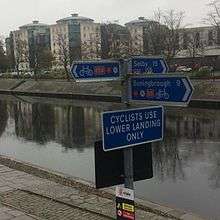
NCN 658 starts at Scarborough Bridge on the west bank of the River Ouse. It passes through the historic city walls at Bootham Bar. Passes York Minster, Monk Bar and Merchant Taylors' Hall before crossing the River Foss. It leaves the city centre on the Foss Islands Cycle track. The route ends at Tang Hall Lane where it meets NCN 66. Much of the route is traffic free.
History
The Foss Islands Cycle track runs along the former Derwent Valley Light Railway.[1] Sections of NCN 658 were originally signed as NCN 66.[2] The route was altered and renumbered during the creation of Way of the Roses Challenge Route.
Related NCN Routes
Route 658 meets the following routes:
Route 658 is part of the Way of the Roses along with:
References
- "Easy cycle rides for leisure. No.7" (PDF). iTravel York. City of York Council. Retrieved 3 November 2016.
- Peace, Richard (2000). The ultimate white rose cycle route guide. Wakefield: Excellent Books. p. 57. ISBN 9781901464085.