Na-hpan
Na-hpan[1] is a village in Mongyai Township, Shan State.[2]
Na-hpan | |
|---|---|
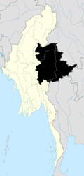
 Na-hpan Location in Burma | |
| Coordinates: 22°39′6″N 97°52′30″E | |
| Country | |
| Division | Shan State |
| District | Lashio District |
| Township | Mongyai Township |
| Elevation | 1,991 ft (607 m) |
| Population | |
| • Ethnicities | Shan |
| Time zone | UTC+6.30 (MST) |
References
- "Na-hpan". Mapcarta. Retrieved 20 May 2016.
- Shan State
- GoogleEarth
Capital: | |
|

This article is issued from Wikipedia. The text is licensed under Creative Commons - Attribution - Sharealike. Additional terms may apply for the media files.