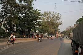
Hsipaw
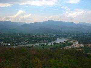
Hsipaw (Shan: သီႇပေႃႉ), also known as Thibaw (Burmese: သီပေါ), is the principal town of Hsipaw Township in Shan State, Myanmar on the banks of the Duthawadi River. It is 200 kilometres (120 mi) north-east of Mandalay.
Hsipaw သီပေါမြို့ Thibaw | |
|---|---|
Town | |
 Hsipaw | |
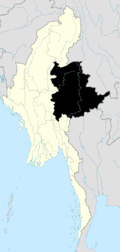
 Hsipaw Location in Myanmar | |
| Coordinates: 22°37′N 97°17′E | |
| Country | |
| State | |
| Population (2005) | |
| • Religions | Buddhism |
| Time zone | UTC+6.30 (MST) |
History
The capital of Hsipaw was originally On Baung. From the 1450s, it was a faithful vasal of the Kingdom of Ava (1364-1527). After the fall of the latter before the Shans, a prince of On Baung, Sao Hkhun Mong, was crowned King of Ava (1543-1546). A few decades later, King Bayinnaung, who reigned in Hanthawaddy Kingdom, sent an army against On Baung, whose prince, like the other Shan princes, had to recognize his sovereignty to keep his throne (1557). The shans also had to cede part of their states, including Mogok, but the prince of On Baung obtained confirmation of his pre-eminence over the other shans princes.
The dynasty of On Baung was maintained, paying tribute to the successive Burmese dynasties: Toungoo dynasty (1535-1752) then Konbaung dynasty (1752-1885). In 1714, its capital was transferred to Hsipaw. Sao Kya Tung was his Saopha for the King of Burma Mindon Min, as a reward for his help against Pagan Min.
Shan Saopha
Hsipaw State was perhaps one of the most well known and powerful saopha Shan States. According to the biography of Sao Nang Hearn Hkam (the chief wife, Madhidevi of Sao Shwe Thaik, the first president of Myanmar and another saopha of Hsenwi), Hsipaw, along with Kengtung and Yawnghwe were the wealthiest and most powerful saopha states in Shan State.
The Saophas played fluctuating roles in regional Shan and national Burmese politics from the 11th century all the way until the 1962 military coup by General Ne Win.
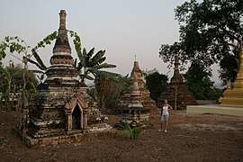
Hsipaw is famous for the Bowgoy Pagoda, situated in Bowgoy Village about 6 miles (9.7 km) away from Hsipaw.
Princes of Hsipaw
- Sao Hswe Kya (1788–1809)
- Sao Hkun Hkwi (1809–1843)
- Sao Hkun Paw (1843–1853)
- Sao Kya Htun (1853–1866)
- Sao Kya Hkeng (1866–1881)
- interregnum (1881–1886)
- Sao Hkun Saing (1886–1902)
- (Sir) Sao Khe (1902–1928)
- Sao On Kya (1928–1938)
- Sao Kya Hseng (1947–1959)
Climate
| Climate data for Hsipaw (1981–2010 extremes 2001–2010) | |||||||||||||
|---|---|---|---|---|---|---|---|---|---|---|---|---|---|
| Month | Jan | Feb | Mar | Apr | May | Jun | Jul | Aug | Sep | Oct | Nov | Dec | Year |
| Record high °C (°F) | 33.4 (92.1) |
35.0 (95.0) |
42.3 (108.1) |
41.0 (105.8) |
42.0 (107.6) |
38.0 (100.4) |
37.0 (98.6) |
36.2 (97.2) |
38.0 (100.4) |
36.0 (96.8) |
33.0 (91.4) |
32.0 (89.6) |
42.3 (108.1) |
| Average high °C (°F) | 27.2 (81.0) |
29.9 (85.8) |
33.4 (92.1) |
35.1 (95.2) |
33.4 (92.1) |
32.2 (90.0) |
31.4 (88.5) |
31.5 (88.7) |
31.8 (89.2) |
31.0 (87.8) |
28.7 (83.7) |
26.6 (79.9) |
31.0 (87.8) |
| Average low °C (°F) | 9.3 (48.7) |
9.5 (49.1) |
12.8 (55.0) |
18.1 (64.6) |
21.5 (70.7) |
23.5 (74.3) |
23.6 (74.5) |
23.4 (74.1) |
22.5 (72.5) |
20.5 (68.9) |
16.2 (61.2) |
12.0 (53.6) |
17.7 (63.9) |
| Record low °C (°F) | 4.0 (39.2) |
5.0 (41.0) |
7.0 (44.6) |
13.8 (56.8) |
16.9 (62.4) |
21.0 (69.8) |
21.0 (69.8) |
21.0 (69.8) |
18.0 (64.4) |
13.3 (55.9) |
10.7 (51.3) |
5.0 (41.0) |
4.0 (39.2) |
| Average rainfall mm (inches) | 7.3 (0.29) |
21.5 (0.85) |
30.1 (1.19) |
65.8 (2.59) |
159.9 (6.30) |
183.3 (7.22) |
329.3 (12.96) |
336.3 (13.24) |
194.3 (7.65) |
78.6 (3.09) |
48.6 (1.91) |
12.6 (0.50) |
1,467.6 (57.78) |
| Source: Norwegian Meteorological Institute[1] | |||||||||||||
References
- "Myanmar Climate Report" (PDF). Norwegian Meteorological Institute. pp. 23–36. Archived from the original (PDF) on 8 October 2018. Retrieved 1 December 2018.
External links
| Wikimedia Commons has media related to Hsipaw. |

- Scott, James George (1911). . In Chisholm, Hugh (ed.). Encyclopædia Britannica. 26 (11th ed.). Cambridge University Press. pp. 846–847.
- Viaja por libre. Hiking in Hsipaw (Spanish)
Gallery
|