Mabein
Mabein is a town in northern Shan State of Myanmar, formerly Burma. It is situated on the Shweli River and connected to Momeik, and to Bhamo and Myitkyina in Kachin State by road.[1][2] Mabein lies only 90 km (56 mi) from the border with Yunnan Province, China, but 200 km (124 mi) north of Mandalay.[3]
Mabein | |
|---|---|
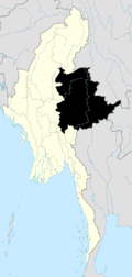
 Mabein Location in Myanmar | |
| Coordinates: 23°29′N 96°37′E | |
| Country | |
| State | |
| District | Mongmit District |
| Township | Mabein Township |
| Population (2005) | |
| • Ethnicities | Shan, Palaung |
| • Religions | Buddhism |
| Time zone | UTC+6.30 (MST) |
Economy
Mabein is a major rice producing area in the Shweli basin.[4] Teak extracted from forests around Mabein is classified as Medium Good.[5] Mabein Township is considered poppy - free by the United Nations International Drug Control Programme (UNDCP) in the Opium Survey 2002, and in the World Drug Report 2005 published by the United Nations Office on Drugs and Crime (UNODC).[6][7]
Gold deposits exist in the Mabein region within the 500 km2 Shante gold belt within the Mogok metamorphics north and north-east of Mandalay.[8] In January 2004, the military government signed a contract with two Canadian companies to prospect gold in two zones known as Set Ga Done and Nga Mu Gyi.[3]
Security vs human rights
On 10 November 2005, seven hired cattle drovers were reported shot dead by an army patrol from a battalion based in Momeik.[9]
Notes
- "Transport in Myanmar". MODiNS.Net. Retrieved 13 March 2009.
- "Maj-Gen Ye Myint inspects regional development tasks". New Light of Myanmar. 26 March 2002. Archived from the original on 31 August 2004. Retrieved 13 March 2009.
- Yolanda Fong-Sam. "The Mineral Industry of Burma" (PDF). United States Geological Survey Minerals Yearbook – 2017. Retrieved 13 March 2009.
- Myo Gyi (3 June 2008). "Regional commander bans rice export to China". Mizzima News. Archived from the original on 29 April 2009. Retrieved 13 March 2009.
- "Teak log Grading". teakboat.com. Archived from the original on 20 December 2005. Retrieved 13 March 2009.
- "Myanmar Central Committee for Drug Abuse Control: Opium Survey 2002". UNDCP. Archived from the original on 27 March 2008. Retrieved 13 March 2009.
- "Myanmar Shan State* Opium Poppy Cultivation 2003-2004" (PDF). World Drug Report 2005 Vol 2 Chap 5. pp. map 21. Retrieved 13 March 2009.
- A H G Mitchell; et al. "PACRIM BERLI Seminar, November 1999: Geological Settings of Gold Districts in Myanmar". freewebs.com. Archived from the original on 26 October 2008. Retrieved 13 March 2009.
- "Hired cattle drovers shot through their hearts". S.H.A.N. 7 December 2005. Archived from the original on 11 February 2009. Retrieved 13 March 2009.
External links