Morrisville, Bucks County, Pennsylvania
Morrisville (/ˈmɒrɪsvɪl/, locally: [ˈmɑɹz-]) is a borough in Bucks County, Pennsylvania, United States. It is located just below the falls of the Delaware River opposite Trenton, New Jersey. The population was 8,728 at the 2010 census.
Morrisville | |
|---|---|
%2C_Morrisville_(Bucks_County%2C_Pennsylvania).jpg) Summerseat, home of Robert Morris | |
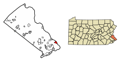 Location of Morrisville in Bucks County, Pennsylvania. | |
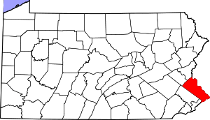
 Morrisville Location of Morrisville in Pennsylvania  Morrisville Morrisville (the United States) | |
| Coordinates: 40°12′27″N 74°46′48″W | |
| Country | United States |
| State | Pennsylvania |
| County | Bucks |
| Settled | 1624 |
| Named for | Robert Morris |
| Government | |
| • Mayor | David T. Rivella |
| Area | |
| • Total | 1.95 sq mi (5.05 km2) |
| • Land | 1.75 sq mi (4.53 km2) |
| • Water | 0.20 sq mi (0.52 km2) |
| Elevation | 56 ft (17 m) |
| Population (2010) | |
| • Total | 8,728 |
| • Estimate (2018)[2] | 8,544 |
| • Density | 4,910.13/sq mi (1,895.38/km2) |
| Time zone | UTC-5 (EST) |
| • Summer (DST) | UTC-4 (EDT) |
| ZIP Code | 19067 |
| Area code(s) | 215 Exchanges: 295,337,428,736 |
| FIPS code | 42-51144 |
| GNIS feature ID | 1214970 |
| Website | morrisvillepagov.com |
History
The earliest known settlement in what is now Morrisville, was a trading post of the Dutch West India Company operating from 1624 to 1627 on an island in the Delaware River. In its early days, the area was known as Crewcorne and was a part of Falls Township. Later, one of the first ferries to cross the Delaware was established at the site. By the late 18th century, a settlement was forming at the ferry crossing then known as Colvin's Ferry. The settlement incorporated into a borough in 1804, taking the name of Morrisville, after Founding Father Robert Morris. In that same year, the first bridge built across the Delaware connected Morrisville to Trenton.
The Gershom Craft House, Summerseat, and Trenton City/Calhoun Street Bridge are listed on the National Register of Historic Places. Summerseat is also designated a National Historic Landmark.[3]
Morrisville is also home to Graystones, the historic site marking William Penn's first Pennsylvania land purchase from the Lenni Lenape Indians.
Morrisville was once considered for the Nation's Capital.[4] Robert Morris campaigned behind the scenes to establish the new capital at the “Falls of the Delaware,” preferably on the Pennsylvania side. Today that is seen from Park Avenue in Morrisville, just atop of the 30-foot tall flood control dike. The Delaware River is viewed from here and just below is the famous Falls of the Delaware, for which Falls Township was named.
In 2019 a family was murdered by an alleged mother-daughter duo. It is believed they're all strangled and it is believed to be a suicide pact.[5]
Geography
Morrisville is located at 40°12′27″N 74°46′48″W (40.207458, -74.779918).[6] It is part of a geographical salient that is mostly surrounded by New Jersey.
Originally a village located in Falls Township, until it was partitioned as a borough by the Pennsylvania Legislature in 1804, Morrisville is bordered by Falls Township to the south, Lower Makefield Township to the north and the Delaware River to the east.
Its name is the default city name in the 19067 ZIP code, which covers an area that includes Yardley, Lower Makefield, Morrisville, and part of Falls Township.
According to the United States Census Bureau, the borough has a total area of 2.0 square miles (5.1 km²), of which 1.8 square miles (4.6 km²) is land and 0.2 square mile (0.5 km²) (10.15%) is water. U.S. 1 traverses Morrisville and crosses into New Jersey via the Trenton–Morrisville Toll Bridge.
There are several parks within Morrisville's borders, and the Delaware Canal State Park runs near the eastern border of both the town and Pennsylvania. Located between the Calhoun Street Bridge and the Lower Trenton Bridge (Trenton Makes) is Williamson Park, home to Morrisville Little League and many community events. Adjacent to Graystones is Graystones woods, a tract of woodland that extends from the Delaware Canal to Crown Street in the town's far north. Just south of the Trenton–Morrisville Toll Bridge and the Morrisville–Trenton Railroad Bridge lie two smaller parks, the Morrisville Riverfront Preserve, an 8.8 acre tract preserving some of the last bits of the Delaware River's tidal basin, and the Morrisville Dog Park, a two pen playground for dogs big and small.
Demographics
| Historical population | |||
|---|---|---|---|
| Census | Pop. | %± | |
| 1810 | 266 | — | |
| 1820 | 391 | 47.0% | |
| 1830 | 531 | 35.8% | |
| 1840 | 405 | −23.7% | |
| 1850 | 565 | 39.5% | |
| 1860 | 784 | 38.8% | |
| 1870 | 813 | 3.7% | |
| 1880 | 968 | 19.1% | |
| 1890 | 1,208 | 24.8% | |
| 1900 | 1,371 | 13.5% | |
| 1910 | 2,002 | 46.0% | |
| 1920 | 3,639 | 81.8% | |
| 1930 | 5,368 | 47.5% | |
| 1940 | 5,493 | 2.3% | |
| 1950 | 6,787 | 23.6% | |
| 1960 | 7,790 | 14.8% | |
| 1970 | 11,309 | 45.2% | |
| 1980 | 9,845 | −12.9% | |
| 1990 | 9,765 | −0.8% | |
| 2000 | 10,023 | 2.6% | |
| 2010 | 8,728 | −12.9% | |
| Est. 2018 | 8,544 | [2] | −2.1% |
| Sources:[7][8][9] | |||
As of a 2014 estimate, the borough was 58.5% Non-Hispanic White, 25.9% Black or African American, 2.4% Native American or Alaskan Native, 2.2% Asian, 4.4% Some other race, and 6.5% were two or more races. 16.4% of the population were of Hispanic or Latino ancestry.[10]
As of the 2010 census, the borough was 70.6% Non-Hispanic White, 15.4% Black or African American, 0.3% Native American, 2.0% Asian, and 2.7% were two or more races. 10.2% of the population were of Hispanic or Latino ancestry. 13.5% of the population were foreign-born.[11]
As of the census[8] of 2000, there were 10,023 people, 4,154 households, and 2,612 families residing in the borough. The population density was 5,659.0 people per square mile (2,186.4/km²). There were 4,313 housing units at an average density of 2,435.1/sq mi (940.8/km²). The racial makeup of the borough was 75.98% White, 19.14% African American, 0.18% Native American, 1.20% Asian, 2.08% from other races, and 1.44% from two or more races. Hispanic or Latino of any race were 4.82% of the population.
There were 4,154 households, out of which 38.5% had children under the age of 18 living with them, 42.7% were married couples living together, 15.0% had a female householder with no husband present, and 37.1% were non-families. 30.0% of all households were made up of individuals, and 10.1% had someone living alone who was 65 years of age or older. The average household size was 2.41 and the average family size was 3.01.
In the borough the population was spread out, with 24.7% under the age of 18, 7.9% from 18 to 24, 34.3% from 25 to 44, 21.1% from 45 to 64, and 12.0% who were 65 years of age or older. The median age was 36 years. For every 100 females, there were 91.6 males. For every 100 females age 18 and over, there were 88.7 males.
The median income for a household in the borough was $43,095, and the median income for a family was $53,316. Males had a median income of $40,204 versus $30,110 for females. The per capita income for the borough was $21,404. About 8.9% of families and 10.0% of the population were below the poverty line, including 12.1% of those under age 18 and 8.8% of those age 65 or over.
Education
The local school district is the Morrisville School District.
In 2012 the Catholic grade school St. John the Evangelist closed.[12]
Etymology
The borough is named for American Founding Father, Pennsylvania merchant, and banker Robert Morris, the main financier of the American Revolution. His home Summerseat still stands in town.
Sports
In 1955 the Morrisville Little League baseball team defeated Merchantville, NJ to claim the Little League World Series title. It is one of four Pennsylvania teams to have won the tournament since its inception in 1947.
Climate
According to the Köppen climate classification system, Morrisville has a Hot-summer, Humid continental climate (Dfa). Dfa climates are characterized by at least one month having an average mean temperature ≤ 32.0 °F (0.0 °C), at least four months with an average mean temperature ≥ 50.0 °F (10.0 °C), at least one month with an average mean temperature ≥ 71.6 °F (22.0 °C) and no significant precipitation difference between seasons. Although most summer days are slightly humid in Morrisville, episodes of heat and high humidity can occur with heat index values > 108 °F (42 °C). Since 1981, the highest air temperature was 103.2 °F (39.6 °C) on 07/06/2010, and the highest daily average mean dew point was 75.0 °F (23.9 °C) on 08/13/2016. The average wettest month is July which corresponds with the annual peak in thunderstorm activity. Since 1981, the wettest calendar day was 6.35 inches (161 mm) on 08/27/2011. During the winter months, the average annual extreme minimum air temperature is 1.6 °F (−16.9 °C).[13] Since 1981, the coldest air temperature was −10.3 °F (−23.5 °C) on 01/22/1984. Episodes of extreme cold and wind can occur with wind chill values < −9 °F (−23 °C). The average annual snowfall (Nov-Apr) is between 24 inches (61 cm) and 30 inches (76 cm). Ice storms and large snowstorms depositing ≥ 12 inches (30 cm) of snow occur once every few years, particularly during nor’easters from
| Climate data for Morrisville, Elevation 46 ft (14 m), 1981-2010 normals, extremes 1981-2018 | |||||||||||||
|---|---|---|---|---|---|---|---|---|---|---|---|---|---|
| Month | Jan | Feb | Mar | Apr | May | Jun | Jul | Aug | Sep | Oct | Nov | Dec | Year |
| Record high °F (°C) | 71.7 (22.1) |
77.9 (25.5) |
87.8 (31.0) |
94.7 (34.8) |
95.6 (35.3) |
96.9 (36.1) |
103.2 (39.6) |
100.5 (38.1) |
98.3 (36.8) |
89.3 (31.8) |
81.1 (27.3) |
76.1 (24.5) |
103.2 (39.6) |
| Average high °F (°C) | 40.2 (4.6) |
43.4 (6.3) |
51.5 (10.8) |
63.7 (17.6) |
73.0 (22.8) |
82.4 (28.0) |
86.6 (30.3) |
84.9 (29.4) |
77.9 (25.5) |
66.8 (19.3) |
55.8 (13.2) |
44.8 (7.1) |
64.3 (17.9) |
| Daily mean °F (°C) | 31.9 (−0.1) |
34.5 (1.4) |
41.8 (5.4) |
52.5 (11.4) |
61.8 (16.6) |
71.4 (21.9) |
76.0 (24.4) |
74.4 (23.6) |
67.2 (19.6) |
55.7 (13.2) |
46.2 (7.9) |
36.5 (2.5) |
54.2 (12.3) |
| Average low °F (°C) | 23.6 (−4.7) |
25.6 (−3.6) |
32.1 (0.1) |
41.3 (5.2) |
50.6 (10.3) |
60.3 (15.7) |
65.3 (18.5) |
64.0 (17.8) |
56.5 (13.6) |
44.7 (7.1) |
36.6 (2.6) |
28.3 (−2.1) |
44.2 (6.8) |
| Record low °F (°C) | −10.3 (−23.5) |
−2.4 (−19.1) |
4.4 (−15.3) |
18.0 (−7.8) |
32.8 (0.4) |
41.2 (5.1) |
47.3 (8.5) |
42.3 (5.7) |
36.1 (2.3) |
25.0 (−3.9) |
11.7 (−11.3) |
0.5 (−17.5) |
−10.3 (−23.5) |
| Average precipitation inches (mm) | 3.54 (90) |
2.80 (71) |
4.32 (110) |
3.97 (101) |
4.10 (104) |
4.39 (112) |
5.30 (135) |
4.20 (107) |
4.38 (111) |
3.69 (94) |
3.54 (90) |
4.05 (103) |
48.28 (1,226) |
| Average relative humidity (%) | 65.4 | 61.7 | 57.8 | 57.0 | 62.1 | 66.1 | 66.2 | 68.6 | 69.8 | 68.8 | 66.9 | 66.8 | 64.8 |
| Average dew point °F (°C) | 21.6 (−5.8) |
22.7 (−5.2) |
28.0 (−2.2) |
37.7 (3.2) |
48.7 (9.3) |
59.5 (15.3) |
63.9 (17.7) |
63.4 (17.4) |
57.0 (13.9) |
45.6 (7.6) |
35.8 (2.1) |
26.5 (−3.1) |
42.6 (5.9) |
| Source: PRISM[14] | |||||||||||||
Ecology
According to the A. W. Kuchler U.S. potential natural vegetation types, Morrisville would have a dominant vegetation type of Appalachian Oak (104) with a dominant vegetation form of Eastern Hardwood Forest (25).[15] The plant hardiness zone is 7a with an average annual extreme minimum air temperature of 1.6 °F (−16.9 °C).[13] The spring bloom typically begins by April 8 and fall color usually peaks by November 3.
Notable people
Morrisville is the birthplace or home to a number of well-known Americans, including:
- Thomas Barclay,[16] America' first consul in France
- George Clymer,[17] politician, signer of the Declaration of Independence and Constitution and Founding Father of The United States
- Willard Curtin, member of the U.S. House of Representatives
- Tony DiStefano, former motocross national champion[18]
- Thomas Mortimer Fowler,[19] prolific panoramic mapmaker of the 19th century.
- Dick Hart, former football player for the Philadelphia Eagles[20] and Buffalo Bills.
- Thomas Story Kirkbride,[21] physician and founder of the Association of Medical Superintendents of American Institutions for the Insane, which would become the American Psychiatric Association
- Jean Victor Marie Moreau,[22] 18/19th century French General.
- Robert Morris,[23] financier of the American Revolution and signer of the Declaration of Independence, the Articles of Confederation, and the Constitution.
- Asher Roth, rapper.
- Mike Vreeswyk, NCAA Hall of Fame basketball player for the Temple Owls
References
- "2017 U.S. Gazetteer Files". United States Census Bureau. Retrieved Mar 24, 2019.
- "Population and Housing Unit Estimates". Retrieved August 18, 2019.
- "National Register Information System". National Register of Historic Places. National Park Service. July 9, 2010.
- "How Morrisville almost became the nation's capital". Bucks County Courier Times. Retrieved 2017-10-31.
- "Police say a mother and daughter killed 5 family members. The mother says they all wanted to die". CNN. Eric Levenson. Retrieved February 26, 2019.
- "US Gazetteer files: 2010, 2000, and 1990". United States Census Bureau. 2011-02-12. Retrieved 2011-04-23.
- "Census of Population and Housing". U.S. Census Bureau. Retrieved 11 December 2013.
- "U.S. Census website". United States Census Bureau. Retrieved 2008-01-31.
- "Incorporated Places and Minor Civil Divisions Datasets: Subcounty Resident Population Estimates: April 1, 2010 to July 1, 2012". Population Estimates. U.S. Census Bureau. Archived from the original on 11 June 2013. Retrieved 11 December 2013.
- Bureau, U.S. Census. "U.S. Census website". United States Census Bureau. Retrieved 2016-02-21.
- "Census 2010: Pennsylvania - USATODAY.com".
- "2012 Catholic grade school consolidations/closings". Catholicphilly.com. 2012-07-15. Retrieved 2020-04-22.
- "USDA Interactive Plant Hardiness Map". United States Department of Agriculture. Retrieved October 16, 2019.
- "PRISM Climate Group, Oregon State University". Retrieved October 16, 2019.
- "U.S. Potential Natural Vegetation, Original Kuchler Types, v2.0 (Spatially Adjusted to Correct Geometric Distortions)". Retrieved October 16, 2019.
- http://explorepahistory.com/hmarker.php?markerId=1-A-E2
- "CLYMER, George - Biographical Information". bioguide.congress.gov.
- Tony D - Enjoying the Good Life. American Motorcyclist. Books.Google.com. 1976. Retrieved 10 November 2018.
- "Oil Town "Aero Views" - American Oil & Gas Historical Society". 18 December 2017.
- "Dick Hart Stats - Pro-Football-Reference.com". Pro-Football-Reference.com.
- http://files.usgwarchives.net/pa/bucks/bios/battle1887/falls.txt
- http://www.napoleon.org/en/reading_room/biographies/files/Moreau_Jean_Victor.asp
- "Archives - Philly.com". articles.philly.com.
External links
| Wikimedia Commons has media related to Morrisville, Bucks County, Pennsylvania. |
| Authority control |
|
|---|