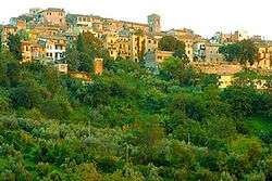
Montopoli di Sabina
Montopoli di Sabina is a town and comune (municipality) in the Province of Rieti in the Italian region Latium, located about 40 kilometres (25 mi) northeast of Rome and about 20 kilometres (12 mi) southwest of Rieti. In 2011, it had a population of 4,222.[2]
Montopoli di Sabina | |
|---|---|
| Comune di Montopoli di Sabina | |
 | |
 Coat of arms | |
.svg.png) Montopoli within the Province of Rieti | |
Location of Montopoli di Sabina 
| |
 Montopoli di Sabina Location of Montopoli di Sabina in Italy 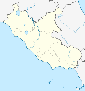 Montopoli di Sabina Montopoli di Sabina (Lazio) | |
| Coordinates: 42°14′45″N 12°41′30″E | |
| Country | Italy |
| Region | Latium |
| Province | Rieti (RI) |
| Frazioni | Bocchignano, Casenove, Colonnetta La Memoria, Ferruti, Granari, Granica, Ponte Sfondato, Ponticchio, Santa Maria |
| Government | |
| • Mayor | Andrea Fiori |
| Area | |
| • Total | 37.6 km2 (14.5 sq mi) |
| Elevation | 331 m (1,086 ft) |
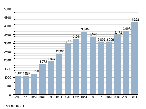
| Population (2011)[2] | |
| • Total | 4,222 |
| • Density | 110/km2 (290/sq mi) |
| Demonym(s) | Montopolesi |
| Time zone | UTC+1 (CET) |
| • Summer (DST) | UTC+2 (CEST) |
| Postal code | 02034 |
| Dialing code | 0765 |
| Patron saint | St. Michael Archangel |
| Saint day | September 29 |
| Website | Official website |
History
The town was first mentioned in 1055, in a document of Farfa Abbey. It is locally known as The Town of Privateers (Italian: Il paese dei Corsari).[3]
Geography
Montopoli, located in the southwestern corner of the province, at the borders with the one of Rome, borders with the municipalities of Castelnuovo di Farfa, Fara in Sabina, Fiano Romano (RM), Nazzano (RM), Poggio Mirteto, Salisano and Torrita Tiberina (RM). Its southwestern borders with Fiano are crossed by the Tiber river.[4]
Montopoli counts the hamlets (frazioni) of Bocchignano, Casenove, Colonnetta La Memoria, Ferruti, Granari, Granica, Ponte Sfondato, Ponticchio and Santa Maria.
Demographics
Main sights
- The Modern Automata Museum, founded in 2001, is located in the town
- The cyclopean masonry of Grotte di Torri is located nearby the village of Ponte Sfondato
Gallery
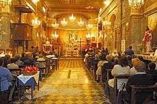 Interior of St. Michael's Church
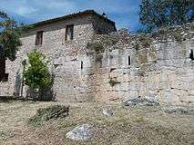 The cyclopean masonry of Grotte di Torri
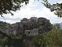 Panoramic view of Bocchignano
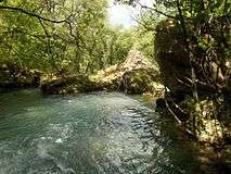 Remains of an ancient bridge over Farfa River at Ponte Sfondato
Transport
Nearest railway station, Poggio Mirteto, is 7 km far and lies in Poggio Mirteto Scalo. It is part of the Roman suburban railway line FL1 Orte–Fiumicino, a line that crosses the southwestern corner of the municipal territory.
References
- "Superficie di Comuni Province e Regioni italiane al 9 ottobre 2011". Istat. Retrieved 16 March 2019.
- (in Italian) Source: Istat 2011
- (in Italian) Montopoli municipal website: Culture and Tourism
- 41834 Montopoli di Sabina on OpenStreetMap
External links
| Wikimedia Commons has media related to Montopoli di Sabina. |
- (in Italian) Montopoli official website
- (in Italian) Modern Automata Museum website