Montes Llanos
Montes Llanos (also spelled Monte Llano), is one of the 31 barrios in the municipality of Ponce, Puerto Rico. Along with Magueyes, Tibes, Portugués, Maragüez, Machuelo Arriba, and Cerrillos, Montes Llanos is one of the municipality's seven rural interior barrios. It was created in 1898.[1]
Barrio Montes Llanos | |
|---|---|
_marcando_entrada_al_Bo._Montes_Llanos%2C_Ponce%2C_PR_(DSC07288).jpg) | |
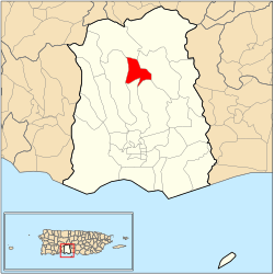 Location of barrio Montes Llanos within the municipality of Ponce shown in red | |
| Commonwealth | |
| Municipality | |
| Area | |
| • Total | 2.15 sq mi (5.6 km2) |
| • Land | 2.15 sq mi (5.6 km2) |
| • Water | 0.00 sq mi (0.0 km2) |
| Population (2000) | |
| • Total | 462 |
| • Density | 215/sq mi (83/km2) |
| Source: 2000 Census | |
Location
.jpg)
Montes Llanos is a mountainous rural barrio located in the central portion of the municipality, north of the city of Ponce, at latitude 18.118717 N, and longitude -66.139594 W.[2] The toponomy, or origin of the name, is related to the old "Hato Llano" barrio. The name Montes Llanos relates to the term monte, which in Spanish describes a natural but significant elevation of the surface of the land that is covered with trees, shrubs or other vegetation.[3]
Boundaries
Montes Llanos is bounded on the North by PR-505 (roughly), on the South by the hills north of Pastillo Road and El Cedro I Road, on the West by the hills west of Río Chiquito, and on the East by the hills west of Río Bayagan and PR-505 (roughly).[4][5]
.jpg)
In terms of barrio-to-barrio boundaries, Montes Llanos is bounded in the North by Barrios San Patricio and Maragüez, in the South by Portugués and Machuelo Arriba, in the West by Tibes, and in the East by Barrio Maragüez.[6]
Demographics
Montes Llanos has 2.15 square miles (5.6 km2) of land area and no water area. In 2000, the population of Montes Llanos was 462 persons, and it had a density of 215 persons per square mile, making it the least populated barrio in the municipality.[7][8][9][10] Montes Llanos is the least populated, though not the least densely populated, barrio in the municipality of Ponce.[11] The community of Villas del Monte Verde is located in Montes Llanos.[12]
Geography
The highest point in barrio Montes Llanos stands at 2,394 feet and is located in the extreme northwest tip of the barrio.[13]
Notable Landmarks
Barrio Montes Llanos is home to the origin of the Río Chiquito. Rio Chiquito feeds into Rio Portugues just as they both enter the Ponce city limits to eventually empty as Rio Bucana into the Caribbean Sea opposite Caja de Muertos.[15]
See also
References
- Barrios de Ponce. Archived 30 September 2015 at the Wayback Machine Antepasados Esclavos.(From: Pedro Tomás de Córdoba. Memorias geográficas, históricas, económicas y estadísticas de la Isla de Puerto Rico.) Retrieved 28 November 2014.
- City Melt Retrieved March 15, 2010.
- Government of the Municipality of Ponce. Periodico "El Señorial". Special issue: Carnaval Ponceño 2013. February 2013. Page 17. Ponce, Puerto Rico.
- General Purpose Population Data, Census 2000. Unidad de Sistemas de Información Geográfica, Área de Tecnología de Información Gubernamental, Oficina de Gerencia y Presupuesto. Gobierno de Puerto Rico. Archived 2010-08-12 at the Wayback Machine Retrieved March 15, 2010.
- Ponce Topographic Map. Map Styles: Map and Shaded. Trails.com. From: United States Geological Survey. Topo Map. Projection: NAD83/WGS84. Retrieved March 15, 2010.
- General Purpose Population Data, Census 2000. Unidad de Sistemas de Información Geográfica, Área de Tecnología de Información Gubernamental, Oficina de Gerencia y Presupuesto. Gobierno de Puerto Rico. Archived 2010-08-12 at the Wayback Machine Retrieved March 15, 2010.
- Censo 2000: Población por Barrios - Ponce. Boricua Online. March 15, 2010.
- City Melt Retrieved, March 15, 2010.
- U.S. Census Bureau. Census 2000. Ponce and Its Barrios. (Ponce Municipio, Puerto Rico -- County Subdivision and Place. GCT-PH1. Population, Housing Units, Area, and Density: 2000. Data Set: Census 2000 Summary File 1 (SF 1) 100-Percent Data) Archived 12 February 2020 at Archive.today Retrieved March 15, 2010.
- "CENSUS2". Archived from the original on 12 February 2020. Retrieved 16 March 2010.
- Ponce, Puerto Rico – La Perla del Sur. BoricuaOnline.com Accessed 5 April 2018.
- Nuevo Mapa de Localizacion Limite de Barrios de Ponce. Oficina de Ordenacion Territorial. Municipio Autonomo de Ponce. Retrieved March 25, 2010.
- Maptest. Archived 2010-02-18 at the Wayback Machine Government of the Commonwealth of Puerto Rico. General Purpose Population Data, Census 2000. Unidad de Sistemas de Información Geográfica, Área de Tecnología de Información Gubernamental, Oficina de Gerencia y Presupuesto. Gobierno de Puerto Rico. Retrieved 14 November 2011.
- General Purpose Population Data, Census 2000. Unidad de Sistemas de Información Geográfica, Área de Tecnología de Información Gubernamental, Oficina de Gerencia y Presupuesto. Gobierno de Puerto Rico. Archived 2010-08-12 at the Wayback Machine Retrieved March 15, 2010.
- General Purpose Population Data, Census 2000. Unidad de Sistemas de Información Geográfica, Área de Tecnología de Información Gubernamental, Oficina de Gerencia y Presupuesto. Gobierno de Puerto Rico. Archived 2010-08-12 at the Wayback Machine Retrieved March 15, 2010.
- U.S. Geological Survey Geographic Names Information System: Monte Llano Barrio