Mont-Saint-Léger
Mont-Saint-Léger is a commune in the Haute-Saône department in the region of Bourgogne-Franche-Comté in eastern France.[2][3][4]
Mont-Saint-Léger | |
|---|---|
 Coat of arms | |
Location of Mont-Saint-Léger 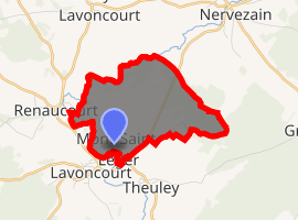
| |
 Mont-Saint-Léger  Mont-Saint-Léger | |
| Coordinates: 47°37′51″N 5°47′30″E | |
| Country | France |
| Region | Bourgogne-Franche-Comté |
| Department | Haute-Saône |
| Arrondissement | Vesoul |
| Canton | Dampierre-sur-Salon |
| Area 1 | 4.90 km2 (1.89 sq mi) |
| Population (2017-01-01)[1] | 51 |
| • Density | 10/km2 (27/sq mi) |
| Time zone | UTC+01:00 (CET) |
| • Summer (DST) | UTC+02:00 (CEST) |
| INSEE/Postal code | 70369 /70120 |
| Elevation | 207–282 m (679–925 ft) |
| 1 French Land Register data, which excludes lakes, ponds, glaciers > 1 km2 (0.386 sq mi or 247 acres) and river estuaries. | |
References
- "Populations légales 2017". INSEE. Retrieved 6 January 2020.
- "Mont-Saint-Léger - Notice Communale". cassini.ehess.fr. Retrieved 2018-02-10.
- "Insee − Institut national de la statistique et des études économiques | Insee". www.insee.fr. Retrieved 2018-02-10.
- "Résultat sur la commune: 'MONT-SAINT-LEGER'" [Results for the town: 'MONT-SAINT-LEGER']. IGN. Archived from the original on 2007-03-13.
| Wikimedia Commons has media related to Mont-Saint-Léger. |
| Authority control |
|
|---|
This article is issued from Wikipedia. The text is licensed under Creative Commons - Attribution - Sharealike. Additional terms may apply for the media files.