Monkseaton
Monkseaton is a village absorbed into Whitley Bay, North Tyneside, in the North East of England. It is in the north-east of the borough, 3⁄4 mile (1.2 km) from the North Sea coast and 1 1⁄2 miles (2.4 km) north of the River Tyne at North Shields.[3] A mile to the north of Monkseaton, the extensive built-up areas of North Tyneside change abruptly into green belt stretching north into south-east Northumberland. The village is at an elevation of 130 feet (40 m) above sea-level.[4]
| Monkseaton | |
|---|---|
 Monkseaton Location within Tyne and Wear | |
| Population | 19,044 (2011.Wards)[1][2] |
| OS grid reference | NZ346722 |
| Metropolitan borough | |
| Metropolitan county | |
| Region | |
| Country | England |
| Sovereign state | United Kingdom |
| Post town | WHITLEY BAY |
| Postcode district | NE25 |
| Dialling code | 0191 |
| Police | Northumbria |
| Fire | Tyne and Wear |
| Ambulance | North East |
| UK Parliament | |
History
_-_geograph.org.uk_-_579498.jpg)
Monkseaton pre-dates the Tyneside coastal resort of Whitley Bay, originally recorded as land owned by the Priory of Tynemouth. The first documentary references to Monkseaton medieval village date from the early 12th century (c.1106–16) when Henry I granted Seton, later to be renamed Monkseaton, to Tynemouth Priory. It was a substantial village in the late 13th century, when Monkseaton Manor was one of ten manors of Tynemouth Priory, with fifteen bondsmen, ten cotmen and three freeholds listed in 1292.[5]
The remains of a medieval brewery wall are still to be seen alongside the Monkseaton Arms public house.
In the Imperial Gazetteer of England and Wales of 1872, the population was recorded as 421 in 80 houses; this gave the village an area of 1,110 acres. It was described as having a large brewery and several collieries.[6] Although Monkseaton has been subsumed in the urban developments of the 20th century, it still retains much of the character of the village it once was.
On 30 April 1989, one person was killed and 14 others injured in a mass shooting.
On 28 June 2012, the village suffered flash flooding following torrential rainfall in the North East of England. Roads were closed causing traffic chaos, and many properties and buildings were flooded, including Langley First School which was closed for three weeks. The heavy rainfall made an embankment on the Tyne and Wear Metro line collapse, causing houses in Brantwood Avenue to be evacuated and West Monkseaton Metro station to be temporarily closed. Many residents suffered significant flood damage to their homes and possessions.
Facilities
Churchill Playing Fields are located within the vicinity and the North Tyneside International Youth Football Tournament takes place here every year. Bowling greens, tennis courts and a cricket pavilion accompany the park.
Monkseaton Metro station was moved to its current position in 1915[7] and the tennis courts in Souter Park South are now where the station was originally located. The station is one of the village's two stops on the circular Tyne and Wear Metro which connects it to Newcastle, the other being West Monkseaton. Another rail route, heading north up the coast, is now disused and has been adapted into a footpath and cycle route leading to the A190 road that links Seaton Sluice to the town of Seaton Delaval.
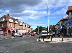
Monkseaton has three centrally-located pubs situated close to each other on the north side of Front Street, the main thoroughfare of the village. Heading west from Monkseaton station, the first of these is the Monkseaton Arms, next is the Black Horse, and finally, set back from the street somewhat, is the Ship Inn. Two other pubs, the Hunting Lodge and the Beacon, are located west and north not far from West Monkseaton Metro station. There are several local schools, including Monkseaton Middle School, Valley Gardens Middle School, Monkseaton High School and Whitley Bay High School.
Notable residents
- Ian La Frenais – comedic writer, of e.g. The Likely Lads[8]
- Denise Welch – actress, dancer and television presenter
- Gladstone Adams – inventor and former chairman of Whitley Bay Urban District
See also
References
- "Monkseaton North Ward population 2011". Retrieved 3 July 2015.
- "Monkseaton South Ward population 2011". Retrieved 3 July 2015.
- Google. "Monkseaton" (Map). Google Maps. Google.
- "Monkseaton". Ordince Survey.
- "Proposed Designation of Monkseaton as a Conservation Area – Draft Consultation Boundary" (PDF). North Tyneside Council. 20 September 2005. Retrieved 13 March 2014.
- "Monkseaton Northumberland". A Vision of Britain. Retrieved 25 August 2018.
- Young, Alan. "Monkseaton (first site)". Disused Stations: Closed Railway Stations in the UK. Retrieved 23 October 2013.
- https://www.chroniclelive.co.uk/whats-on/comedy-news/hear-ian-la-frenais-talk-15106521
External links
| Wikimedia Commons has media related to Monkseaton. |