Monchio delle Corti
Monchio delle Corti (Parmigiano: Monc') is a comune (municipality) in the Province of Parma in the Italian region Emilia-Romagna, located about 100 kilometres (62 mi) west of Bologna and about 45 kilometres (28 mi) southwest of Parma, including part of the Appennino Parmense. The Monte Sillara, at 1,861 metres (6,106 ft), is the highest peak in the province.
Monchio delle Corti | |
|---|---|
| Comune di Monchio delle Corti | |
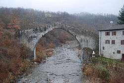 The old bridge in Ponte Lugagnano, Monchio delle Corti | |
 Coat of arms | |
Location of Monchio delle Corti 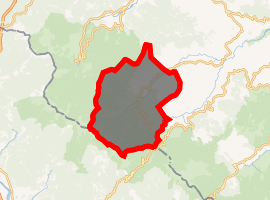
| |
 Monchio delle Corti Location of Monchio delle Corti in Italy 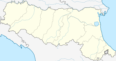 Monchio delle Corti Monchio delle Corti (Emilia-Romagna) | |
| Coordinates: 44°25′N 10°7′E | |
| Country | Italy |
| Region | Emilia-Romagna |
| Province | Parma (PR) |
| Frazioni | Aneta, Antria, Bastia, Casarola, Ceda, Cozzanello, Lugagnano Inferiore, Lugagnano Superiore, Monchio Basso, Montale, Pianadetto, Ponte Lugagnano, Prato, Riana, Rigoso, Rimagna, Ticchiano, Trecoste, Trefiumi, Trincera, Valditacca, Vecciatica |
| Government | |
| • Mayor | Claudio Moretti |
| Area | |
| • Total | 69.04 km2 (26.66 sq mi) |
| Elevation | 820 m (2,690 ft) |
| Population | |
| • Total | 901 |
| • Density | 13/km2 (34/sq mi) |
| Demonym(s) | Monchiesi |
| Time zone | UTC+1 (CET) |
| • Summer (DST) | UTC+2 (CEST) |
| Postal code | 43010 |
| Dialing code | 0521 |
| Website | Official website |
Sights include the medieval church of Sts. Lawrence and Michael, reconsecrated in 1536.
References
- "Superficie di Comuni Province e Regioni italiane al 9 ottobre 2011". Istat. Retrieved 16 March 2019.
- Data from Istat
- "Popolazione Residente al 1° Gennaio 2018". Istat. Retrieved 16 March 2019.
External links

This article is issued from Wikipedia. The text is licensed under Creative Commons - Attribution - Sharealike. Additional terms may apply for the media files.