Langhirano
Langhirano (Parmigiano: Langhiràn) is a comune (municipality) in the Province of Parma in the Italian region Emilia-Romagna, located about 90 kilometres (56 mi) west of Bologna and about 20 kilometres (12 mi) south of Parma.
Langhirano | |
|---|---|
| Comune di Langhirano | |
 Castle of Torrechiara. | |
 Coat of arms | |
Location of Langhirano 
| |
 Langhirano Location of Langhirano in Italy 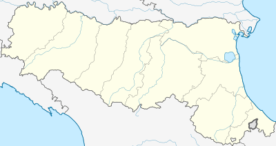 Langhirano Langhirano (Emilia-Romagna) | |
| Coordinates: 44°37′N 10°16′E | |
| Country | Italy |
| Region | Emilia-Romagna |
| Province | Parma (PR) |
| Frazioni | Antesica, Arola, Berzola, Calicella, Casatico, Case Manfredelli, Case Ughi, Cattabiano, Costa di Castrignano, Cozzano, Fontana, Goiano, Il Chioso, Manzano, Mattaleto, Pastorello, Pilastro, Pranello, Querceto, Quinzano, Riano, Sodina, Strognano, Tabbiano, Tordenaso, Torrechiara, Valle di Castrignano, Vidiana, Villaggio Pineta |
| Government | |
| • Mayor | Giordano Bricoli |
| Area | |
| • Total | 70.8 km2 (27.3 sq mi) |
| Elevation | 265 m (869 ft) |
| Population (31 August 2017)[2] | |
| • Total | 10,365 |
| • Density | 150/km2 (380/sq mi) |
| Demonym(s) | Langhiranesi |
| Time zone | UTC+1 (CET) |
| • Summer (DST) | UTC+2 (CEST) |
| Postal code | 43013 |
| Dialing code | 0521 |
| Patron saint | St. James |
| Saint day | July 25 |
| Website | Official website |
Langhirano borders the following municipalities: Calestano, Corniglio, Felino, Lesignano de' Bagni, Neviano degli Arduini, Parma, Tizzano Val Parma.
Its most striking feature is the castle of Torrechiara. The town is also known as a major production centre for the Prosciutto di Parma.
Langhirano was the childhood home of soprano Renata Tebaldi, who is buried there.
International relations
Langhirano is twinned with:
References
- "Superficie di Comuni Province e Regioni italiane al 9 ottobre 2011". Istat. Retrieved 16 March 2019.
- All demographics and other statistics: Italian statistical institute Istat.
External links

| Authority control |
|
|---|
This article is issued from Wikipedia. The text is licensed under Creative Commons - Attribution - Sharealike. Additional terms may apply for the media files.