Mitchell Township, Michigan
Mitchell Township is a civil township of Alcona County in the U.S. state of Michigan. The population was 352 at the 2010 census.[3]
Mitchell Township, Michigan | |
|---|---|
| Motto(s): "The Black Bear Capital of Michigan" | |
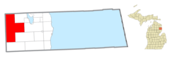 Location within Alcona County | |
 Mitchell Township Location within the state of Michigan | |
| Coordinates: 44°42′50″N 83°47′55″W | |
| Country | United States |
| State | Michigan |
| County | Alcona |
| Organized | 1890 |
| Government | |
| • Supervisor | Carla Brimm |
| • Clerk | Donita Charron |
| Area | |
| • Total | 143.39 sq mi (371.4 km2) |
| • Land | 142.54 sq mi (369.2 km2) |
| • Water | 0.85 sq mi (2.2 km2) |
| Elevation | 886 ft (270 m) |
| Population (2010) | |
| • Total | 352 |
| • Density | 2.5/sq mi (1.0/km2) |
| Time zone | UTC-5 (EST) |
| • Summer (DST) | UTC-4 (EDT) |
| ZIP code(s) | |
| Area code(s) | 989 |
| FIPS code | 26-54740[1] |
| GNIS feature ID | 1626750[2] |
| Website | Official website |
Communities
- Curran is located in Mitchell Township at the junction of M-65 and M-72. Phillip Curran built a lumber camp here in 1875, and the village began about 1886. The Loud & Sons Lumber Company built a narrow gauge railway through the area in 1890. A post office was established on April 28, 1890, with Edward Cunning as postmaster. The office closed September 30, 1890, and reopened October 10, 1890, with John S. Fullerton as postmaster.[4][5] The Curran ZIP code 48728 serves a large portion of Mitchell Township, as well as small areas of eastern Caledonia Township and Millen Township and parts of western Clinton Township and Comins Township in Oscoda County.[6]
- Barton City is to the east, and the Barton City ZIP code 48705 also serves a portion of eastern Mitchell Township.[7]
- Glennie is to the south, and the Glennie ZIP code 48737 also serves a portion of southeastern Mitchell Township.[8]
- South Branch is to the southwest, and the South Branch ZIP code 48761 also serves a portion of southwestern Mitchell Township.[9]
Geography
According to the United States Census Bureau, the township has a total area of 143.39 square miles (371.38 km2), of which 55.04 square miles (142.54 km2) is land and 0.33 square miles (0.85 km2) (0.59%) is water.[3]
Demographics
| Historical population | |||
|---|---|---|---|
| Census | Pop. | %± | |
| 1960 | 220 | — | |
| 1970 | 197 | −10.5% | |
| 1980 | 248 | 25.9% | |
| 1990 | 290 | 16.9% | |
| 2000 | 396 | 36.6% | |
| 2010 | 352 | −11.1% | |
| Source: Census Bureau. Census 1960- 2000, 2010. | |||
As of the census[1] of 2000, there were 396 people, 193 households, and 122 families residing in the township. The population density was 2.8 per square mile (1.1/km²). There were 731 housing units at an average density of 5.1 per square mile (2.0/km²). The racial makeup of the township was 97.73% White, 0.51% Asian, and 1.77% from two or more races. Hispanic or Latino of any race were 0.76% of the population.
There were 193 households out of which 11.9% had children under the age of 18 living with them, 57.0% were married couples living together, 5.2% had a female householder with no husband present, and 36.3% were non-families. 30.6% of all households were made up of individuals and 16.6% had someone living alone who was 65 years of age or older. The average household size was 2.05 and the average family size was 2.54.
In the township the population was spread out with 15.2% under the age of 18, 2.5% from 18 to 24, 18.2% from 25 to 44, 37.4% from 45 to 64, and 26.8% who were 65 years of age or older. The median age was 53 years. For every 100 females, there were 104.1 males. For every 100 females age 18 and over, there were 108.7 males.
The median income for a household in the township was $26,875, and the median income for a family was $33,875. Males had a median income of $38,750 versus $20,000 for females. The per capita income for the township was $18,739. About 16.0% of families and 16.5% of the population were below the poverty line, including 31.8% of those under age 18 and 17.7% of those age 65 or over.
References
- "U.S. Census website". United States Census Bureau. Retrieved 2008-01-31.
- U.S. Geological Survey Geographic Names Information System: Mitchell Township, Michigan
- "Geographic Identifiers: 2010 Demographic Profile Data (G001): Mitchell township, Alcona County, Michigan". U.S. Census Bureau, American Factfinder. Archived from the original on February 12, 2020. Retrieved June 4, 2013.
- Romig, Walter (1986) [1973]. Michigan Place Names. Detroit, Michigan: Wayne State University Press. ISBN 0-8143-1838-X.
- U.S. Geological Survey Geographic Names Information System: Curran Post Office
- 48728 5-Digit ZCTA, 487 3-Digit ZCTA - Reference Map - American FactFinder, U.S. Census Bureau, 2000 census
- 48705 5-Digit ZCTA, 487 3-Digit ZCTA - Reference Map - American FactFinder, U.S. Census Bureau, 2000 census
- 48737 5-Digit ZCTA, 487 3-Digit ZCTA - Reference Map - American FactFinder, U.S. Census Bureau, 2000 census
- 48761 5-Digit ZCTA, 487 3-Digit ZCTA - Reference Map - American FactFinder, U.S. Census Bureau, 2000 census
External links
- Mitchell Township official website
- "Bibliography on Alcona County". Clarke Historical Library, Central Michigan University. Retrieved February 9, 2013.
- Lumberman's Monument
- Lumberman's Monument at the U.S. Forest Service
Municipalities and communities of Alcona County, Michigan, United States | ||
|---|---|---|
| City |  Map of Michigan highlighting Alcona County | |
| Village | ||
| Civil townships | ||
| CDPs | ||
| Other Unincorporated communities |
| |