Caledonia Township, Alcona County, Michigan
Caledonia Township is a civil township of Alcona County, Michigan, United States. The population was 1,161 at the 2010 census.[3]
Caledonia Township, Michigan | |
|---|---|
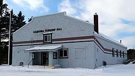 Township Hall in the community of Spruce | |
%2C_MI_location2.png) Location within Alcona County (red) and administered portions of the Hubbard Lake community (pink) | |
 Caledonia Township Location within the state of Michigan | |
| Coordinates: 44°49′39″N 83°36′49″W | |
| Country | United States |
| State | Michigan |
| County | Alcona |
| Established | 1868 |
| Government | |
| • Supervisor | Cyndi Apsey |
| • Clerk | Kerry Scott |
| Area | |
| • Total | 72.73 sq mi (188.4 km2) |
| • Land | 67.58 sq mi (175.0 km2) |
| • Water | 5.15 sq mi (13.3 km2) |
| Elevation | 866 ft (264 m) |
| Population (2010) | |
| • Total | 1,161 |
| • Density | 17.2/sq mi (6.6/km2) |
| Time zone | UTC-5 (Eastern (EST)) |
| • Summer (DST) | UTC-4 (EDT) |
| ZIP code(s) | |
| Area code(s) | 989 |
| FIPS code | 26-12460[1] |
| GNIS feature ID | 1626019[2] |
| Website | Official website |
Communities
- Spruce is an unincorporated community located at 44°50′39″N 83°27′57″W within the eastern portion of the township about three miles (5 km) west of U.S. Highway 23.[4] The ZIP code is 48762 and the FIPS place code is 75980. A large statue of Paul Bunyan with a neutered Babe the Blue Ox was on site near the F-41 junction for many years. It was moved to downtown Ossineke, on US-23.[5]
Geography
According to the United States Census Bureau, the township has a total area of 72.73 square miles (188.37 km2), of which 67.58 square miles (175.03 km2) is land and 5.15 square miles (13.34 km2) (7.08%) is water.[3]
Caledonia Township and Spruce are part of the region of Northern Michigan.
Demographics
| Historical population | |||
|---|---|---|---|
| Census | Pop. | %± | |
| 1960 | 654 | — | |
| 1970 | 763 | 16.7% | |
| 1980 | 1,065 | 39.6% | |
| 1990 | 987 | −7.3% | |
| 2000 | 1,203 | 21.9% | |
| 2010 | 1,161 | −3.5% | |
| Source: Census Bureau. Census 1960- 2000, 2010. | |||
As of the census[1] of 2000, there were 1,203 people, 535 households, and 379 families residing in the township. The population density was 17.8 per square mile (6.9/km2). There were 1,074 housing units at an average density of 15.9 per square mile (6.2/km2). The racial makeup of the township was 99.00% White, 0.25% Native American, 0.17% Asian, and 0.58% from two or more races. Hispanic or Latino of any race were 0.42% of the population.
There were 535 households, out of which 18.1% had children under the age of 18 living with them, 61.9% were married couples living together, 5.4% had a female householder with no husband present, and 29.0% were non-families. 24.1% of all households were made up of individuals, and 12.9% had someone living alone who was 65 years of age or older. The average household size was 2.25 and the average family size was 2.64.
In the township the population was spread out, with 16.8% under the age of 18, 5.3% from 18 to 24, 20.9% from 25 to 44, 32.3% from 45 to 64, and 24.8% who were 65 years of age or older. The median age was 50 years. For every 100 females, there were 104.6 males. For every 100 females age 18 and over, there were 105.1 males.
The median income for a household in the township was $36,000, and the median income for a family was $38,625. Males had a median income of $29,539 versus $21,964 for females. The per capita income for the township was $19,051. About 9.6% of families and 13.6% of the population were below the poverty line, including 18.7% of those under age 18 and 11.2% of those age 65 or over.
References
- "U.S. Census website". United States Census Bureau. Retrieved 2008-01-31.
- U.S. Geological Survey Geographic Names Information System: Caledonia Township, Alcona County, Michigan
- "Geographic Identifiers: 2010 Demographic Profile Data (G001): Caledonia township, Alcona County, Michigan". U.S. Census Bureau, American Factfinder. Archived from the original on February 12, 2020. Retrieved June 3, 2013.
- U.S. Geological Survey Geographic Names Information System: Spruce, Michigan
- Roadside attractions, Ossineke, Michigan Babe and Paul Bunyan
External links
| Wikimedia Commons has media related to Caledonia Township, Alcona County, Michigan. |
- Official website
- "Bibliography on Alcona County". Clarke Historical Library, Central Michigan University. Retrieved February 9, 2013.
- Lumberman's Monument
- Lumberman's Monument at the U.S. Forest Service
Municipalities and communities of Alcona County, Michigan, United States | ||
|---|---|---|
| City |  Map of Michigan highlighting Alcona County | |
| Village | ||
| Civil townships | ||
| CDPs | ||
| Other Unincorporated communities |
| |