Haynes Township, Michigan
Haynes Township is a civil township of Alcona County in the U.S. state of Michigan. The population was 722 at the 2010 census.[3] The township is to the north of the city of Harrisville and to the northeast of the village of Lincoln, which are the nearest population centers.
Haynes Township, Michigan | |
|---|---|
.jpg) | |
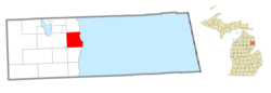 Location within Alcona County | |
 Haynes Township Location within the state of Michigan | |
| Coordinates: 44°43′57″N 83°19′38″W | |
| Country | United States |
| State | Michigan |
| County | Alcona |
| Government | |
| • Supervisor | James Effrick |
| • Clerk | Sharon Schefferly |
| Area | |
| • Total | 35.07 sq mi (90.8 km2) |
| • Land | 34.93 sq mi (90.5 km2) |
| • Water | 0.14 sq mi (0.4 km2) |
| Elevation | 787 ft (240 m) |
| Population (2010) | |
| • Total | 722 |
| • Density | 54/sq mi (20.7/km2) |
| Time zone | UTC-5 (Eastern (EST)) |
| • Summer (DST) | UTC-4 (EDT) |
| ZIP code(s) | |
| Area code(s) | 989 |
| FIPS code | 26-37380[1] |
| GNIS feature ID | 1626456[2] |
Communities
Alcona is a tiny, unincorporated community in the township on the shore of Lake Huron about one mile (1.6 km) south of the boundary with Alcona Township at 44°45′36″N 83°17′52″W. Once a thriving business, fishing, lumbering and maritime community, it is a "ghost town" with little remaining evidence of what was once there, except for the historical markers commemorating its existence.[4] The FIPS place code is 26-01050, and the elevation is 590 feet (180 m) above sea level.[5] It was first settled by Canadian-born commercial fisherman William Hill about 1855. First known as The Cove, it was later renamed after Alcona County. The settlement remained a fishing town until about 1865 and then a lumbering town until about 1880. A post office was established on January 9, 1867, with Bryant S. Lagrange as the first postmaster. The post office operated until August 15, 1903.[6][7] The town is located on Sanctuary Bay, approximately three miles north of Sturgeon Point Light Station with its own dock served by passenger ships. The town virtually disappeared in the early 20th century, and its historic buildings fell into disrepair and were eventually torn down. It was considered a "ghost town."[8] Thereafter, there has been development, and homes are in the area, although the central business district seems forever lost.
Geography
According to the United States Census Bureau, the township has a total area of 35.07 square miles (90.83 km2), of which 34.93 square miles (90.47 km2) is land and 0.14 square miles (0.36 km2) (0.40%) is water.[3]
Haynes Township is part of the eastern edge of Huron National Forest, which offers outdoor recreational opportunities such as hunting, swimming, cross-country skiing and trout fishing. The forest contains 330 miles (530 km) of hiking trails.
The Lake Huron beaches in and around Haynes Township (including two state parks) have been recognized as being among the top ten in Michigan.[9]
Sturgeon Point Light Station, both an operational lighthouse and a museum, is within Haynes Township and is open to the public.[10] A one-room schoolhouse, the Old Bailey School, is also at that location.
Major highways


Demographics
| Historical population | |||
|---|---|---|---|
| Census | Pop. | %± | |
| 1960 | 368 | — | |
| 1970 | 416 | 13.0% | |
| 1980 | 569 | 36.8% | |
| 1990 | 549 | −3.5% | |
| 2000 | 724 | 31.9% | |
| 2010 | 722 | −0.3% | |
| Source: Census Bureau. Census 1960- 2000, 2010. | |||
As of the census[1] of 2000, there were 724 people, 308 households, and 230 families residing in the township. The population density was 20.7 per square mile (8.0/km2). There were 598 housing units at an average density of 17.1 per square mile (6.6/km2). The racial makeup of the township was 98.34% White, 0.28% Native American, 0.14% Pacific Islander, and 1.24% from two or more races. Hispanic or Latino of any race were 0.41% of the population.
There were 308 households out of which 24.4% had children under the age of 18 living with them, 64.6% were married couples living together, 7.1% had a female householder with no husband present, and 25.3% were non-families. 22.7% of all households were made up of individuals and 12.3% had someone living alone who was 65 years of age or older. The average household size was 2.35 and the average family size was 2.71.
In the township the population was spread out with 19.9% under the age of 18, 5.7% from 18 to 24, 19.3% from 25 to 44, 34.8% from 45 to 64, and 20.3% who were 65 years of age or older. The median age was 49 years. For every 100 females, there were 107.4 males. For every 100 females age 18 and over, there were 102.8 males.
The median income for a household in the township was $34,896, and the median income for a family was $39,750. Males had a median income of $32,125 versus $20,000 for females. The per capita income for the township was $20,279. About 5.0% of families and 6.9% of the population were below the poverty line, including 13.8% of those under age 18 and 5.0% of those age 65 or over.
Haynes Township elected officials
Township meetings are held the first Wednesday of every month at Haynes Township Hall, 3930 McNeil Road.[13] (information as of May 2012)
Media
- The Alcona County Review, located in Harrisville, is the newspaper of record, and has served the community since 1877.[15]
References
Notes
- "U.S. Census website". United States Census Bureau. Retrieved January 31, 2008.
- U.S. Geological Survey Geographic Names Information System: Haynes Township, Michigan
- "Geographic Identifiers: 2010 Demographic Profile Data (G001): Haynes township, Alcona County, Michigan". U.S. Census Bureau, American Factfinder. Archived from the original on February 12, 2020. Retrieved June 4, 2013.
- Bunting, Robert L.; McGreevy, Robert, Illustrator (October 31, 2007). Into Oblivion (Hardcover) (1st ed.). Black River Trading Company, LTD. ISBN 0979749204. ISBN 978-0979749209. Retrieved September 8, 2017.
- U.S. Geological Survey Geographic Names Information System: Alcona, Michigan
- Romig 1986.
- U.S. Geological Survey Geographic Names Information System: Alcona Post Office (historical)
- Schelley, Marie. "Alcona, a Ghost Town". CMU Term Paper, 1967, in Clarke Historical Collection, Bibliography for Alcona County
- "Old-fashioned lake vacations abound on this pretty stretch of Lake Huron." Detroit Free Press, May 26, 2007
- Sturgeon Point lighthouse and museum Archived 2007-09-27 at the Wayback Machine
- "Photos of ends of M-72". state-ends.com. Archived from the original on December 9, 2007.
- History of Michigan highways.
- "TOWNSHIP GOVERNMENT - Haynes Twp, Michigan". infomi.com.
- "list of elected officials". Alcona County Review. Retrieved May 1, 2012.
- "Alcona County Review - The Weekly Newspaper of Record For Alcona County Michigan". alconareview.com.
Sources
- Romig, Walter (October 1, 1986) [1973]. Michigan Place Names: The History of the Founding and the Naming of More Than Five Thousand Past and Present Michigan Communities. Great Lakes Books Series (Paperback). Detroit, Michigan: Wayne State University Press. ISBN 081431838X. ISBN 978-0814318386.CS1 maint: ref=harv (link)
External links
- Alcona Historical Society
- "Bibliography on Alcona County". Clarke Historical Library, Central Michigan University. Retrieved February 9, 2013.
Municipalities and communities of Alcona County, Michigan, United States | ||
|---|---|---|
| City |  Map of Michigan highlighting Alcona County | |
| Village | ||
| Civil townships | ||
| CDPs | ||
| Other Unincorporated communities |
| |