Manang Airport
Manang Airport (IATA: NGX, ICAO: VNMA) is an airport serving Manang valley,[1] a town in the Manang district of Gandaki Province in Nepal. The airport is situated 2.5 kilometers east of Manang town, in the village of Humde. Situated at an elevation of 11,000 feet (3,353 m) above mean sea level,[1] it is one of the highest airports in the world and the highest one in Nepal.[2]
Manang Airport मनाङ्ग विमानस्थल | |||||||||||
|---|---|---|---|---|---|---|---|---|---|---|---|
 | |||||||||||
| Summary | |||||||||||
| Airport type | Public | ||||||||||
| Operator | Civil Aviation Authority of Nepal | ||||||||||
| Serves | Manang, Nepal | ||||||||||
| Elevation AMSL | 11,000 ft / 3,353 m | ||||||||||
| Coordinates | 28°38′28.03″N 84°05′16.94″E | ||||||||||
| Map | |||||||||||
 NGX Location of airport in Nepal | |||||||||||
| Runways | |||||||||||
| |||||||||||
Facilities
The airport was opened in February 1981.[2] It has one runway which is 650 metres (2,133 ft) in length. In 2015, the airport was renovated and the runway was blacktopped.[3]
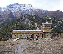
Airport terminal
Airlines and destinations
Since 2012, there are no scheduled services to and from Manang Airport.[4] Previously Nepal Airlines and Tara Air operated routes to Kathmandu and Pokhara.[5][6]
See also
References
- Airport information for Manang, Nepal (VNMA / NGX) at Great Circle Mapper.
- "Manang Airport" (PDF). Civil Aviation Authority of Nepal. Retrieved 1 September 2018.
- "Joy in locals as aircraft lands after 2 years at Humde Airport". Aviation Nepal. 5 December 2017. Retrieved 1 April 2019.
- "Inactive Manang Airport causes locals to face major problems". Aviation Nepal. 23 July 2015. Retrieved 1 September 2018.
- "Schedule Effective from 15 May, 2010 to 30 October, 2010". Nepal Airlines. Retrieved 9 June 2010.
- http://www.taraair.com/
External links
| International | |||||
|---|---|---|---|---|---|
| Domestic |
| ||||
| Under construction | |||||
| Defunct | |||||
Unscheduled airports may be scheduled at certain times | |||||
This article is issued from Wikipedia. The text is licensed under Creative Commons - Attribution - Sharealike. Additional terms may apply for the media files.