Lubango
Lubango, formerly known as Sá da Bandeira, is a municipality in Angola, capital of the Huíla Province, with a population of 776,249 (2014 census). The city center has a population of 600,751 (2014 census)[2] making it the second largest city in Angola after the capital city Luanda.
Lubango Sá da Bandeira | |
|---|---|
Municipality | |
.jpg) .jpg) .jpg) | |
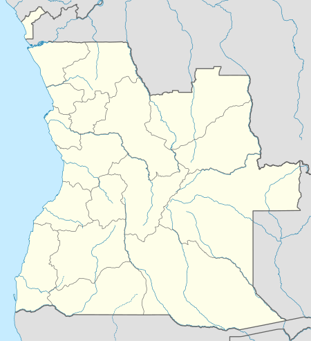 Lubango Location in Angola | |
| Coordinates: 14°55′S 13°30′E | |
| Country | Angola |
| Province | Huíla |
| Area | |
| • Total | 3,147 km2 (1,215 sq mi) |
| Elevation | 1,720 m (5,640 ft) |
| Population (2014 Census)[1] | |
| • Total | 776,246 |
| • Density | 250/km2 (640/sq mi) |
| Time zone | UTC+1 (WAT) |
| Climate | Cwb |
History
Portuguese rule

In 1882 approximately one thousand of Portuguese settlers came from the island of Madeira to the area of current-day Lubango, Angola. These Portuguese farmers confiscated the land of the indigenous population and developed the economy of the area to suit their economic interests, founding a whites-only settlement, reducing those living on the land to servitude.[3] The city, originally established in 1885 to serve colonists from the Madeira Islands, lies at an elevation of 1,760 metres in a valley of the Huíla Plateau and was surrounded by a scenic park spreading up the mountain slopes.
By 1910 there were over 1,700 ethnic Portuguese living in the settlement, which was referred to as "Lubango". By 1923 the Moçâmedes Railway had connected the settlement to the town of Moçâmedes in the coast. The Portuguese government made it a city and renamed it "Sá da Bandeira", after Bernardo de Sá, 1st Marquess of Sá da Bandeira. Once the major centre of Portuguese settlement in the hinterland of southern Angola, which forcibly transplanted the cattle herding, agrarian based culture and economy of the indigenous people living there prior to colonialism [4], it was built in a Portuguese style of architecture, with a cathedral, commerce hall, industrial hall, and a secondary school, and, like every Portuguese city or town in the mainland and the overseas territories, it would have the Portuguese town hall, the hospital and the typical CTT post office, besides banking (most prominently the Banco Nacional Ultramarino - BNU), insurance and other services. The city developed as an agricultural and transportation centre, with its own airport and railway station, as well as major maintenance and repair facilities for them. Land ownership in Lubango was reserved exclusively for the white population.
Several Basters (children of African and Cape Colony Dutch descent) emigrated from Namibia to Angola and settled in Lubango, where they are known as the Ouivamo. Many of them were forced to return to Namibia between 1928 and 1930 by white South Africans.
In 1951, the Portuguese colony of Angola was officially rebranded the Overseas Province of Angola.[5]
Post independence
After Angola's Independence from Portugal due to the events of the April 25, 1974 Carnation Revolution in Lisbon, the city was once again renamed Lubango. During the Angolan Civil War (1975–2002), Lubango served as a major base of Cuban, SWAPO and government troops. Its once thriving economy plummeted.
Economy
Lubango's economy is based on agriculture, especially meat products, cereals, sisal, tobacco, fruits and vegetables produced in the surrounding fertile region. Food processing, leather tanning, and consumer goods industries dominate the industrial sector.
A number of Angolan banks like BAI or BPC offer good financial services, and it is possible to receive funds from outside Angola by way of electronic fund transfer into these banks. ATMs are available around the city but they disburse kwanza, which is the local currency. In the markets US dollars or kwanza both are acceptable.
The main shopping plaza in Lubango is a newly built Mall called "Milleneum", where most products of daily use as well as other products like cosmetics, shoes, clothes etc. are available.
Transport
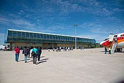
Lubango is the site of an airport (Lubango Airport IATA code:SDD) and headquarters for a fighter bomber regiment of the Angolan Air Force. The airport receives daily flights from Luanda and thrice a week from Windhoek, Namibia through TAAG, the Angolan airline.
The town is served by the Moçâmedes Railway, known as CFM. It is the junction for the branch railway to Chiange. Also the town is serviced by taxis (mostly shared) which run in circles around the city. One can hire personal taxis which are marked "PARTICULAR". Walking around town is also a good way to explore Lubango. Bus services are available from Lubito and the buses run by a firm called "SGO" are pretty comfortable.
Education
The town has a Portuguese international school, the Escola Portuguesa do Lubango (Portuguese School of Lubango), [6] and the Instituto Superior Politécnico Gregório Semedo (Gregório Semedo Polytechnical Institute)[7] that offers degree courses in various disciplines.
Climate
With an altitude of 1,760 metres (5,774 ft) above sea level, Lubango is one of the highest places in Angola. The city features a subtropical highland climate (Cwb) under the Köppen climate classification. The climate is hot and humid during the day and cool to cold at night, the annual average temperature is 18.6 °C (65.5 °F), though there are extremes of 0 to 34.4 °C (32.0 to 93.9 °F). June and July are cold when frosts are possible, albeit rare. The heaviest rains are between December and March and the warmest months are September and October.
| Climate data for Lubango (1931–1960) | |||||||||||||
|---|---|---|---|---|---|---|---|---|---|---|---|---|---|
| Month | Jan | Feb | Mar | Apr | May | Jun | Jul | Aug | Sep | Oct | Nov | Dec | Year |
| Record high °C (°F) | 30.1 (86.2) |
30.7 (87.3) |
30.1 (86.2) |
29.1 (84.4) |
29.8 (85.6) |
28.1 (82.6) |
27.7 (81.9) |
30.1 (86.2) |
31.4 (88.5) |
34.4 (93.9) |
32.0 (89.6) |
31.1 (88.0) |
34.4 (93.9) |
| Average high °C (°F) | 25.0 (77.0) |
24.6 (76.3) |
24.6 (76.3) |
24.9 (76.8) |
24.8 (76.6) |
23.6 (74.5) |
24.2 (75.6) |
26.2 (79.2) |
28.2 (82.8) |
28.0 (82.4) |
26.3 (79.3) |
25.3 (77.5) |
25.5 (77.9) |
| Daily mean °C (°F) | 19.0 (66.2) |
18.8 (65.8) |
18.8 (65.8) |
18.7 (65.7) |
17.3 (63.1) |
15.8 (60.4) |
16.2 (61.2) |
18.6 (65.5) |
20.8 (69.4) |
20.7 (69.3) |
19.8 (67.6) |
19.2 (66.6) |
18.6 (65.5) |
| Average low °C (°F) | 13.1 (55.6) |
12.9 (55.2) |
13.0 (55.4) |
12.5 (54.5) |
9.8 (49.6) |
7.9 (46.2) |
8.3 (46.9) |
11.0 (51.8) |
13.4 (56.1) |
13.4 (56.1) |
13.2 (55.8) |
13.2 (55.8) |
11.8 (53.2) |
| Record low °C (°F) | 5.3 (41.5) |
5.4 (41.7) |
2.0 (35.6) |
3.2 (37.8) |
0.6 (33.1) |
−1.0 (30.2) |
−1.0 (30.2) |
0.0 (32.0) |
4.6 (40.3) |
4.1 (39.4) |
5.1 (41.2) |
3.9 (39.0) |
−1.0 (30.2) |
| Average precipitation mm (inches) | 139.7 (5.50) |
152.8 (6.02) |
171.6 (6.76) |
93.5 (3.68) |
5.5 (0.22) |
0.1 (0.00) |
0.0 (0.0) |
0.4 (0.02) |
4.3 (0.17) |
70.4 (2.77) |
118.0 (4.65) |
152.6 (6.01) |
909.0 (35.79) |
| Average precipitation days (≥ 0.1 mm) | 15 | 14 | 17 | 10 | 1 | 0 | 0 | 0 | 2 | 10 | 14 | 17 | 100 |
| Average relative humidity (%) | 65 | 67 | 69 | 63 | 47 | 40 | 34 | 30 | 33 | 49 | 59 | 63 | 52 |
| Mean monthly sunshine hours | 164.3 | 163.9 | 173.6 | 204.0 | 272.8 | 285.0 | 282.1 | 282.1 | 240.0 | 213.9 | 207.0 | 201.5 | 2,690.2 |
| Mean daily sunshine hours | 5.3 | 5.8 | 5.6 | 6.8 | 8.8 | 9.5 | 9.1 | 9.1 | 8.0 | 6.9 | 6.9 | 6.5 | 7.4 |
| Source: Deutscher Wetterdienst[8] | |||||||||||||
The city is regarded as the coldest city in Angola[9], with registered temperatures of −2 °C (28 °F).
Notable citizens
- Marco Abreu (born 8 December 1974), footballer and member of the Angola national football team.
See also
References
- "Resultados Definitivos Recenseamento Geral da População e Habitação – 2014 Província da Huíla" (PDF). Instituto Nacional de Estatística, República de Angola. Retrieved 3 May 2020.
- Citypopulation.de Population of the major cities in Angola
- https://plus.google.com/+UNESCO. "UNESCO". UNESCO. Retrieved 2020-05-28.
- https://plus.google.com/+UNESCO. "UNESCO". UNESCO. Retrieved 2020-05-28.
- SáDaBandeiraAnosOuro.wmv, a film of Sá da Bandeira, Overseas Province of Angola, before 1975.
- Escolas com Currículo Português em Angola (in Portuguese), Lisbon, Portugal: Direção de Serviços de Ensino e Escolas Portuguesas no Estrangeiro (DSEEPE) of the Portuguese Education Ministry, archived from the original on 18 April 2015, retrieved 26 October 2015
- ISPGS (ed.). "Instituto Superior Politécnico Gregório Semedo" (in Portuguese). Mapunda, Angola. Archived from the original on 2016-11-04. Retrieved 2016-11-03.
- "Klimatafel von Lubango (Sá da Bandeira), Prov. Huila / Angola" (PDF). Baseline climate means (1961-1990) from stations all over the world (in German). Deutscher Wetterdienst. Retrieved 25 January 2016.
- "Encyclopedia Britannica". Encyclopedia Britannica. Retrieved 2020-05-28.
External links
![]()