List of unmanned aerial vehicle applications
Unmanned aerial vehicles are used across the world for civilian, commercial, as well as military applications. This is an incomplete list of those applications.
Applications

Aerospace
Airlines and maintenance, repair, and operations contractors use UAVs for aircraft maintenance. In June 2015 EasyJet began testing UAVs in the maintenance of their Airbus A320s[1] and in July 2016 at the Farnborough Airshow, Airbus (manufacturer of the A320), demonstrated the use of UAVs for the visual inspection of an aircraft.[2] However, some aircraft maintenance professionals remain wary of the technology and its ability to properly catch potential dangers.[3]

A helicopter UAV has been proposed to accompany a future NASA Mars rover mission. Investigators believe a solar-powered craft would be able to fly for a few minutes at a time despite the thin atmosphere of the planet, and help the rover scout out interesting destinations.[4]
Military
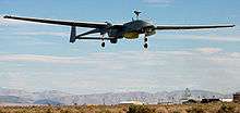
UAVs are used by a broad range of military forces, from Argentina[5] to the US and also by Islamic State of Iraq and the Levant (ISIS).
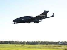
As of January 2014, the U.S. military operated 7,362 RQ-11B Ravens; 145 AeroVironment RQ-12A Wasps; 1,137 AeroVironment RQ-20A Pumas; 306 RQ-16 T-Hawk small UAS; 246 Predators and MQ-1C Grey Eagles; 126 MQ-9 Reapers; 491 RQ-7 Shadows and 33 RQ-4 Global Hawk large systems.[6] The MQ-9 Reaper costs $12 million while a manned F-22 costs over $120 million.[7]
ISIS announced a "Unmanned Aircraft of the Mujahideen" unit in January 2017 and use drones for both reconnaissance and to drop bombs.[8]
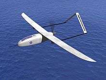
Reconnaissance
The Tu-141 "Swift" reusable Soviet reconnaissance UAV is intended for reconnaissance to a depth of several hundred kilometers from the front line at supersonic speeds.[9] The Tu-123 "Hawk" is a supersonic long-range reconnaissance UAV intended for conducting photographic and signals intelligence to a distance of 3200 km; it was produced beginning in 1964.[10] The La-17P (UAV) is a reconnaissance UAV produced since 1963.[11] In 1945 the Soviet Union began producing "doodlebug". 43 Soviet/Russian UAV models are known.[12]
In 2013, the U.S. Navy launched a UAV from a submerged submarine, the first step to "providing mission intelligence, surveillance and reconnaissance capabilities to the U.S. Navy's submarine force."[13]
Turkish forces have used the Bayraktar Tactical UAS for reconnaissance during operations in northern Syria.[14]
Attack
UAVs avoid potential diplomatic embarrassment when a manned aircraft is shot down and the pilots captured.[15][16][17][18]
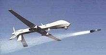
MQ-1 Predator UAVs armed with Hellfire missiles have been used by the U.S. as platforms for hitting ground targets. Armed Predators were first used in late 2001, mostly aimed at assassinating high-profile individuals (terrorist leaders, etc.) inside Afghanistan.[19]
Islamic State of Iraq and the Levant have used drones, adapting UAVs bought online, to drop explosives, primarily using quadcopters.[20] Other groups in Syria are also thought to have used UAVs in attacks. A swarm of drones armed with bombs attacked Russian bases in western Syria in early January 2018.[21][22]
Defense against UAVs
The US armed forces have no defense against low-level UAV attack, but the Joint Integrated Air and Missile Defense Organization is working to repurpose existing systems.[23] Two German companies are developing 40-kW lasers to damage UAVs.[24] Other systems still include the OpenWorks Engineering Skywall and the Battelle DroneDefender.[25]
In late 2017, Russia established a ground-based unit to combat UAVs by jamming their controlling signals.[26] They used jamming and anti-aircraft fire to defend against a swarm attack in Syria in early January 2018.[22]
Targets for military training
Since 1997, the US military has used more than 80 F-4 Phantoms converted into UAVs as aerial targets for combat training of human pilots.[27] The F-4s were supplemented in September 2013 with F-16s as more realistically maneuverable targets.[27]
Demining
Since January 2016 British scientists are developing UAVs with advanced imaging technology to more cheaply and effectively map and speed up the clearing of minefields. The Find A Better Way charity, working since 2011 to advance technologies that will enable safer and more efficient clearance of landmines, teamed up with scientists at the University of Bristol to develop UAVs fit with hyperspectral imaging technology that can quickly identify landmines buried in the ground. John Fardoulis, project researcher from Bristol University states that "the maps [their] UAVs will generate should help deminers focus on the places where mines are most likely to be found". Their intended UAVs will be able to perform flyovers and gather images at various wavelengths which, according to Dr John Day from the University of Bristol, could indicate explosive chemicals seeping from landmines into the surrounding foliage as "chemicals in landmines leak out and are often absorbed by plants, causing abnormalities" which can be detected as "living plants have a very distinctive reflection in the near infrared spectrum, just beyond human vision, which makes it possible to tell how healthy they are".[28]
The Dutch Mine Kafon project, led by designer Massoud Hassani is working on a UAV system that can quickly detect and clear land mines. The unmanned airborne de-mining system called Mine Kafon Drone uses a three step process to autonomously map, detect and detonate land mines. It flies above potentially dangerous areas, generating a 3D map, and uses a metal detector to pinpoint the location of mines. The UAV can then place a detonator above the mines using its robotic gripping arm, before retreating to a safe distance. The firm claims its UAV is safer, 20 times faster and up to 200 times cheaper than current technologies and might clear mines globally in 10 years.[29][30] The project raised funds on the crowdfunding site Kickstarter with their goal set at €70,000 and receiving over €100,000 above it.[31]
Civil
Civil uses include aerial crop surveys,[32] aerial photography,[32] search and rescue,[32] inspection of power lines and pipelines,[33][34] counting wildlife,[33] delivering medical supplies to otherwise inaccessible regions,[35] and detection of illegal hunting,[36] reconnaissance operations,[34][37] cooperative environment monitoring,[38] border patrol missions,[34][39] convoy protection,[40] forest fire detection and monitoring,[34] surveillance,[34][41] coordinating humanitarian aid,[42] plume tracking,[43] land surveying,[44] fire and large-accident investigation,[44] landslide measurement,[44] illegal landfill detection,[44] the construction industry,[45] smuggling,[46] and crowd monitoring.[44]
US government agencies use UAVs such as the RQ-9 Reaper to patrol borders, scout property and locate fugitives.[47] One of the first authorized for domestic use was the ShadowHawk in Montgomery County, Texas SWAT and emergency management offices.[48]
Private citizens and media organizations use UAVs for surveillance, recreation, news-gathering, or personal land assessment.[49] In February 2012, an animal rights group used a MikroKopter hexacopter to film hunters shooting pigeons in South Carolina. The hunters then shot the UAV down. In 2014, a UAV was used to successfully locate a man with dementia, who was missing for 3 days.[50]
Archaeology
In Peru, archaeologists used UAVs to speed up survey work and protect sites from squatters, builders and miners. Small UAVs helped researchers produce three-dimensional models of Peruvian sites instead of the usual flat maps – and in days and weeks instead of months and years.[51]
"You can go up three metres and photograph a room, 300 metres and photograph a site, or you can go up 3,000 metres and photograph the entire valley."[51]
UAVs have replaced expensive and clumsy small planes, kites and helium balloons. UAVs costing as little as £650 have proven useful. In 2013, UAVs flew over Peruvian archaeological sites, including the colonial Andean town Machu Llacta 4,000 m (13,000 ft) above sea level. The UAVs had altitude problems in the Andes, leading to plans to make a UAV blimp.[51]
In Jordan, UAVs were used to discover evidence of looted archaeological sites.[52]
In September 2014, UAVs were used for 3D mapping of the above-ground ruins of Aphrodisias and the Gallo-Roman remains in Switzerland.[53][54]
On 6 February 2017 it was reported that scientists from the UK and Brazil discovered hundreds of ancient earthworks similar to those at Stonehenge in the Amazon rainforest with the use of UAVs.[55][56]
Cargo transport

UAVs can transport medicines and medical specimens into and out of inaccessible regions.[35] In 2013, in a research project of DHL, a small quantity of medicine was delivered via a UAV.[57][58]
Initial attempts at commercial use of UAVs, such as the Tacocopter company for food delivery, were blocked by FAA regulation.[59] A 2013 announcement that Amazon was planning deliveries using UAVs was met with skepticism.[60]
In 2014, the prime minister of the United Arab Emirates announced that the UAE planned to launch a fleet of UAVs[61] to deliver official documents and supply emergency services at accidents.[62]
Google revealed in 2014 it had been testing UAVs for two years. The Google X program aims to produce UAVs that can deliver items.[63]
16 July 2015, A NASA Langley fixed-wing Cirrus SR22 aircraft, flown remotely from the ground, operated by NASA's Langley Research Center in Hampton and a hexacopter UAV delivered pharmaceuticals and other medical supplies to an outdoor free clinic at the Wise County Fairgrounds, Virginia. The aircraft picked up 10 pounds of pharmaceuticals and supplies from an airport in Tazewell County in southwest Virginia and delivered the medicine to the Lonesome Pine Airport in Wise County. The aircraft had a pilot on board for safety. The supplies went to a crew, which separated the supplies into 24 smaller packages to be delivered by small, unmanned UAV to the free clinic, during multiple flights over two hours. A company pilot controlled the hexacopter, which lowered the pharmaceuticals to the ground by tether. Health care workers distributed the medications to appropriate patients.[64]
The Uvionix Nksy aerial delivery service is planning to allow local shops to deliver goods from a UAV.[65] The company wants to deliver fast food, beer, coffee, soda, electronics, prescriptions and personal care products.[65]
Conservation
In 2011, Lian Pin Koh and Serge Wich conceived the idea of using UAVs for conservation-related applications, before founding ConservationDrones in 2012.[66] ConservationDrones works with NGOs, research organizations, and governments to collect environmental data through drone usage. They also work to provide low cost UAVs to these organizations, especially in developing countries, for as little as $2500.[67] UAV usage in conservation is able to alleviate many of the challenges facing conservationists on foot, such as "the large size of species’ geographic ranges, low population densities, inaccessible habitat, elusive behavior and sensitivity to disturbance."[68] By 2012 the International Anti-Poaching Foundation was using UAVs.[69] A whale conservation UAV capable of collecting blowhole mucus into a sterile petri dish was put into use in January 2018 following its development by researchers at Macquarie University in Sydney, Australia.[70]
UAVs have a particular role in anti-poaching activities. In June 2012, World Wide Fund for Nature (WWF) announced it would begin using UAVs in Nepal to aid conservation efforts following a successful trial of two aircraft in Chitwan National Park. The global wildlife organization planned to train ten personnel to use the UAVs, with operational use beginning in the fall.[71][72] In August 2012, UAVs were used by members of the Sea Shepherd Conservation Society in Namibia to document the annual seal cull.[73] In December 2013, the Falcon UAV was selected by the Namibian Government and WWF to help combat rhinoceros poaching.[74] The UAVs will operate in Etosha National Park and will use implanted RFID tags.[75]
In 2012, the WWFund supplied two FPV Raptor 1.6 UAVs[76] to Nepal National Parks. These UAVs were used to monitor rhinos, tigers and elephants and deter poachers.[77] The UAVs were equipped with time-lapse cameras and could fly for 18 miles at 650 feet.[78]
In December 2012, Kruger National Park started using a Seeker II UAV against rhino poachers. The UAV was loaned to the South African National Parks authority by its manufacturer, Denel Dynamics of South Africa.[79][80]
Anti-whaling activists used an Osprey UAV (made by Kansas-based Hangar 18) in 2012 to monitor Japanese whaling ships in the Antarctic.[81]
In 2012, the Ulster Society for the Prevention of Cruelty to Animals used a quadcopter UAV to deter badger baiters in Northern Ireland.[82] In March 2013, the British League Against Cruel Sports announced that they had carried out trial flights with UAVs and planned to use a fixed-wing OpenRanger and an "octocopter" to gather evidence to make private prosecutions against illegal hunting of foxes and other animals.[79] The UAVs were supplied by ShadowView. A spokesman for Privacy International said that "licensing and permission for UAVs is only on the basis of health and safety, without considering whether privacy rights are violated."[79] CAA rules prohibit flying a UAV within 50 m of a person or vehicle.[79][83]
In Pennsylvania, Showing Animals Respect and Kindness used UAVs to monitor people shooting at pigeons for sport.[84] One of their UAVs was shot down by hunters.[85]
In March 2013, UAV conservation nonprofit ShadowView, founded by former members of Sea Shepherd Conservation Society, worked with antihunting charity the League Against Cruel Sports to expose illegal fox hunting in the UK.[86]
In 2014, Will Potter proposed using UAVs to monitor conditions on factory farms. The idea is to circumvent ag-gag prohibitions by keeping the UAVs on public property, but equipping them with cameras sensitive enough to monitor distant activities.[87] Potter raised nearly $23,000 in 2 days for this project on Kickstarter.[87]
Healthcare
A 2018 review identified three roles for UAVs in healthcare:
- Prehospital emergency care;
- Speeding up laboratory testing;
- Surveillance.[88]
While other uses are being researched, such as their use for larval source management (LSM) to control vectors of diseases like malaria.[89]
Filmmaking
For commercial UAV camerawork inside the United States, industry sources state that usage relies on the de facto consent – or benign neglect – of local law enforcement. Use of UAVs for filmmaking is generally easier on large private lots or in rural and exurban areas with fewer space constraints. In localities such as Los Angeles and New York, authorities have actively interceded to shut down UAV filmmaking over safety or terrorism concerns.[90][91][92]
In June 2014, the FAA acknowledged that it had received a petition from the Motion Picture Association of America seeking approval for the use of UAVs for aerial photography. Seven companies behind the petition argued that low-cost UAVs could be used for shots that would otherwise require a helicopter or a manned aircraft, saving money and reducing risk for pilot and crew.[93] UAVs are already used by media in other parts of the world.
UAVs have been used to film sporting events, such as the 2014 Winter Olympics, as they have greater freedom of movement than cable-mounted cameras.[94]
Hobby and recreational use
Model aircraft (small UAS) have been flown by hobbyists since the earliest days of manned flight. In the United States, hobby and recreational use of such UAS is permitted (a) strictly for hobby or recreational use; (b) when operated in accordance with a community-based set of safety guidelines and nationwide community-based organizations; (c) when limited to not more than 55 pounds (with exceptions); (d)without interfering with and giving way to any manned aircraft; and (e) within 5 miles of an airport only after notifying air traffic control.[95] The Academy of Model Aeronautics is a community based organization that maintains operational safety guidelines[96] with a long proven history of effectiveness and safety.
Recreational uses of UAVs include:
- Filming and photographing recreational activity
- Drone racing, generally in the form where participants control radio-controlled UAVs equipped with cameras, while wearing head-mounted displays showing the live stream camera feed from the drones.
- Being pulled by a UAV in combination with some sports equipment, such as a snowboard ("droneboarding"),[97][98] or wakeboard ("drone surfing").[99] However, these activities generally require rather large (and hence rather expensive) UAVs.
Journalism
Journalists are interested in using UAVs for newsgathering. The College of Journalism and Mass Communications at University of Nebraska-Lincoln established the Drone Journalism Lab.[100] University of Missouri created the Missouri Drone Journalism Program.[101] The Professional Society of Drone Journalists was established in 2011.[102] UAVs have covered disasters such as typhoons.[103] A coalition of 11 news organizations is working with the Mid-Atlantic Aviation Partnership at Virginia Tech on how reporters could use unmanned aircraft to gather news.[104]
Law enforcement
Many police departments in India have procured UAVs for law and order and aerial surveillance.[105][106][107][108]
UAVs have been used for domestic police work in Canada and the United States.[109][110] A dozen US police forces had applied for UAV permits by March 2013.[111] UAVs have been used by U.S. Customs and Border Protection since 2005.[112] with plans to use armed UAVs.[113] The FBI stated in 2013 that they use UAVs for "surveillance".[114]
In 2014, it was reported that five English police forces had obtained or operated UAVs for observation.[115] Merseyside police caught a car thief with a UAV in 2010, but the UAV was lost during a subsequent training exercise[116] and the police stated the UAV would not be replaced due to operational limitations and the cost of staff training.[116]
Approximately 167 police and fire departments bought unmanned aerial vehicles in the United States in 2016, double the number that were purchased in 2015.[117]
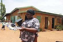
_in_Goma%2C_North_Kivu_province_(11189522286).jpg)
In August 2013, the Italian defence company Selex ES provided an unarmed surveillance UAV to the Democratic Republic of Congo to monitor movements of armed groups in the region and to protect the civilian population more effectively.
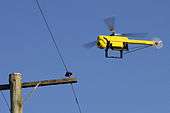
Dutch train networks use tiny UAVs to look out for graffiti as an alternative to CCTV cameras.[118]
Scientific research
UAVs are especially useful in accessing areas that are too dangerous for manned aircraft. The U.S. National Oceanic and Atmospheric Administration began using the Aerosonde unmanned aircraft system in 2006 as a hurricane hunter. The 35-pound system can fly into a hurricane and communicate near-real-time data directly to the National Hurricane Center. Beyond the standard barometric pressure and temperature data typically culled from manned hurricane hunters, the Aerosonde system provides measurements from closer to the water's surface than before. NASA later began using the Northrop Grumman RQ-4 Global Hawk for hurricane measurements.
Search and rescue

UAVs were used in search and rescue after hurricanes struck Louisiana and Texas in 2008. Predators, operating between 18,000 and 29,000 feet, performed search and rescue and damage assessment. Payloads were an optical sensor and a synthetic aperture radar. The latter can penetrate clouds, rain or fog and in daytime or nighttime conditions, all in real time. Photos taken before and after the storm are compared and a computer highlights damage areas.[119][120] Micro UAVs, such as the Aeryon Scout, have been used to perform search and rescue activities on a smaller scale, such as the search for missing persons.[121]
In 2014, a UAV helped locate an 82-year-old man who had been missing for three days. The UAV searched a 200-acre field and located the man in 20 minutes.[122] In March 2017, DJI released a study of lives saved by the use of drones stating at least 59 lives have been saved by civilian drones in 18 different incidents.[123][124]
UAVs have been tested as airborne lifeguards, locating distressed swimmers using thermal cameras and dropping life preservers to swimmers.[125][126] In January 2018, the lives of two teenage boys were saved by a drone in New South Wales, Australia. They were struggling in heavy waters around 700 meters away from the shoreline. Lifesavers, while still in training to use the drone system, immediately dispatched the drone to the site, where it dropped the inflatable rescue pod.[127]
Surveillance
Aerial surveillance of large areas is possible with low-cost UAS. Surveillance applications include livestock monitoring, wildfire mapping, pipeline security, home security, road patrol and antipiracy. UAVs in commercial aerial surveillance (like the Applied Aeronautics Albatross UAV) is expanding with the advent of automated object detection.[128]
Inspections
UAVs are increasingly finding applications in infrastructure inspections. They are particularly useful for inspections that are dangerous for human surveyors like roof inspections, power line inspections, wind turbine inspections, mining inspections or inspections inside power-plants. UAVs carrying thermal cameras are frequently used for solar panel or building inspections.
Surveying
UAS technologies are used worldwide, often for aerial photogrammetry or with LiDAR sensors.[129]
Pollution monitoring
UAVs equipped with air quality monitors provide real time air analysis at various elevations.[130][131]
Oil, gas and mineral exploration and production
UAVs can be used to perform geophysical surveys, in particular geomagnetic surveys[132] where measurements of the Earth's varying magnetic field strength are used to calculate the nature of the underlying magnetic rock structure. A knowledge of the underlying rock structure helps to predict the location of mineral deposits. Oil and gas production entails the monitoring of the integrity of oil and gas pipelines and related installations. For above-ground pipelines, this monitoring activity can be performed using digital cameras mounted on UAVs.
In 2012, Cavim, the state-run arms manufacturer of Venezuela, claimed to be producing its own UAV as part of a system to survey and monitor pipelines, dams and other rural infrastructure.[133][134]
Disaster relief
UAVs can help in disaster relief by providing intelligence across an affected area.[135]
For example, two George Mason University students are aiming to design a device that uses soundwaves to extinguish fire. Their idea specifies using the technology with UAVs: Equip unmanned aerial vehicles with an extinguisher that works through soundwaves and send them into fires that are too dangerous for people to enter.[122]
T-Hawk[136] and Global Hawk[137] UAVs were used to gather information about the damaged Fukushima Number 1 nuclear plant and disaster-stricken areas of the Tōhoku region after the March 2011 tsunami.
Agriculture

Japanese farmers have been using Yamaha's R-50 and RMAX unmanned helicopters to dust their crops since 1987.[138][139] Some farming initiatives in the U.S. use UAVs for crop spraying, as they are often cheaper than a full-sized helicopter.
UAV are also now becoming an invaluable tool by farmers in other aspect of farming, such as monitoring livestock, crops and water levels. NDVI images, generated with a near-IR sensor, can provide detailed information on crop health, improving yield and reducing input cost. Sophisticated UAV have also been used to create 3D images of the landscape to plan for future expansions and upgrading.[140]
Construction
At least one drone has demonstrated the feasibility of painting a wall with spray cans.[141]
Carlo Paneni, of Ausco Modular, has conducted a preliminary proof of concept of a drone in the construction of modular buildings (Australian patent application no. 2019902083) [142]. In modular, most of the building is constructed in separate modules in the safe and controlled environment of a factory. Yet, after the modules are delivered on site, the gaps between such modules need to be covered: for an operation that is relative minimal, extensive protections need to be established for a worker to safely complete this task at heights. This relatively small task with high impost in terms of safety if done manually, is perfectly suited for a drone. Developed with the collaboration of Freelance Robotics, a proof of concept was conducted in Ausco Modular’s hire yard in Brisbane, Australia.
In construction, drones can be used to survey building sites to help monitor and report progress, spot errors early on and avoid rework and show off finished projects in marketing materials. In China, drones may fly over a building site to monitor progress made during the day. Until 2016 this was not allowed under United States FAA regulation. US government has since passed CFR 14 Part 107 regulation which allows drone pilots to become licensed by the FAA for small UAS operation, and use drones for commercial purposes such as construction progress monitoring and site surveying. Errors in construction can be costly in terms of money and time to resolve, so detecting these errors can result in large savings. Drones may also be used in construction to measure raw materials as inputs to building construction. Aerial photographs can be used to create 3D models and 2D orthomosaic maps of buildings. Construction sites are generally high hazard environments and thus workers are already protected by hardhats and other safety precautions, which makes introduction of drones safer, however, UAS pilots are still advised to implement safety and alerting procedures and checklists. The construction companies can attempt to implement all aspects of a drone program themselves, or outsource all or parts of it to a drone services provider. Since the easing of FAA restrictions on commercial drones, there has been an increase of aerial services providers in the US and worldwide.[143]
Passenger transport
In January 2016, Ehang UAV announced UAVs capable of carrying passengers.[144]
Light show
UAVs equipped with LED's can be used to give a nighttime aerial display, for example Intels "Shooting star" UAV system used by Disney and Super Bowl 2017 halftime show[145]
Criminal and terrorist
Some UAVs have been observed dropping contraband onto U.S. prisons.[146] The New York City Police Department is concerned about UAV attacks with chemical weapons, firearms, or explosives; one UAV nearly collided with an NYPD helicopter.[147] Others have voiced concerns about assassinations and attacks on nuclear power stations.[148]
Uses already seen include:
- Surveillance for ISIS in Iraq and Syria[148]
- Landing radioactive material on the roof of the Japanese Prime Minister's office[149] possibly in protest of nuclear energy policy
- Incitement of a brawl when an UAV flew a flag over a soccer stadium[150]
- Invasion of Israeli airspace by Hezbollah[151]
- Smuggling of drugs across borders and into prisons
See also
References
- "EasyJet tests UAV with A320 inspection". Flightglobal.com. 5 June 2015. Retrieved 22 January 2017.
- "Airbus demonstrates aircraft inspection by drone at Farnborough". airbus. Retrieved 22 January 2017.
- echoer (12 September 2016). "Rapid Advances in MRO Technology". KapcoGlobal. Retrieved 22 January 2017.
- "NASA testing helicopter drone to accompany next Mars rover – ExtremeTech". 13 June 2016.
- Jenkinson, Orlando (2015-03-19). "Argentine Military Drones Are Coming - The Bubble - Argentina News". www.thebubble.com.
- "Pentagon Plans for Cuts to Drone Budgets". DoD Buzz. 2014-01-02. Archived from the original on 8 January 2015. Retrieved 8 January 2015.
- "Five Reasons Why Drones Are Here to Stay". Bloomberg. Retrieved 8 February 2015.
- Warrick, Joby (21 February 2017). "Use of weaponized drones by ISIS spurs terrorism fears" – via www.washingtonpost.com.
- "Туполев Ту-141 Стриж". Airwar.ru. Retrieved 6 February 2014.
- "Туполев Ту-123 Ястреб". Airwar.ru. Retrieved 6 February 2014.
- "Лавочкин Ла-17Р". Airwar.ru. Retrieved 6 February 2014.
- "Беспилотные аппараты". Airwar.ru. Retrieved 6 February 2014.
- Cenciotti, David (6 December 2013). "U.S. Navy successfully launched a surveillance drone from a submerged submarine". The Aviationist. Retrieved 6 February 2014.
- "Turkish drone 'Bayraktar' guides warplanes to destroy Daesh terrorist targets in north Syria operation". 7 September 2016.
- "Shrapnel Points to Drone in Pakistan Attack". Fox News. 5 December 2005. Retrieved 8 January 2015.
- "Predator Kills Important al-Qaeda Leader in Pakistan". Defense Industry Daily. 19 May 2005. Retrieved 8 January 2015.
- "CIA drone said to kill al-Qaida operative | US news | Security | NBC News". NBC News. 14 May 2005. Retrieved 8 January 2015.
- FIROUZ SEDARAT (31 January 2008). "Al-Qaeda chieftain killed". The Guardian. Archived from the original on 5 February 2008. Retrieved 15 June 2016.
- Sauer, Frank; Schoernig Niklas (2012). "Killer drones: The 'silver bullet' of democratic warfare?". Security Dialogue. 43 (4): 363–380. doi:10.1177/0967010612450207.
- "The Drones of ISIS".
- "Swarm of armed DIY drones attacks Russian military base in Syria". 2018-01-11.
- "How Russia Says It Swatted Down a Drone Swarm in Syria". 2018-01-12.
- Stewart, Joshua (2 August 2014). "Modified UAVs raise concerns for infantry". www.marinecorpstimes.com. Gannett Government Media. Retrieved 2 August 2014.
- Sweetman, Bill (2 April 2015). "Lasers Technology Targets Mini-UAVs". Aviation Week & Space Technology. Retrieved 4 April 2015.
- anti-UAV/
- "Russian Army Gets Specialized Drone-Hunters". 2017-10-31.
- "US Air Force successfully flies unmanned F-16, says robotic planes will only be used as 'target practice'". Australian Broadcasting Corporation. 26 September 2013. Archived from the original on 14 October 2013.
- Lavars, Nick. "Imaging drones to spot signs of explosive chemicals leaking from landmines". New Atlas. Retrieved 20 December 2016.
- Vincent, James (2016-07-19). "This drone can detect and detonate land mines". The Verge. Retrieved 20 December 2016.
- Myers, Joe. "This drone could help remove all landmines around the world in 10 years". World Economic Forum. Retrieved 20 December 2016.
- "Mine Kafon Drone on Kickstarter". Retrieved 20 December 2016.
- Fung, Brian (16 August 2013). "Why drone makers have declared war on the word 'drone'". The Washington Post. Archived from the original on 17 August 2013.
- Peterson, Andrea (19 August 2013). "States are competing to be the Silicon Valley of drones". The Washington Post. Archived from the original on 23 August 2013.
- Abdessameud, Abdelkader andAbdelhamid Tayebi. 2013. Motion Coordination for VTOL Unmanned Aerial Vehicles: Attitude Synchronisation and Formation Control. Description of printed book by Springer Science+Business Media.
- Raptopoulos, Andreas (June 2013). "No roads? There's a drone for that". TED (conference). Archived from the original on 21 November 2013. (Click "Show transcript".)
- Lallanilla, Marc (23 March 2013). "9 Totally Cool Uses for Drones". LiveScience. TechMedia Network. Viewed 4 March 2014.
- Saska, M.; Kasl, Z.; Preucil, L. Motion Planning and Control of Formations of Micro Aerial Vehicles. In Proceedings of the 19th World Congress of the International Federation of Automatic Control. 2014.
- Saska, M.; Vonasek, V.; Krajnik, T.; Preucil, L. Coordination and Navigation of Heterogeneous UAVs-UGVs Teams Localized by a Hawk-Eye Approach. In Proceedings of 2012 IEEE/RSJ International Conference on Intelligent Robots and Systems. 2012.
- Wall, Tyler, Monahan, Torin (2011). "Surveillance and Violence from Afar: The Politics of Drones and Liminal Security-Scapes" (PDF). Theoretical Criminology. 15 (3): 239–254. doi:10.1177/1362480610396650.CS1 maint: multiple names: authors list (link)
- Saska, M.; Vonasek, V.; Krajnik, T.; Preucil, L. (2014). "Coordination and Navigation of Heterogeneous MAV–UGV Formations Localized by a 'hawk-eye'-like Approach Under a Model Predictive Control Scheme" (PDF). International Journal of Robotics Research. 33 (10): 1393–1412. doi:10.1177/0278364914530482.
- Saska, M.; Chudoba, J.; Preucil, L.; Thomas, J.; Loianno, G.; Tresnak, A.; Vonasek, V.; Kumar, V. Autonomous Deployment of Swarms of Micro-Aerial Vehicles in Cooperative Surveillance. In Proceedings of 2014 International Conference on Unmanned Aircraft Systems (ICUAS). 2014.
- Sandvik, Kristin Bergtora, Lohne, Kjersti (2014). "The Rise of the Humanitarian Drone: Giving Content to an Emerging Concept". Millennium. 43: 145–164. doi:10.1177/0305829814529470.CS1 maint: multiple names: authors list (link)
- Saska, M.; Langr J.; L. Preucil. Plume Tracking by a Self-stabilized Group of Micro Aerial Vehicles. In Modelling and Simulation for Autonomous Systems. 2014.
- McFarland, Matt (17 September 2014). "In Switzerland, police find a use for drones". The Washington Post. Archived from the original on 20 September 2014.
- "The Eye in the Sky: How Drones are Transforming the Construction Industry – Carey London Limited". Carey London Limited. 10 May 2016. Retrieved 10 May 2016.
- "Two plead guilty in border drug smuggling by drone". 12 August 2015 – via LA Times.
- Pasztor, Andy; Emshwiller, John (21 April 2012). "Drone Use Takes Off on the Home Front". The Wall Street Journal.
- Campoy, Ana (13 December 2011). "The Law's New Eye in the Sky". The Wall Street Journal.
- Noel Sharkey & Sarah Knuckey (22 December 2011). "OWS Fights Back Against Police Surveillance by Launching "Occucopter" Citizen Drone". Occupy Wall Street. Retrieved 26 December 2011.
Tim Pool, an Occupy Wall Street protester, has acquired a Parrot AR.Drone he amusingly calls the "occucopter"
- "Drone Finds Missing Man". Drones Den. 2014-07-24.
- Reuters in Lima. "Peru's archaeologists turn to drones to help protect and explore ancient ruins | World news". theguardian.com. Retrieved 27 August 2013.
- "Drones: Archaeology's Newest Tool to Combat Looting". news.nationalgeographic.com. 13 April 2014. Retrieved 2 March 2016.
- Hudson, Hal (24 September 2014). "Air-chaeological drones search for ancient treasures". New Scientist. No. 2988. Retrieved 2 October 2014.
- "Drone-assisted archeology". euronews. 2013-10-15. Retrieved 2 March 2016.
- Knapton, Sarah (2017-02-06). "Hundreds of ancient earthworks resembling Stonehenge found in Amazon rainforest". The Telegraph. Retrieved 11 February 2017.
- "'Amazon Stonehenge' discovered by scientists". Retrieved 11 February 2017.
- Fuest, Benedikt (9 December 2013). "DHL testet erstmals Paketlieferung per Drohne". Die Welt.
- Elliot, Danielle (9 December 2013). "DHL testing delivery drones". CBS News.
- Gilbert, Jason (20 August 2012). "Tacocopter Aims To Deliver Tacos Using Unmanned Drone Helicopters". The Huffington Post.
- Robillard, Kevin; Byers, Alex (2 December 2013). "Amazon drones: Obstacles to the Bezos dream". Politico. Archived from the original on 6 December 2013.
- Kerr, Simon (11 February 2014) UAE to develop fleet of drones to deliver public services, The Financial Times, World News, Retrieved 12 February 2014
- Sleiman, Mirna (10 February 2014) Aerial ID card renewal: UAE to use drones for government services Reuters, Retrieved 12 February 2014
- Alexis C. Madrigal (28 August 2014). "Inside Google's Secret Drone-Delivery Program". The Atlantic. Retrieved 8 January 2015.
- "NASA Assists in FAA-Approved Drone Medical Supply Delivery Research". 2015-07-17. Retrieved 17 July 2015.
- Attkisson, Anna (4 May 2016). "Uvionix Nsky wants to bring drone delivery service". Yahoo. Retrieved 4 May 2016.
- "The Story of ConservationDrones.org". conservationdrones.org. Retrieved 3 February 2016.
- "How Drones Are Emerging As Valuable Conservation Tool - Yale E360". e360.yale.edu. Retrieved 2018-03-09.
- Gonzalez, Luis et al. “Unmanned Aerial Vehicles (UAVs) and Artificial Intelligence Revolutionizing Wildlife Monitoring and Conservation.” Sensors 16.12 (2016): 97. Crossref. Web.
- "Ex-soldier takes on poachers with hi-tech help for wildlife". Herald Sun. (subscription required)
- Pash, Chris (15 January 2018). "This drone collects snot from humpback whales for the good of science". Business Insider. Retrieved 15 January 2018.
- "Drones to protect Nepal's endangered species from poachers". BBC News. 20 June 2012.
- Press Trust of India (21 June 2012). "Nepal to train rangers to handle drone aircraft to save rhinos". Business Standard India. Business-standard.com. Retrieved 8 January 2015.
- "Sea Shepherd Aerial drone to monitor seal slaughter". 31 August 2012.
- "An Eye in the Sky for Boots on the Ground". Worldwildlife.org. Retrieved 8 January 2015.
- Fran. "Google-funded surveillance drones keeping watch over Namibia's rhinos". Your African Safari. Retrieved 8 January 2015.
- "FPV RAPTOR 1.6 – KIT". Archived from the original on 3 November 2017. Retrieved 15 March 2020.
- "New Technology to Fight Wildlife Crime" (12 September 2012). World Wildlife Fund Stories. Retrieved 27 September 2014.
- Richardson, Nigel (27 July 2013) "Joining forces to save the Bengal tiger" The Telegraph, Retrieved 27 July 2013
- Sclesinger, Fay (16 March 2013) "Animal activists to use drones in fight against illegal hunting" The Times, Page 17'; subscription required
- Conway-Smith, Erin (11 January 2013) South Africa sics drones on rhino poachers Global Post, Retrieved 19 March 2013
- Franklin, Jonathan (1 January 2012) Whaling: campaigners use drones in the fight against Japanese Whalers The Guardian, Retrieved 8 April 2013
- (13 March 2012) USPCA drones join fight against badger cruelty BBC News Northern Ireland, Retrieved 19 March 2013
- Reed, Jim (29 August 2012). "The skies open up for large civilian drones". BBC News Technology. Retrieved 8 April 2013.
- Atherton, Kelsey D. (26 September 2013). "Activist Drone Catches Pigeon Shooters". Popular Science. Retrieved 17 July 2014.
- Chang, David (20 November 2012). "Flying Camera From Animal Rights Group Shot Down at Pigeon Shoot". NBC 10 Philadelphia. Retrieved 17 July 2014.
- "Animal activists to use drones in fight against illegal hunting". 16 March 2013.
- Zara, Christopher (12 June 2014). "Fighting Ag-Gag Laws With Drones? Journalist Eyes The Skies For Factory-Farm Investigations". International Business Times. Retrieved 17 July 2014.
- Bhatt, Kunj; Pourmand, Ali; Sikka, Neal (2018). "Targeted Applications of Unmanned Aerial Vehicles (Drones) in Telemedicine". Telemedicine and E-Health. 24 (11): 833–838. doi:10.1089/tmj.2017.0289. PMID 29489441.
- Carrasco-Escobar, Gabriel; Manrique, Edgar; Ruiz-Cabrejos, Jorge; Saavedra, Marlon; Prussing, Catharine; Bickersmith, Sara; Alava, Freddy; Gamboa, Dionicia; Moreno, Marta (2019-01-17). "High-accuracy detection of malaria vector larval habitats using drone-based multispectral imagery". PLOS Neglected Tropical Diseases. 13 (1): e0007105. doi:10.1371/journal.pntd.0007105. ISSN 1935-2735. PMC 6353212. PMID 30653491.
- Ungerleider, Neal (31 January 2013). "See What You Can Do With Drone Filmmaking". UAV Drones. USA: fastcocreate.
- Ungerleider, Neal (15 February 2012). "Unmanned Drones Go From Afghanistan To Hollywood". UAV Drones. USA: fastcompany.com.
- Lavrinc, Damon (17 May 2012). "Forget the Helicopter: New Drone Cuts Cost of Aerial Video". Wired. New York: Condé Nast. Archived from the original on 6 April 2014. Retrieved 6 April 2014.
- Dorr, Les. "Press Release – FAA to Consider Exemptions for Commercial UAS Movie and TV Production". Federal Aviation Administration. Retrieved 29 January 2017.
- Feltman, Rachel. "The Future of Sports Photography: Drones". The Atlantic. Retrieved 4 February 2014.
- "FAA MODERNIZATION AND REFORM ACT OF 2012" (PDF).
- "Academy of Model Aeronautics National Model Aircraft Safety Code" (PDF). Academy of Model Aeronautics. 1 January 2014.
- Jacob Kastrenakes (3 February 2016). "Droneboarding is 2016's best new sport". The Verge. Retrieved 21 December 2016.
- Aliya Barnwell (12 February 2016). "Watch This Drone Pull A Full Grown Man And Witness The Humble Beginnings Of Droneboarding". Digital Trends. Retrieved 21 December 2016.
- Trevor Mogg (15 September 2016). "'Drone Surfing' Is Exactly What You Think It Is". Digital Trends. Retrieved 21 December 2016.
- "Drone Journalism Lab". dronejournalismlab.org.
- "The Missouri Drone Journalism Program". Archived from the original on 2018-10-11. Retrieved 2017-12-09.
- "Professional Society of Drone Journalists (PSDJ)". Home of the Professional Society of Drone Journalists (PSDJ). 24 March 2015. Archived from the original on 12 December 2013. Retrieved 24 March 2015.
- Kaufman, Leslie (24 December 2013). "Drones Offer Journalists a Wider View". New York Times. Retrieved 24 March 2015.
- "Researchers to begin work with news organizations in an effort to advance aerial journalism". Virginia Tech News. 5 February 2015. Retrieved 24 March 2015.
- A Selvaraj (25 February 2014). "In a first, Tamil Nadu police use UAV in murder probe". Times of India. Archived from the original on 21 February 2015. Retrieved 9 December 2017.
- "Gujarat Police to use UAV for security during 'Run for Unity' marathon". Zee News. 2013-12-13. Retrieved 8 January 2015.
- PTI (20 April 2011). "Chandigarh police get UAV". The Hindu. Chennai, India. Retrieved 8 January 2015.
- "2012: Privacy Highlights in India". Cis-india.org. Retrieved 8 January 2015.
- Lundin, Leigh (3 February 2013). "Eye in the Sky". UAV Drones. Orlando: SleuthSayers.
- Lundin, Leigh (10 February 2013). "Spy in the Sky". UAV Drones. Orlando: SleuthSayers.
- Horgen, John (March 2013) Unmanned Flight National Geographic, Retrieved 20 February 2013
- Amie Stepanovich. "Unmanned Aerial Vehicles and Drones". Electronic Privacy Information Center. Retrieved 19 June 2012.
- Philip Bump (2013-07-02). "The Border Patrol Wants to Arm Drones". The Wire. Retrieved 8 January 2015.
- Kravets, David (19 June 2013). "FBI Admits It Surveils U.S. With Drones". Wired. Retrieved 20 June 2013.
FBI Director Robert Mueller said today the bureau was surveiling the United States with drones. The revelation was during an FBI oversight hearing before the Senate Judiciary Committee and comes as the bureau, along with the National Security Agency, are on the defensive about revelations that they are obtaining metadata on Americans’ phone records and Americans’ private data from companies like Google, Facebook, Microsoft and others. The FBI is not alone in monitoring the U.S. with drones.
- (22 October 2014) UK drones: Concern over increase in use BBC News UK, Retrieved 22 October 2014
- "Police drone crashes into River Mersey". BBC News. 31 October 2011.
- Glaser, April (2017-04-06). "Police departments are using drones to find and chase down suspects". Recode. Retrieved 2017-04-07.
- Michelle Nichols (1 August 2013). "Italian firm to provide surveillance drone for U.N. in Congo". Reuters.
- Archived 15 September 2008 at the Wayback Machine
- "2008 Search and Rescue Missions". Just Aero Works, Inc. Archived from the original on 13 July 2011. Retrieved 15 June 2016.
- Craig Pearson (12 January 2012). "Police use drone helicopter in search".
- "7 ways drones could help first responders save more lives". FireRescue1. Retrieved 24 January 2017.
- "Lives Saved: A Survey of Drones In Action" (PDF). DJI. Retrieved 24 August 2017.
- "Lives Saved: A Survey of Drones In Action". Dronefly.com. March 24, 2017. Retrieved August 24, 2017.
- McFarland, Matt (30 January 2014). "One day a drone might throw you a life preserver". The Washington Post and Fast Company. Archived from the original on 31 January 2014.
- Lara, Julio (18 March 2015). "Drones Might Save Lives in Chilean Beaches". Drones' Republic.
- "Drone saves teen swimmers in world first". BBC News. 2018-01-18.
- Gaszczak, A; T.P. Breckon; J.W. Han (January 2011). Real-time people and vehicle detection from UAV imagery. Proc. SPIE Conference Intelligent Robots and Computer Vision XXVIII: Algorithms and Techniques. Intelligent Robots and Computer Vision XXVIII: Algorithms and Techniques. 7878 (78780B). pp. 78780B. Bibcode:2011SPIE.7878E..0BG. doi:10.1117/12.876663.
- Drone Surveying
- Chwaleba, Augustyn; Olejnik, Aleksander; Rapacki, Tomasz; Tuśnio, Norbert (2014). "Analysis of capability of air pollution monitoring from an unmanned aircraft". Aviation (published 3 April 2014). 18 (1): 13–19. doi:10.3846/16487788.2014.865936.
- Anderson, Chris (25 August 2013). "Archeologists use drones to protect and explore ancient Peruvian ruins". DIY Drones. Retrieved 16 November 2016.
- "Our UAV". Universal Wing. 28 July 2005. Archived from the original on 16 March 2012. Retrieved 31 March 2012.
- (14 June 2012) Chavez unveils surveillance drone BBC News Latin America & Caribbean, Retrieved 8 April 2013
- (14 June 2012) Chavez shows off first Venezuelan drone Dawn.com, Retrieved 6 April 2013
- "Smart software uses drones to plot disaster relief". Newscientist.com. Retrieved 8 January 2015.
- Madrigal, Alexis C. (28 April 2011) Inside the Drone Missions to Fukushima The Atlantic, Retrieved 1 April 2013
- Takateru, Doi (17 August 2011) Defense Ministry plans its version of Global Hawk aircraft The Asahi Shimbun, Retrieved 1 April 2013
- Ross, Philip E. (27 February 2014) Chris Anderson's Expanding Drone Empire IEEE Spectrum, Retrieved 8 March 2014
- (2014) Yamaha RMAX Type IG/Type II unmanned helicopter Archived 2014-03-09 at the Wayback Machine Yamaha Company website, Retrieved 8 March 2014
- "Best Farming Drones – UAV for Agriculture". Small Drone Reviews. 2015-10-07. Retrieved 18 October 2015.
- First in the World Graffiti Drone (Part 1)
- "Drone Proof Of Concept- Australian Patent Application No 2019902083". Vimeo. Retrieved 2019-12-20.
- "Drones—what are they good for?". The Economist. 2017-06-10. Retrieved 2017-06-21.
- Press, Associated (7 January 2016). "First passenger drone makes its debut at CES". The Guardian. Associated Press.
- "Drone Light Shows Powered by Intel". Intel. Retrieved 2017-02-08.
- Bryna Godar (24 January 2016). "Legislators seek $5,000 fine for flying drones over prisons". Associated Press. Retrieved 15 June 2016.
- "NYPD scanning the sky for new terrorism threat". CBS News. 29 October 2014. Retrieved 15 June 2016.
- Matthew Weaver (11 January 2016). "UK should prepare for use of drones in terrorist attacks, says thinktank". The Guardian. Retrieved 15 June 2016.
- "Drone 'containing radiation' lands on roof of Japanese PM's office". The Guardian. Associated Press. 22 April 2015. Retrieved 15 June 2016.
- Nick Ames; Sasa Ibrulj (14 October 2014). "Serbia v Albania abandoned after players and fans brawl on pitch". The Guardian. Retrieved 15 June 2016.
- "Netanyahu's helicopter forced to land as Israeli forces shoot down drone". The Guardian. Associated Press. 25 April 2013. Retrieved 15 June 2016.
Research and groups
- Center for Unmanned Aircraft Systems, a National Science Foundation Industry & University Cooperative Research Center
- UVS International Non Profit Organization representing manufacturers of unmanned vehicle systems (UVS), subsystems and critical components for UVS and associated equipment, as well as companies supplying services with or for UVS, research organizations and academia.
- The Remote Control Aerial Platform Association, commercial UAS operators
- Cities and Drones National League of Cities report on urban government use and regulation of UAS equipment
- Drone Tech Planet, The website that is dedicated to everything related to drone technology and future use of drones.
- Drones and Drone Data Technical Interest Group (TIG) Technology and techniques (equipment, software, workflows, survey designs) to allow individuals to enhance their capabilities with data obtained from drones and drone surveys. Chaired by Karl Osvald and James McDonald.
Further reading
- Garcia-Bernardo, Sheridan Dodds, F. Johnson (2016). "Quantitative patterns in drone wars" (PDF). Science direct. Archived from the original (PDF) on 2016-02-06.CS1 maint: multiple names: authors list (link)
- Hill, J., & Rogers, A. (2014). The rise of the drones: From The Great War to Gaza. Vancouver Island University Arts & Humanities Colloquium Series.
- Rogers, A., & Hill, J. (2014). Unmanned: Drone warfare and global security. Between the Lines. ISBN 9781771131544
- How Intelligent Drones Are Shaping the Future of Warfare, Rolling Stone Magazine
External links
| Wikimedia Commons has media related to Unmanned aerial vehicles. |
| Wikiquote has quotations related to: Drones |
| Main articles |  | |
|---|---|---|
| Types | ||
| Classifications | ||
| Locomotion | ||
| Research | ||
| Related | ||
| ||